TopoQuest Logo
Do you find TopoQuest useful?
Help keep TopoQuest running and adding new maps/features by donating!
Bitcoin:  19c7KJd3qBynnjoSw5npx9KScwjBe4ifkT
Litecoin:  LXs6TkuXGGXo1vDsWCkWVdjQX94eUKd6ui
Home View Maps Find Maps Find Places Resources & Links


Marblemount, Washington Topographic Map

USGS Map Title: Marblemount, WA
USGS Map MRC: 48121E4
DRG (GeoTIFF) Download: o48121e4.tif


Neighboring USGS Topographic Map Quads:


  Bacon Peak, WA  
48121F5
 

  Damnation Peak, WA  
48121F4
 

  Mount Triumph, WA  
48121F3
 

  Sauk Mountain, WA  
48121E5
 

  Marblemount, WA  
48121E4
 

  Big Devil Peak, WA  
48121E3
 

  Rockport, WA  
48121D5
 

  Illabot Peaks, WA  
48121D4
 

  Snowking Mountain, WA  
48121D3


Map MRC Location:

N49°
W122°
N49°
W121°
H8 H7 H6 H5 H4 H3 H2 H1
G8 G7 G6 G5 G4 G3 G2 G1
F8 F7 F6 F5 F4 F3 F2 F1
E8 E7 E6 E5 E4 E3 E2 E1
D8 D7 D6 D5 D4 D3 D2 D1
C8 C7 C6 C5 C4 C3 C2 C1
B8 B7 B6 B5 B4 B3 B2 B1
A8 A7 A6 A5 A4 A3 A2 A1
N48°
W122°
N48°
W121°

Marblemount, WA USGS 1:24K Topographic Map Preview:
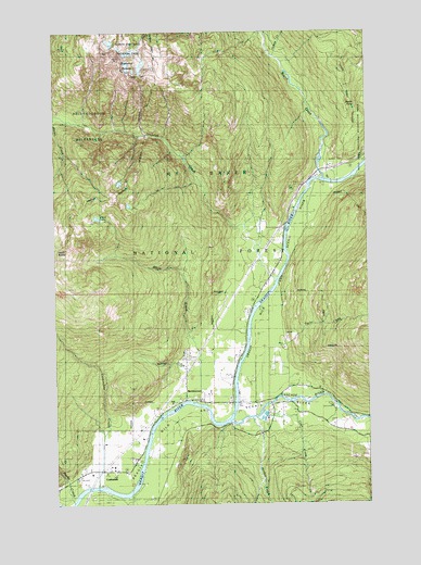
Marblemount, WA USGS Topographic Map
Click on map above to begin viewing in our Map Viewer.

This topographic map contains these locations and features:
Feature Name Type Latitude Longitude GNIS ID View Map
Backus CreekStreamN48.5332°W121.4460°1516019View Map
Bacon CreekStreamN48.5862°W121.3946°1516021View Map
Bacon Creek Campground (historical)LocaleN48.5873°W121.3951°1516023View Map
Bacon Creek Siding (historical)LocaleN48.5890°W121.3918°1516024View Map
Bacon PointSummitN48.6058°W121.3816°1516026View Map
Bacon Point LookoutLocaleN48.6037°W121.3807°1530101View Map
Cascade Island CampgroundLocaleN48.5260°W121.3912°1529874View Map
Cascade Islands CampgroundLocaleN48.5257°W121.3907°1528565View Map
Cascade RiverStreamN48.5237°W121.4298°1517451View Map
Clark CreekStreamN48.5226°W121.4212°1528566View Map
CorkindalePopulated PlaceN48.5087°W121.4737°1518108View Map
Corkindale CreekStreamN48.5048°W121.4857°1518109View Map
Diobsud ButtesSummitN48.6187°W121.4766°1518781View Map
Diobsud CreekStreamN48.5593°W121.4129°1518782View Map
Jordan CreekStreamN48.5215°W121.4221°1521467View Map
MarblemountPopulated PlaceN48.5276°W121.4496°1522717View Map
Marblemount Census Designated PlaceCensusN48.5379°W121.4344°2408175View Map
Marblemount Post OfficePost OfficeN48.5263°W121.4327°2606976View Map
Marblemount Ranger DistrictForestN48.5440°W121.4487°1529844View Map
Marblemount South Cascade Community ChurchChurchN48.5267°W121.4420°2609656View Map
Oakes CreekStreamN48.6182°W121.4126°1523957View Map
Olson CreekStreamN48.5385°W121.4415°1524036View Map
Olson LakeLakeN48.5757°W121.4842°1524039View Map
PortagePopulated PlaceN48.5840°W121.3904°1530569View Map
Rocky CreekStreamN48.5007°W121.4949°1525166View Map
Skagit County Fire District 19 Marblemount Fire DepartmentBuildingN48.5282°W121.4315°2643941View Map
Skagit HatcheryLocaleN48.5225°W121.4185°2605554View Map
Stewart Siding (historical)LocaleN48.5729°W121.4099°1526559View Map
Taylor CreekStreamN48.5418°W121.4085°1526955View Map

Note: Coordinates in the location and feature list above are referenced to NAD83 datum.


Copyright (C) 2008-2025 Ryan Niemi / Sunset Dynamics ... All Rights Reserved