TopoQuest Logo
Do you find TopoQuest useful?
Help keep TopoQuest running and adding new maps/features by donating!
Bitcoin:  19c7KJd3qBynnjoSw5npx9KScwjBe4ifkT
Litecoin:  LXs6TkuXGGXo1vDsWCkWVdjQX94eUKd6ui
Home View Maps Find Maps Find Places Resources & Links


Snowmass Mountain, Colorado Topographic Map

USGS Map Title: Snowmass Mountain, CO
USGS Map MRC: 39107A1
DRG (GeoTIFF) Download: o39107a1.tif


Neighboring USGS Topographic Map Quads:


  Redstone, CO  
39107B2
 

  Capitol Peak, CO  
39107B1
 

  Highland Peak, CO  
39106B8
 

  Marble, CO  
39107A2
 

  Snowmass Mountain, CO  
39107A1
 

  Maroon Bells, CO  
39106A8
 

  Marcellina Mountain, CO  
38107H2
 

  Oh-be-joyful, CO  
38107H1
 

  Gothic, CO  
38106H8


Map MRC Location:

N40°
W108°
N40°
W107°
H8 H7 H6 H5 H4 H3 H2 H1
G8 G7 G6 G5 G4 G3 G2 G1
F8 F7 F6 F5 F4 F3 F2 F1
E8 E7 E6 E5 E4 E3 E2 E1
D8 D7 D6 D5 D4 D3 D2 D1
C8 C7 C6 C5 C4 C3 C2 C1
B8 B7 B6 B5 B4 B3 B2 B1
A8 A7 A6 A5 A4 A3 A2 A1
N39°
W108°
N39°
W107°

Snowmass Mountain, CO USGS 1:24K Topographic Map Preview:
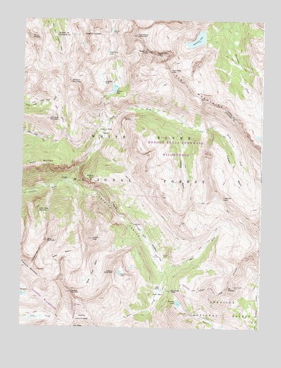
Snowmass Mountain, CO USGS Topographic Map
Click on map above to begin viewing in our Map Viewer.

This topographic map contains these locations and features:
Feature Name Type Latitude Longitude GNIS ID View Map
Arkansas MountainSummitN39.0847°W107.1114°175562View Map
Baroni MineMineN39.0297°W107.0506°175583View Map
Bear BasinBasinN39.0328°W107.1034°175574View Map
Bear MountainSummitN39.0353°W107.1117°175572View Map
Black Queen ShaftMineN39.0617°W107.1234°1684149View Map
Bonton MineMineN39.0394°W107.0850°1684150View Map
Chimneys of Treasure MountainPillarN39.0322°W107.1164°175573View Map
CrystalPopulated PlaceN39.0592°W107.1012°175564View Map
Crystal CanyonValleyN39.0591°W107.1040°175593View Map
Crystal PeakSummitN39.0361°W107.0881°175577View Map
Crystal Tunnel MineMineN39.0394°W107.0850°1684151View Map
Devils RockpilePillarN39.0847°W107.0720°175567View Map
Disc Shaft MineMineN39.0400°W107.0648°1684152View Map
Don Number Two MineMineN39.0439°W107.0662°1684153View Map
East Fork South Fork Crystal RiverStreamN39.0239°W107.0525°175589View Map
Elk MountainsRangeN39.0972°W107.0367°175208View Map
Elko LakeLakeN39.0155°W107.0519°175580View Map
Elko ParkFlatN39.0142°W107.0537°175592View Map
Emerald LakeLakeN39.0101°W107.0427°175581View Map
Emerald Lake Picnic AreaLocaleN39.0092°W107.0412°197235View Map
Fravert BasinBasinN39.0642°W107.0148°175569View Map
Frigid Air PassGapN39.0536°W107.0203°175570View Map
Galena LakeLakeN39.0221°W107.0735°175579View Map
Galena MountainSummitN39.0228°W107.0764°175578View Map
Geneva LakeLakeN39.0970°W107.0776°175561View Map
Hagerman PeakSummitN39.1122°W107.0595°175554View Map
Harris Fairly MineMineN39.0436°W107.0653°1684154View Map
Hasley BasinBasinN39.0619°W107.0414°175568View Map
Heckert PassGapN39.1237°W107.0423°203956View Map
High Tide Tunnel MineMineN39.0394°W107.0850°1684155View Map
Lead King BasinBasinN39.0794°W107.0820°175566View Map
Lead King MineMineN39.0725°W107.0881°1684156View Map
Little Bear MountainSummitN39.0475°W107.1164°175571View Map
Little Gem LakeLakeN39.1147°W107.0812°175558View Map
Low Tide MineMineN39.0394°W107.0850°1684157View Map
Lucky Boy MineMineN39.0589°W107.1112°1684158View Map
Maroon Bells-Snowmass WildernessReserveN39.1133°W107.0249°2035196View Map
McVey Tunnel MineMineN39.0542°W107.1245°1684159View Map
Meadow MountainSummitN39.1000°W107.1006°175559View Map
Mineral PointCliffN39.0611°W107.0873°175565View Map
Mount BellviewSummitN39.0161°W107.0165°175586View Map
Mount RicheySummitN39.1175°W107.1214°175557View Map
North Fork Crystal RiverStreamN39.0592°W107.1039°175591View Map
North Pole MineMineN39.0350°W107.0873°1684160View Map
Puritan Group MineMineN39.0303°W107.0800°1684161View Map
Rock CreekStreamN39.0236°W107.0525°175576View Map
SchofieldLocaleN39.0411°W107.0550°175588View Map
Schofield MineMineN39.0394°W107.0850°1684162View Map
Schofield ParkFlatN39.0336°W107.0534°175582View Map
Schofield PassGapN39.0150°W107.0467°175587View Map
Sheep MountainSummitN39.0653°W107.1231°202308View Map
Sheep Mountain Tunnel MineMineN39.0603°W107.0998°1684163View Map
Siberia LakeLakeN39.1208°W107.0793°175552View Map
Silver CreekStreamN39.0703°W107.0903°175563View Map
Silver Spruce MineMineN39.0172°W107.0137°175585View Map
Snowfield LakeLakeN39.0997°W107.0835°175560View Map
Snowmass LakeLakeN39.1171°W107.0345°175551View Map
Snowmass MountainSummitN39.1189°W107.0664°175555View Map
Snowmass PeakSummitN39.1108°W107.0523°175553View Map
South Fork Crystal RiverStreamN39.0592°W107.1039°175590View Map
Trail Rider PassGapN39.1047°W107.0489°175556View Map
Treasure MountainSummitN39.0244°W107.1228°202309View Map
Treasury MountainSummitN39.0144°W107.0995°175575View Map
Treasury Mountain MineMineN39.0136°W107.1050°1684164View Map
Yule PassGapN39.0003°W107.0981°2790900View Map

Note: Coordinates in the location and feature list above are referenced to NAD83 datum.


Copyright (C) 2008-2024 Ryan Niemi / Sunset Dynamics ... All Rights Reserved