TopoQuest Logo
Do you find TopoQuest useful?
Help keep TopoQuest running and adding new maps/features by donating!
Bitcoin:  19c7KJd3qBynnjoSw5npx9KScwjBe4ifkT
Litecoin:  LXs6TkuXGGXo1vDsWCkWVdjQX94eUKd6ui
Home View Maps Find Maps Find Places Resources & Links


Soldier Summit, Utah Topographic Map

USGS Map Title: Soldier Summit, UT
USGS Map MRC: 39111H1
DRG (GeoTIFF) Download: o39111h1.tif


Neighboring USGS Topographic Map Quads:


  Strawberry Reservoir SW, UT  
40111A2
 

  Strawberry Reservoir SE, UT  
40111A1
 

  Strawberry Peak, UT  
40110A8
 

  Tucker, UT  
39111H2
 

  Soldier Summit, UT  
39111H1
 

  Flat Ridge, UT  
39110H8
 

  Scofield Reservoir, UT  
39111G2
 

  Colton, UT  
39111G1
 

  Kyune, UT  
39110G8


Map MRC Location:

N40°
W112°
N40°
W111°
H8 H7 H6 H5 H4 H3 H2 H1
G8 G7 G6 G5 G4 G3 G2 G1
F8 F7 F6 F5 F4 F3 F2 F1
E8 E7 E6 E5 E4 E3 E2 E1
D8 D7 D6 D5 D4 D3 D2 D1
C8 C7 C6 C5 C4 C3 C2 C1
B8 B7 B6 B5 B4 B3 B2 B1
A8 A7 A6 A5 A4 A3 A2 A1
N39°
W112°
N39°
W111°

Soldier Summit, UT USGS 1:24K Topographic Map Preview:
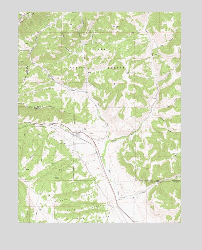
Soldier Summit, UT USGS Topographic Map
Click on map above to begin viewing in our Map Viewer.

This topographic map contains these locations and features:
Feature Name Type Latitude Longitude GNIS ID View Map
Aagard RidgeRidgeN39.8894°W111.0804°1438110View Map
Averett CanyonValleyN39.9752°W111.0763°1438308View Map
Boiler CanyonValleyN39.9766°W111.1154°1438990View Map
Coddington Ranch (historical)LocaleN39.8891°W111.0479°1448287View Map
Daniels Ranch (historical)LocaleN39.9255°W111.0602°1448321View Map
Gremo HillSummitN39.9913°W111.0510°1441493View Map
Hunter SpringSpringN39.9016°W111.0968°1441949View Map
Johnson ForkStreamN39.9400°W111.0241°1442183View Map
Left Fork White RiverStreamN39.9236°W111.0566°1442541View Map
Middle Fork White RiverStreamN39.9530°W111.0743°1443361View Map
Right Fork White RiverStreamN39.9236°W111.0566°1444964View Map
Road RidgeRidgeN39.8830°W111.0752°1445011View Map
Soldier SummitPopulated PlaceN39.9286°W111.0779°1445773View Map
Soldier Summit CemeteryCemeteryN39.9234°W111.0821°2769273View Map
Soldier Summit DivisionCivilN39.9651°W111.0423°1939417View Map
Tabbyune CanyonValleyN39.8888°W111.0488°1449092View Map
Tabbyune CreekStreamN39.8888°W111.0485°1446310View Map
Trail CanyonValleyN39.9775°W111.0243°1446668View Map
Trail HollowValleyN39.9441°W111.0218°1446682View Map
Watch CanyonValleyN39.9813°W111.0754°1447029View Map
Wide RidgeRidgeN39.8777°W111.0677°1447324View Map

Note: Coordinates in the location and feature list above are referenced to NAD83 datum.


Copyright (C) 2008-2025 Ryan Niemi / Sunset Dynamics ... All Rights Reserved