TopoQuest Logo
Do you find TopoQuest useful?
Help keep TopoQuest running and adding new maps/features by donating!
Bitcoin:  19c7KJd3qBynnjoSw5npx9KScwjBe4ifkT
Litecoin:  LXs6TkuXGGXo1vDsWCkWVdjQX94eUKd6ui
Home View Maps Find Maps Find Places Resources & Links


Soloman Butte, Oregon Topographic Map

USGS Map Title: Soloman Butte, OR
USGS Map MRC: 42121F7
DRG (GeoTIFF) Download: o42121f7.tif


Neighboring USGS Topographic Map Quads:


  Sun Pass, OR  
42121G8
 

  Fuego, OR  
42121G7
 

  Wocus Bay, OR  
42121G6
 

  Fort Klamath, OR  
42121F8
 

  Soloman Butte, OR  
42121F7
 

  Applegate Butte, OR  
42121F6
 

  Agency Lake, OR  
42121E8
 

  Chiloquin, OR  
42121E7
 

  S'Ocholis Canyon, OR  
42121E6


Map MRC Location:

N43°
W122°
N43°
W121°
H8 H7 H6 H5 H4 H3 H2 H1
G8 G7 G6 G5 G4 G3 G2 G1
F8 F7 F6 F5 F4 F3 F2 F1
E8 E7 E6 E5 E4 E3 E2 E1
D8 D7 D6 D5 D4 D3 D2 D1
C8 C7 C6 C5 C4 C3 C2 C1
B8 B7 B6 B5 B4 B3 B2 B1
A8 A7 A6 A5 A4 A3 A2 A1
N42°
W122°
N42°
W121°

Soloman Butte, OR USGS 1:24K Topographic Map Preview:
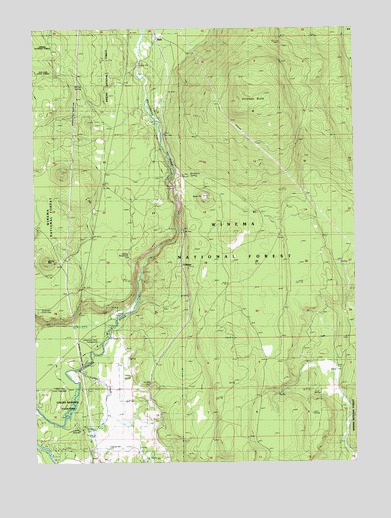
Soloman Butte, OR USGS Topographic Map
Click on map above to begin viewing in our Map Viewer.

This topographic map contains these locations and features:
Feature Name Type Latitude Longitude GNIS ID View Map
Buckeroo SpringSpringN42.7078°W121.8150°1159089View Map
CalimusLocaleN42.6804°W121.8197°1166626View Map
Hilltop ReservoirReservoirN42.6841°W121.8397°1155419View Map
KirkPopulated PlaceN42.7474°W121.8295°1144638View Map
Kirk Post Office (historical)Post OfficeN42.7474°W121.8295°1165490View Map
Larkin CreekStreamN42.6512°W121.8595°1154975View Map
Larkin SpringSpringN42.6343°W121.8593°1154974View Map
Lumberton (historical)LocaleN42.6612°W121.8217°1166244View Map
Martin (historical)LocaleN42.7318°W121.8245°1166245View Map
Merritt SpringSpringN42.7340°W121.8579°1146109View Map
Oux-Kanee OverlookLocaleN42.6682°W121.8742°1639090View Map
Oux-Kanee Recreation SiteLocaleN42.6735°W121.8734°1162455View Map
Soloman ButteSummitN42.7257°W121.7956°1149871View Map
Spring HillSummitN42.6826°W121.8722°1155418View Map
Sun Pass State ForestForestN42.7374°W121.8734°1155125View Map
Warco (historical)LocaleN42.7146°W121.8225°1166248View Map
Williamson River Access ParkParkN42.6587°W121.8520°1154976View Map

Note: Coordinates in the location and feature list above are referenced to NAD83 datum.


Copyright (C) 2008-2025 Ryan Niemi / Sunset Dynamics ... All Rights Reserved