TopoQuest Logo
Do you find TopoQuest useful?
Help keep TopoQuest running and adding new maps/features by donating!
Bitcoin:  19c7KJd3qBynnjoSw5npx9KScwjBe4ifkT
Litecoin:  LXs6TkuXGGXo1vDsWCkWVdjQX94eUKd6ui
Home View Maps Find Maps Find Places Resources & Links


Somerton, Arizona Topographic Map

USGS Map Title: Somerton, AZ
USGS Map MRC: 32114E6
DRG (GeoTIFF) Download: o32114e6.tif


Neighboring USGS Topographic Map Quads:


  Grays Well NE, CA  
32114F7
 

  Yuma West, AZ  
32114F6
 

  Yuma East, AZ  
32114F5
 

  Gadsden, AZ  
32114E7
 

  Somerton, AZ  
32114E6
 

  Yuma SE, AZ  
32114E5


  South of Somerton, AZ  
32114D6
 

  Southeast of Somerton, AZ  
32114D5


Map MRC Location:

N33°
W115°
N33°
W114°
H8 H7 H6 H5 H4 H3 H2 H1
G8 G7 G6 G5 G4 G3 G2 G1
F8 F7 F6 F5 F4 F3 F2 F1
E8 E7 E6 E5 E4 E3 E2 E1
D8 D7 D6 D5 D4 D3 D2 D1
C8 C7 C6 C5 C4 C3 C2 C1
B8 B7 B6 B5 B4 B3 B2 B1
A8 A7 A6 A5 A4 A3 A2 A1
N32°
W115°
N32°
W114°

Somerton, AZ USGS 1:24K Topographic Map Preview:
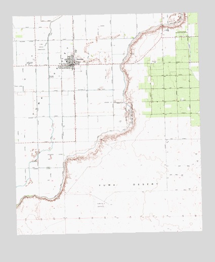
Somerton, AZ USGS Topographic Map
Click on map above to begin viewing in our Map Viewer.

This topographic map contains these locations and features:
Feature Name Type Latitude Longitude GNIS ID View Map
Abbott LateralCanalN32.5709°W114.7008°23474View Map
B Main LateralCanalN32.6028°W114.6313°23487View Map
Bondesson LateralCanalN32.6187°W114.7102°1797View Map
Bronk LateralCanalN32.6156°W114.6933°1987View Map
Cahoon LateralCanalN32.5584°W114.7400°23498View Map
Carter LateralCanalN32.5598°W114.7291°23501View Map
Case LateralCanalN32.5964°W114.7300°23503View Map
Central DrainCanalN32.5528°W114.7438°2696View Map
Checkerboard Airport (historical)AirportN32.5453°W114.6372°45571View Map
Church LateralCanalN32.5853°W114.7477°43124View Map
City of SomertonCivilN32.6009°W114.6990°2411927View Map
Cocopah DrainCanalN32.5684°W114.6752°3088View Map
Converse LateralCanalN32.5889°W114.7441°3188View Map
Corey DrainCanalN32.6217°W114.6458°3258View Map
Desert Sonora Elementary SchoolSchoolN32.5987°W114.7149°23595View Map
East Hearn LateralCanalN32.5751°W114.7263°23523View Map
Faulkner LateralCanalN32.6109°W114.7413°4557View Map
Fishbaugh LateralCanalN32.6084°W114.6847°23526View Map
Franklin LateralCanalN32.6034°W114.7327°23530View Map
Fuller LateralCanalN32.5348°W114.7441°4880View Map
Garven LateralCanalN32.5892°W114.7050°23531View Map
Graham LateralCanalN32.6034°W114.7452°23533View Map
Harris LateralCanalN32.5745°W114.6788°5577View Map
Havens LateralCanalN32.5901°W114.6844°5624View Map
Hearn LateralCanalN32.5820°W114.7313°23541View Map
Hevener LateralCanalN32.5670°W114.7375°5744View Map
Iglesia de Dios PentecostesChurchN32.6000°W114.7108°2623456View Map
Johnson LateralCanalN32.5745°W114.6866°6473View Map
Lateral B-2CanalN32.6112°W114.6347°23550View Map
Lent LateralCanalN32.5320°W114.7269°6975View Map
Main DrainCanalN32.6067°W114.7272°43139View Map
Main LateralCanalN32.6031°W114.6313°7605View Map
Mohawk PeakSummitN32.5895°W114.6480°23567View Map
Molina LateralCanalN32.5598°W114.7411°23568View Map
Orange Grove Elementary SchoolSchoolN32.5888°W114.6591°2543457View Map
Orange Grove Mobile Manor Census Designated PlaceCensusN32.5985°W114.6606°2582836View Map
Rancho Mesa Verde Census Designated PlaceCensusN32.5944°W114.6551°2582848View Map
Rolle AirfieldAirportN32.5144°W114.6983°45507View Map
Rural / Metro Fire Department Station 8BuildingN32.5976°W114.6320°2672736View Map
Shields LateralCanalN32.5867°W114.7286°23591View Map
SomertonPopulated PlaceN32.5964°W114.7097°11548View Map
Somerton / Cocopah Fire DepartmentBuildingN32.5958°W114.7061°2622573View Map
Somerton AirportAirportN32.5983°W114.6678°45506View Map
Somerton CanalCanalN32.5973°W114.7013°11549View Map
Somerton City HallBuildingN32.5967°W114.7105°23594View Map
Somerton DivisionCivilN32.5404°W114.6740°1934982View Map
Somerton LateralCanalN32.5745°W114.7050°23596View Map
Somerton Lateral WastewayCanalN32.5526°W114.7225°23597View Map
Somerton LibraryBuildingN32.6035°W114.7119°2623598View Map
Somerton Middle SchoolSchoolN32.6043°W114.7110°2543485View Map
Somerton ParkParkN32.5962°W114.7175°23598View Map
Somerton Police DepartmentBuildingN32.5961°W114.7060°2622621View Map
Somerton Post OfficePost OfficeN32.5972°W114.7059°44978View Map
Southeast DrainCanalN32.5823°W114.6972°11652View Map
Stevenson LateralCanalN32.5453°W114.7230°11833View Map
Stub Number OneCanalN32.5914°W114.6886°11900View Map
Stub Number TwoCanalN32.5801°W114.6769°11901View Map
Templo de OracionChurchN32.5968°W114.7159°2623528View Map
Thurman LateralCanalN32.5378°W114.7327°43146View Map
Tierra del Sol Elementary SchoolSchoolN32.5884°W114.7086°2543584View Map
Trevorrow LateralCanalN32.5889°W114.7313°23609View Map
Tuttle LateralCanalN32.5742°W114.7119°23612View Map
University of Arizona Agricultural Experiment StationLocaleN32.6131°W114.6363°43219View Map
Valle del Encanto Learning CenterSchoolN32.5993°W114.7177°2543486View Map
West DrainCanalN32.6220°W114.7286°13491View Map
West Hearn LateralCanalN32.5751°W114.7272°23619View Map
White LateralCanalN32.6181°W114.6675°23620View Map
Yuma Number Four Airfield (historical)AirportN32.5162°W114.6938°23636View Map

Note: Coordinates in the location and feature list above are referenced to NAD83 datum.


Copyright (C) 2008-2024 Ryan Niemi / Sunset Dynamics ... All Rights Reserved