TopoQuest Logo
Do you find TopoQuest useful?
Help keep TopoQuest running and adding new maps/features by donating!
Bitcoin:  19c7KJd3qBynnjoSw5npx9KScwjBe4ifkT
Litecoin:  LXs6TkuXGGXo1vDsWCkWVdjQX94eUKd6ui
Home View Maps Find Maps Find Places Resources & Links


Gadsden, Arizona Topographic Map

USGS Map Title: Gadsden, AZ
USGS Map MRC: 32114E7
DRG (GeoTIFF) Download: o32114e7.tif


Neighboring USGS Topographic Map Quads:


  Grays Well, CA  
32114F8
 

  Grays Well NE, CA  
32114F7
 

  Yuma West, AZ  
32114F6


  Gadsden, AZ  
32114E7
 

  Somerton, AZ  
32114E6


  South of Somerton, AZ  
32114D6


Map MRC Location:

N33°
W115°
N33°
W114°
H8 H7 H6 H5 H4 H3 H2 H1
G8 G7 G6 G5 G4 G3 G2 G1
F8 F7 F6 F5 F4 F3 F2 F1
E8 E7 E6 E5 E4 E3 E2 E1
D8 D7 D6 D5 D4 D3 D2 D1
C8 C7 C6 C5 C4 C3 C2 C1
B8 B7 B6 B5 B4 B3 B2 B1
A8 A7 A6 A5 A4 A3 A2 A1
N32°
W115°
N32°
W114°

Gadsden, AZ USGS 1:24K Topographic Map Preview:
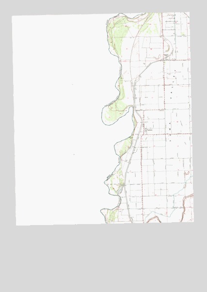
Gadsden, AZ USGS Topographic Map
Click on map above to begin viewing in our Map Viewer.

This topographic map contains these locations and features:
Feature Name Type Latitude Longitude GNIS ID View Map
Adams LateralCanalN32.5745°W114.7777°43122View Map
Arizona Desert Elementary SchoolSchoolN32.5003°W114.7811°2543571View Map
Barkley LateralCanalN32.5089°W114.7911°43123View Map
Cocopah ReservationCivilN32.6176°W114.7828°3089View Map
Croft LateralCanalN32.5881°W114.7613°43125View Map
Cummings LateralCanalN32.5345°W114.7611°43126View Map
Desert View Elementary SchoolSchoolN32.5051°W114.7535°2543466View Map
Edwards LateralCanalN32.5598°W114.7800°43128View Map
Ellis LateralCanalN32.5706°W114.7872°43129View Map
Frates LateralCanalN32.5892°W114.7700°43130View Map
GadsdenPopulated PlaceN32.5545°W114.7850°43131View Map
Gadsden Census Designated PlaceCensusN32.5564°W114.7811°2408271View Map
Gadsden Elementary SchoolSchoolN32.5551°W114.7833°43151View Map
Gadsden ParkParkN32.5564°W114.7861°43152View Map
Gadsden Post OfficePost OfficeN32.5593°W114.7850°44977View Map
Gadsden PurchaseAreaN32.5501°W114.7841°43157View Map
Groover LateralCanalN32.5234°W114.7911°43132View Map
Henry LateralCanalN32.5156°W114.7694°43133View Map
Horn LateralCanalN32.6014°W114.7605°23543View Map
Ingraham LateralCanalN32.5334°W114.7783°43134View Map
Ingraham LateralCanalN32.5417°W114.7866°43135View Map
Kingdom Hall of Jehovahs Witnesses Spanish CongregationChurchN32.5622°W114.7854°2623486View Map
Larkin LateralCanalN32.5162°W114.7911°43136View Map
Lott LateralCanalN32.5667°W114.7527°43137View Map
Lyon LateralCanalN32.5306°W114.7916°43138View Map
Malloy LateralCanalN32.5856°W114.7825°43153View Map
Mann LateralCanalN32.5451°W114.7844°43140View Map
McDaniel Field (historical)AirportN32.5881°W114.7677°43154View Map
Monroe LateralCanalN32.5987°W114.7591°23569View Map
Neatherlin LateralCanalN32.5523°W114.7591°43155View Map
Noe CanalCanalN32.5087°W114.7616°43141View Map
Parvin LateralCanalN32.5342°W114.7866°43156View Map
Pesch CanalCanalN32.6231°W114.7527°9339View Map
Rural / Metro Fire Department Station 11BuildingN32.5572°W114.7855°2622586View Map
San Luis High SchoolSchoolN32.5007°W114.7628°2543482View Map
Schutz LateralCanalN32.5526°W114.7697°43143View Map
Somerton SidingLocaleN32.5989°W114.7663°11550View Map
South DrainCanalN32.5484°W114.7875°43144View Map
Southwest LateralCanalN32.5553°W114.7569°43145View Map
Walton LateralCanalN32.6184°W114.7575°13334View Map
Yuma ValleyValleyN32.5001°W114.8002°43149View Map

Note: Coordinates in the location and feature list above are referenced to NAD83 datum.


Copyright (C) 2008-2025 Ryan Niemi / Sunset Dynamics ... All Rights Reserved