TopoQuest Logo
Do you find TopoQuest useful?
Help keep TopoQuest running and adding new maps/features by donating!
Bitcoin:  19c7KJd3qBynnjoSw5npx9KScwjBe4ifkT
Litecoin:  LXs6TkuXGGXo1vDsWCkWVdjQX94eUKd6ui
Home View Maps Find Maps Find Places Resources & Links


Blackcap Mountain, California Topographic Map

USGS Map Title: Blackcap Mountain, CA
USGS Map MRC: 37118A7
DRG (GeoTIFF) Download: o37118a7.tif


Neighboring USGS Topographic Map Quads:


  Ward Mountain, CA  
37118B8
 

  Mount Henry, CA  
37118B7
 

  Mount Darwin, CA  
37118B6
 

  Courtright Reservoir, CA  
37118A8
 

  Blackcap Mountain, CA  
37118A7
 

  Mount Goddard, CA  
37118A6
 

  Rough Spur, CA  
36118H8
 

  Tehipite Dome, CA  
36118H7
 

  Slide Bluffs, CA  
36118H6


Map MRC Location:

N38°
W119°
N38°
W118°
H8 H7 H6 H5 H4 H3 H2 H1
G8 G7 G6 G5 G4 G3 G2 G1
F8 F7 F6 F5 F4 F3 F2 F1
E8 E7 E6 E5 E4 E3 E2 E1
D8 D7 D6 D5 D4 D3 D2 D1
C8 C7 C6 C5 C4 C3 C2 C1
B8 B7 B6 B5 B4 B3 B2 B1
A8 A7 A6 A5 A4 A3 A2 A1
N37°
W119°
N37°
W118°

Blackcap Mountain, CA USGS 1:24K Topographic Map Preview:
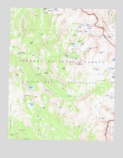
Blackcap Mountain, CA USGS Topographic Map
Click on map above to begin viewing in our Map Viewer.

This topographic map contains these locations and features:
Feature Name Type Latitude Longitude GNIS ID View Map
Ambition LakeLakeN37.0771°W118.7518°256212View Map
Bench ValleyBasinN37.0917°W118.7947°256820View Map
Big Maxson MeadowFlatN37.0627°W118.8340°256957View Map
Big Shot LakeLakeN37.1240°W118.8242°1667313View Map
Bighorn LakeLakeN37.0687°W118.7567°219285View Map
Blackcap BasinBasinN37.0663°W118.7709°257170View Map
Blackcap MountainSummitN37.0720°W118.7936°257171View Map
Bullet LakeLakeN37.1028°W118.7902°257675View Map
Castle RidgeRidgeN37.1128°W118.8127°277137View Map
Chuck PassGapN37.0088°W118.8590°258359View Map
Cold SpringsSpringN37.1205°W118.8368°1667323View Map
Colt LakeLakeN37.0866°W118.7983°258608View Map
Crabtree LakeLakeN37.1067°W118.7953°258852View Map
Crown BasinBasinN37.0302°W118.7718°258946View Map
Crown LakeLakeN37.0333°W118.8481°258947View Map
Crown PassGapN37.0413°W118.8568°1667327View Map
Division LakeLakeN37.0604°W118.7525°259401View Map
Fall CreekStreamN37.0747°W118.8415°260025View Map
Filly LakeLakeN37.0916°W118.7918°260104View Map
Fleming CreekStreamN37.0869°W118.8676°260202View Map
Guest LakeLakeN37.0776°W118.7973°260977View Map
Halfmoon LakeLakeN37.0495°W118.8497°261017View Map
Hockey LakesLakeN37.1027°W118.7784°277138View Map
Holster LakeLakeN37.1063°W118.7840°261426View Map
Horseshoe LakeLakeN37.0901°W118.7996°261527View Map
Hummingbird LakeLakeN37.0211°W118.7622°1667337View Map
Lake ConfusionLakeN37.0985°W118.7613°1667324View Map
Lightning Corral MeadowFlatN37.0666°W118.7732°1667342View Map
Little Jo LakeLakeN37.0876°W118.7841°262645View Map
Lone Doe LakeLakeN37.0994°W118.8009°262796View Map
Maxson BasinBasinN37.0313°W118.7998°1667352View Map
Maxson LakeLakeN37.0308°W118.8128°263277View Map
McGuire LakesLakeN37.0785°W118.8063°263368View Map
Meadow BrookStreamN37.0805°W118.8534°263418View Map
Meadow Brook CabinBuildingN37.0819°W118.8626°1667354View Map
Midway LakeLakeN37.0417°W118.7509°263558View Map
Mountain MeadowFlatN37.0677°W118.8137°1667356View Map
Nichols CanyonValleyN37.0799°W118.8614°264085View Map
Old Pipe LakeLakeN37.0608°W118.8682°264335View Map
Portal LakeLakeN37.0430°W118.7575°264962View Map
Rainbow LakeLakeN37.0843°W118.7653°265141View Map
Ram LakeLakeN37.0640°W118.7506°265160View Map
Roman Four LakeLakeN37.0939°W118.7961°265555View Map
Scepter LakeLakeN37.0304°W118.8361°265900View Map
Scepter PassGapN37.0472°W118.8343°265901View Map
Schoolmarm LakeLakeN37.1088°W118.7893°265924View Map
Six Shooter LakeLakeN37.1090°W118.7862°266222View Map
Twin Buck LakesLakeN37.1023°W118.7950°236684View Map
Wah Hoo LakeLakeN37.1080°W118.7846°268739View Map

Note: Coordinates in the location and feature list above are referenced to NAD83 datum.


Copyright (C) 2008-2025 Ryan Niemi / Sunset Dynamics ... All Rights Reserved