TopoQuest Logo
Do you find TopoQuest useful?
Help keep TopoQuest running and adding new maps/features by donating!
Bitcoin:  19c7KJd3qBynnjoSw5npx9KScwjBe4ifkT
Litecoin:  LXs6TkuXGGXo1vDsWCkWVdjQX94eUKd6ui
Home View Maps Find Maps Find Places Resources & Links


South Red Iron Lake, South Dakota Topographic Map

USGS Map Title: South Red Iron Lake, SD
USGS Map MRC: 45097F3
DRG (GeoTIFF) Download: o45097f3.tif


Neighboring USGS Topographic Map Quads:


  Hillhead, SD  
45097G4
 

  Veblen, SD  
45097G3
 

  Claire City SW, SD  
45097G2
 

  Lake City, SD  
45097F4
 

  South Red Iron Lake, SD  
45097F3
 

  Whitestone Lake, SD  
45097F2
 

  Eden, SD  
45097E4
 

  Piyas Lake, SD  
45097E3
 

  Drywood Lakes, SD  
45097E2


Map MRC Location:

N46°
W98°
N46°
W97°
H8 H7 H6 H5 H4 H3 H2 H1
G8 G7 G6 G5 G4 G3 G2 G1
F8 F7 F6 F5 F4 F3 F2 F1
E8 E7 E6 E5 E4 E3 E2 E1
D8 D7 D6 D5 D4 D3 D2 D1
C8 C7 C6 C5 C4 C3 C2 C1
B8 B7 B6 B5 B4 B3 B2 B1
A8 A7 A6 A5 A4 A3 A2 A1
N45°
W98°
N45°
W97°

South Red Iron Lake, SD USGS 1:24K Topographic Map Preview:
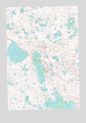
South Red Iron Lake, SD USGS Topographic Map
Click on map above to begin viewing in our Map Viewer.

This topographic map contains these locations and features:
Feature Name Type Latitude Longitude GNIS ID View Map
Almos LakeLakeN45.6321°W97.3052°1253630View Map
Buffalo Lake DistrictCivilN45.6736°W97.3475°2419323View Map
Clear LakeLakeN45.6935°W97.3594°1254397View Map
Crystal LakeLakeN45.7457°W97.3467°1265632View Map
Goodbird LakeLakeN45.7273°W97.3114°1255280View Map
Greys LakeLakeN45.7174°W97.2568°1255371View Map
Heipa DistrictCivilN45.7193°W97.2804°2418961View Map
Island LakeLakeN45.7144°W97.2864°1255790View Map
Island LakeLakeN45.7478°W97.3269°1255791View Map
Josephine LakeLakeN45.6499°W97.3120°1255889View Map
Lake IsabellaLakeN45.6389°W97.3422°1255787View Map
Luffman (historical)LocaleN45.7030°W97.3520°1263212View Map
Meyer SloughLakeN45.6676°W97.2976°1256441View Map
Mud LakeLakeN45.7272°W97.2648°1256606View Map
North Red Iron LakeLakeN45.6902°W97.3232°1256770View Map
Old Eden CemeteryCemeteryN45.6441°W97.3517°1256860View Map
Pete W SloughLakeN45.6787°W97.2988°1257021View Map
Sarah LakeLakeN45.6837°W97.2902°1257808View Map
Simmon LakeLakeN45.7197°W97.3424°1258072View Map
South Red Iron LakeLakeN45.6718°W97.3184°1258211View Map
Township of Red Iron LakeCivilN45.6890°W97.2892°1267762View Map
Wolf LakeLakeN45.6960°W97.2538°1259066View Map

Note: Coordinates in the location and feature list above are referenced to NAD83 datum.


Copyright (C) 2008-2025 Ryan Niemi / Sunset Dynamics ... All Rights Reserved