TopoQuest Logo
Do you find TopoQuest useful?
Help keep TopoQuest running and adding new maps/features by donating!
Bitcoin:  19c7KJd3qBynnjoSw5npx9KScwjBe4ifkT
Litecoin:  LXs6TkuXGGXo1vDsWCkWVdjQX94eUKd6ui
Home View Maps Find Maps Find Places Resources & Links


Southard, Oklahoma Topographic Map

USGS Map Title: Southard, OK
USGS Map MRC: 36098A4
DRG (GeoTIFF) Download: o36098a4.tif


Neighboring USGS Topographic Map Quads:


  Longdale, OK  
36098B5
 

  Homestead, OK  
36098B4
 

  Isabella, OK  
36098B3
 

  Canton, OK  
36098A5
 

  Southard, OK  
36098A4
 

  Okeene, OK  
36098A3
 

  Eagle City, OK  
35098H5
 

  Watonga Lake, OK  
35098H4
 

  Hitchcock, OK  
35098H3


Map MRC Location:

N37°
W99°
N37°
W98°
H8 H7 H6 H5 H4 H3 H2 H1
G8 G7 G6 G5 G4 G3 G2 G1
F8 F7 F6 F5 F4 F3 F2 F1
E8 E7 E6 E5 E4 E3 E2 E1
D8 D7 D6 D5 D4 D3 D2 D1
C8 C7 C6 C5 C4 C3 C2 C1
B8 B7 B6 B5 B4 B3 B2 B1
A8 A7 A6 A5 A4 A3 A2 A1
N36°
W99°
N36°
W98°

Southard, OK USGS 1:24K Topographic Map Preview:
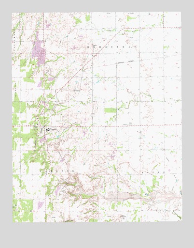
Southard, OK USGS Topographic Map
Click on map above to begin viewing in our Map Viewer.

This topographic map contains these locations and features:
Feature Name Type Latitude Longitude GNIS ID View Map
Bitter CreekStreamN36.0136°W98.3770°1090177View Map
DarrowPopulated PlaceN36.0981°W98.3884°1100342View Map
Karber PondReservoirN36.0934°W98.4787°1754347View Map
Karber Pond DamDamN36.0934°W98.4787°1754346View Map
Midlin CemeteryCemeteryN36.0361°W98.3886°1851638View Map
Mount HenquentSummitN36.0034°W98.4209°1093670View Map
Ruby Mill CanyonValleyN36.0011°W98.4353°1097517View Map
SouthardPopulated PlaceN36.0559°W98.4754°1098285View Map
Township of CarltonCivilN36.0306°W98.4781°1825489View Map
Township of HomesteadCivilN36.1084°W98.4115°1825480View Map

Note: Coordinates in the location and feature list above are referenced to NAD83 datum.


Copyright (C) 2008-2025 Ryan Niemi / Sunset Dynamics ... All Rights Reserved