TopoQuest Logo
Do you find TopoQuest useful?
Help keep TopoQuest running and adding new maps/features by donating!
Bitcoin:  19c7KJd3qBynnjoSw5npx9KScwjBe4ifkT
Litecoin:  LXs6TkuXGGXo1vDsWCkWVdjQX94eUKd6ui
Home View Maps Find Maps Find Places Resources & Links


Sparr, Michigan Topographic Map

USGS Map Title: Sparr, MI
USGS Map MRC: 45084A5
DRG (GeoTIFF) Download: o45084a5.tif


Neighboring USGS Topographic Map Quads:


  Vanderbilt, MI  
45084B6
 

  Green Timbers, MI  
45084B5
 

  Hardwood Lake, MI  
45084B4
 

  Gaylord, MI  
45084A6
 

  Sparr, MI  
45084A5
 

  Saunders Creek, MI  
45084A4
 

  Otsego Lake, MI  
44084H6
 

  Turtle Lake, MI  
44084H5
 

  Johannesburg, MI  
44084H4


Map MRC Location:

N46°
W85°
N46°
W84°
H8 H7 H6 H5 H4 H3 H2 H1
G8 G7 G6 G5 G4 G3 G2 G1
F8 F7 F6 F5 F4 F3 F2 F1
E8 E7 E6 E5 E4 E3 E2 E1
D8 D7 D6 D5 D4 D3 D2 D1
C8 C7 C6 C5 C4 C3 C2 C1
B8 B7 B6 B5 B4 B3 B2 B1
A8 A7 A6 A5 A4 A3 A2 A1
N45°
W85°
N45°
W84°

Sparr, MI USGS 1:24K Topographic Map Preview:
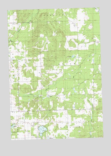
Sparr, MI USGS Topographic Map
Click on map above to begin viewing in our Map Viewer.

This topographic map contains these locations and features:
Feature Name Type Latitude Longitude GNIS ID View Map
Big LakeLakeN45.0086°W84.5827°621328View Map
Big Lake SchoolSchoolN45.0050°W84.5878°621330View Map
Brown's Dale Post Office (historical)Post OfficeN45.1125°W84.5583°2492616View Map
Kassuba LakeLakeN45.0130°W84.6231°629469View Map
King SchoolSchoolN45.0006°W84.5489°629707View Map
Lake FifteenLakeN45.0786°W84.5379°625942View Map
Marquardt SchoolSchoolN45.0697°W84.5820°631599View Map
Mossback CreekStreamN45.0958°W84.6184°632757View Map
Otsego CountyCivilN45.0214°W84.5990°1623011View Map
Pulaski SchoolSchoolN45.0272°W84.6231°635509View Map
Shields SchoolSchoolN45.0697°W84.6239°637799View Map
South Branch Pigeon RiverStreamN45.0656°W84.5320°638301View Map
SparrPopulated PlaceN45.0414°W84.5725°1623742View Map
Sparr Post Office (historical)Post OfficeN45.0417°W84.5725°2492601View Map
Threetops Golf CourseLocaleN45.0972°W84.5883°2492530View Map
Township of DoverCivilN45.0701°W84.5515°1626190View Map
Treetops Masterpiece Golf CourseLakeN45.0289°W84.6033°2492561View Map
Treetops Premier Golf CourseLocaleN45.0894°W84.5856°2492532View Map
Treetops Resort Ski AreaLocaleN45.0372°W84.5861°2492528View Map
Treetops Signature Golf CourseLocaleN45.0989°W84.5961°2492531View Map
Treetops Tradition Golf CourseLocaleN45.0900°W84.5750°2492534View Map

Note: Coordinates in the location and feature list above are referenced to NAD83 datum.


Copyright (C) 2008-2024 Ryan Niemi / Sunset Dynamics ... All Rights Reserved