TopoQuest Logo
Do you find TopoQuest useful?
Help keep TopoQuest running and adding new maps/features by donating!
Bitcoin:  19c7KJd3qBynnjoSw5npx9KScwjBe4ifkT
Litecoin:  LXs6TkuXGGXo1vDsWCkWVdjQX94eUKd6ui
Home View Maps Find Maps Find Places Resources & Links


Vanderbilt, Michigan Topographic Map

USGS Map Title: Vanderbilt, MI
USGS Map MRC: 45084B6
DRG (GeoTIFF) Download: o45084b6.tif


Neighboring USGS Topographic Map Quads:


  Wildwood, MI  
45084C6
 

  Wolverine, MI  
45084C5
 

  Thumb Lake, MI  
45084B7
 

  Vanderbilt, MI  
45084B6
 

  Green Timbers, MI  
45084B5
 

  Elmira, MI  
45084A7
 

  Gaylord, MI  
45084A6
 

  Sparr, MI  
45084A5


Map MRC Location:

N46°
W85°
N46°
W84°
H8 H7 H6 H5 H4 H3 H2 H1
G8 G7 G6 G5 G4 G3 G2 G1
F8 F7 F6 F5 F4 F3 F2 F1
E8 E7 E6 E5 E4 E3 E2 E1
D8 D7 D6 D5 D4 D3 D2 D1
C8 C7 C6 C5 C4 C3 C2 C1
B8 B7 B6 B5 B4 B3 B2 B1
A8 A7 A6 A5 A4 A3 A2 A1
N45°
W85°
N45°
W84°

Vanderbilt, MI USGS 1:24K Topographic Map Preview:
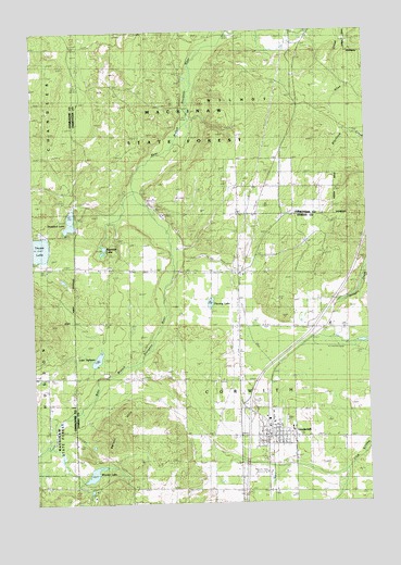
Vanderbilt, MI USGS Topographic Map
Click on map above to begin viewing in our Map Viewer.

This topographic map contains these locations and features:
Feature Name Type Latitude Longitude GNIS ID View Map
Berryville Post Office (historical)Post OfficeN45.1283°W84.7278°2492617View Map
Black Bear Golf ClubLocaleN45.1797°W84.6425°2492634View Map
Fleming LakeLakeN45.1779°W84.6840°626157View Map
Holy Redeemer ChurchChurchN45.1439°W84.6642°2492625View Map
Interchange 290CrossingN45.1500°W84.6700°2492651View Map
Kingdom Hall of Jehovah's WitnessesChurchN45.2000°W84.6661°2492627View Map
Lake EighteenLakeN45.1632°W84.7264°625409View Map
Mill Street Mobile Home ParkPopulated PlaceN45.1333°W84.6667°2492633View Map
Northern Lights Christian ChurchChurchN45.1653°W84.6733°2492626View Map
Pigeon River Baptist ChurchChurchN45.1411°W84.6631°2492624View Map
Reardon LakeLakeN45.1913°W84.7245°635698View Map
School Number 4SchoolN45.2092°W84.6523°637403View Map
Standard LakeLakeN45.1996°W84.7360°638711View Map
Township of WilmotCivilN45.2449°W84.6724°1627276View Map
VanderbiltPopulated PlaceN45.1428°W84.6603°1615504View Map
Vanderbilt / Corwith Fire and RescueBuildingN45.1450°W84.6627°2492630View Map
Vanderbilt Area SchoolSchoolN45.1442°W84.6539°2492631View Map
Vanderbilt CemeteryCemeteryN45.1542°W84.6625°1615505View Map
Vanderbilt Community ChurchChurchN45.1428°W84.6642°2492623View Map
Vanderbilt LibraryBuildingN45.1453°W84.6625°2492629View Map
Vanderbilt Post OfficePost OfficeN45.1422°W84.6625°2492632View Map
Vanderbilt Station (historical)LocaleN45.1431°W84.6617°2492628View Map
Village of VanderbiltCivilN45.1437°W84.6641°2400045View Map
Watson HillsSummitN45.1439°W84.7217°1615876View Map
Woodin LakeLakeN45.1328°W84.7285°1616750View Map

Note: Coordinates in the location and feature list above are referenced to NAD83 datum.


Copyright (C) 2008-2025 Ryan Niemi / Sunset Dynamics ... All Rights Reserved