TopoQuest Logo
Do you find TopoQuest useful?
Help keep TopoQuest running and adding new maps/features by donating!
Bitcoin:  19c7KJd3qBynnjoSw5npx9KScwjBe4ifkT
Litecoin:  LXs6TkuXGGXo1vDsWCkWVdjQX94eUKd6ui
Home View Maps Find Maps Find Places Resources & Links


Spirit Mountain NW, Nevada Topographic Map

USGS Map Title: Spirit Mountain NW, NV
USGS Map MRC: 35114D6
DRG (GeoTIFF) Download: o35114d6.tif


Neighboring USGS Topographic Map Quads:


  Ireteba Peaks, NV  
35114E7
 

  Mount Davis, AZ  
35114E6
 

  Mount Perkins, AZ  
35114E5
 

  Fourth of July Mountain, NV  
35114D7
 

  Spirit Mountain NW, NV  
35114D6
 

  Spirit Mountain NE, AZ  
35114D5
 

  Searchlight SE, NV  
35114C7
 

  Spirit Mountain, NV  
35114C6
 

  Spirit Mountain SE, AZ  
35114C5


Map MRC Location:

N36°
W115°
N36°
W114°
H8 H7 H6 H5 H4 H3 H2 H1
G8 G7 G6 G5 G4 G3 G2 G1
F8 F7 F6 F5 F4 F3 F2 F1
E8 E7 E6 E5 E4 E3 E2 E1
D8 D7 D6 D5 D4 D3 D2 D1
C8 C7 C6 C5 C4 C3 C2 C1
B8 B7 B6 B5 B4 B3 B2 B1
A8 A7 A6 A5 A4 A3 A2 A1
N35°
W115°
N35°
W114°

Spirit Mountain NW, NV USGS 1:24K Topographic Map Preview:
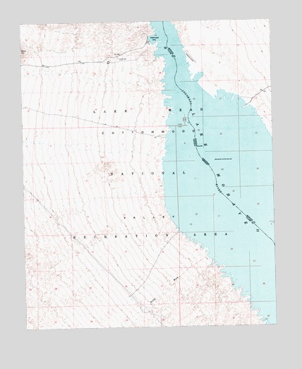
Spirit Mountain NW, NV USGS Topographic Map
Click on map above to begin viewing in our Map Viewer.

This topographic map contains these locations and features:
Feature Name Type Latitude Longitude GNIS ID View Map
Airport CoveBayN35.4817°W114.6672°42985View Map
Bill Gayes CoveBayN35.4611°W114.6761°863648View Map
Box CoveBayN35.4994°W114.6841°863718View Map
Carp CoveBayN35.4775°W114.6608°43083View Map
Cottontail CoveBayN35.4867°W114.6819°863650View Map
Cottonwood Camp (historical)LocaleN35.4064°W114.6272°855738View Map
Cottonwood CoveLocaleN35.4914°W114.6866°849597View Map
Cottonwood CoveBayN35.4925°W114.6833°839736View Map
Cottonwood Cove Rural Branch Post OfficePost OfficeN35.4914°W114.6866°865005View Map
Cottonwood East AreaAreaN35.4555°W114.6439°42981View Map
Cottonwood Island (historical)IslandN35.4064°W114.6272°851583View Map
Cottonwood Island CoveBayN35.4667°W114.6775°863646View Map
Cottonwood Landing Field (historical)AirportN35.4853°W114.6661°22892View Map
Cottonwood ValleyValleyN35.4344°W114.6902°845301View Map
Cottonwood Valley CoveBayN35.4678°W114.6439°42983View Map
D Hutton Ranch (historical)LocaleN35.4514°W114.6675°863361View Map
Dead CoveBayN35.3969°W114.6502°863638View Map
Finger CoveBayN35.3758°W114.6291°863633View Map
Five Rapids (historical)RapidsN35.4000°W114.6341°24044View Map
Gremlin CoveBayN35.3942°W114.6466°863637View Map
Hog Farm CoveBayN35.4478°W114.6783°863641View Map
Lake MohaveReservoirN35.4581°W114.6426°8177View Map
Levi CoveBayN35.4894°W114.6697°42986View Map
Lost CoveBayN35.3883°W114.6408°863635View Map
Mesa CoveBayN35.3908°W114.6455°863636View Map
Mesquite CoveBayN35.4630°W114.6747°863647View Map
Nellis CoveBayN35.4036°W114.6580°863639View Map
Nellis WashStreamN35.4033°W114.6594°842401View Map
Nellis Wash WildernessReserveN35.3836°W114.7319°2575140View Map
Nine Mile CovesBayN35.4142°W114.6733°863640View Map
North Basin Light CoveBayN35.4803°W114.6786°863651View Map
Pot CoveBayN35.4661°W114.6411°42982View Map
Quartette (historical)LocaleN35.4314°W114.6550°851523View Map
Riverside Ranch (historical)LocaleN35.4903°W114.6814°846653View Map
Sandy Point CoveBayN35.4708°W114.6794°863645View Map
Searchlight FerryLocaleN35.4064°W114.6272°851588View Map
Six Mile AreaAreaN35.4583°W114.6772°863642View Map
Six Mile CoveBayN35.4530°W114.6780°863643View Map
Ski CoveBayN35.4903°W114.6814°863652View Map
Tequila CoveBayN35.4755°W114.6794°863644View Map
Three Sisters CoveBayN35.3839°W114.6372°863634View Map
Water Wheel CoveBayN35.4689°W114.6494°42984View Map
Windmill CoveBayN35.4586°W114.6786°863649View Map

Note: Coordinates in the location and feature list above are referenced to NAD83 datum.


Copyright (C) 2008-2025 Ryan Niemi / Sunset Dynamics ... All Rights Reserved