TopoQuest Logo
Do you find TopoQuest useful?
Help keep TopoQuest running and adding new maps/features by donating!
Bitcoin:  19c7KJd3qBynnjoSw5npx9KScwjBe4ifkT
Litecoin:  LXs6TkuXGGXo1vDsWCkWVdjQX94eUKd6ui
Home View Maps Find Maps Find Places Resources & Links


Spirit Mountain SE, Arizona Topographic Map

USGS Map Title: Spirit Mountain SE, AZ
USGS Map MRC: 35114C5
DRG (GeoTIFF) Download: o35114c5.tif


Neighboring USGS Topographic Map Quads:


  Spirit Mountain NW, NV  
35114D6
 

  Spirit Mountain NE, AZ  
35114D5
 

  Grasshopper Junction NW, AZ  
35114D4
 

  Spirit Mountain, NV  
35114C6
 

  Spirit Mountain SE, AZ  
35114C5
 

  Burns Spring, AZ  
35114C4
 

  Bridge Canyon, NV  
35114B6
 

  Davis Dam, AZ  
35114B5
 

  Union Pass, AZ  
35114B4


Map MRC Location:

N36°
W115°
N36°
W114°
H8 H7 H6 H5 H4 H3 H2 H1
G8 G7 G6 G5 G4 G3 G2 G1
F8 F7 F6 F5 F4 F3 F2 F1
E8 E7 E6 E5 E4 E3 E2 E1
D8 D7 D6 D5 D4 D3 D2 D1
C8 C7 C6 C5 C4 C3 C2 C1
B8 B7 B6 B5 B4 B3 B2 B1
A8 A7 A6 A5 A4 A3 A2 A1
N35°
W115°
N35°
W114°

Spirit Mountain SE, AZ USGS 1:24K Topographic Map Preview:
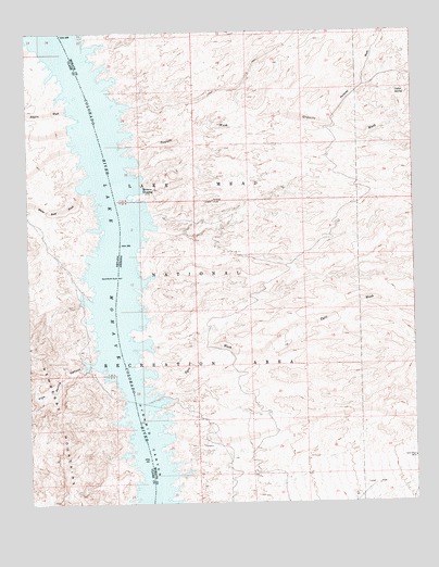
Spirit Mountain SE, AZ USGS Topographic Map
Click on map above to begin viewing in our Map Viewer.

This topographic map contains these locations and features:
Feature Name Type Latitude Longitude GNIS ID View Map
Burro CoveBayN35.2603°W114.5791°43054View Map
Cactus CoveBayN35.3708°W114.6039°43075View Map
Calles SpringSpringN35.3592°W114.5061°2379View Map
Camp Thurman CovesBayN35.3453°W114.6091°863627View Map
Chemeheuve CoveBayN35.3639°W114.6175°863632View Map
Chili Pepper CoveBayN35.2978°W114.5900°43064View Map
Cholla CoveBayN35.2533°W114.5911°863612View Map
Clam CoveBayN35.3586°W114.6139°863630View Map
Cottonwood IslandIslandN35.3581°W114.6097°863631View Map
Coyote CoveBayN35.2889°W114.5911°43062View Map
Desert CoveBayN35.3089°W114.5883°43066View Map
Eighty-Three Dollar CoveBayN35.2869°W114.6039°863618View Map
Empire CoveBayN35.3547°W114.6114°863629View Map
Empire WashStreamN35.3544°W114.6127°840365View Map
Forty-Niner CoveBayN35.3103°W114.6064°863622View Map
Gasoline AlleyBayN35.2575°W114.5700°43053View Map
Gold Chain MineMineN35.2619°W114.5011°5098View Map
Gold CoveBayN35.3403°W114.5916°863737View Map
Granite CoveBayN35.3481°W114.5936°43073View Map
Granite WashStreamN35.3367°W114.5880°411View Map
Green Light CoveBayN35.2786°W114.5952°863616View Map
Indian CoveBayN35.3442°W114.5939°43072View Map
Jeep CoveBayN35.3556°W114.5939°43074View Map
Katherine Powerline CoveBayN35.2767°W114.5841°43058View Map
Lode CoveBayN35.3236°W114.5852°43068View Map
Lone Tree CoveBayN35.3156°W114.6055°863623View Map
Lost Cabin WashStreamN35.3553°W114.5919°7395View Map
Mine Shaft CoveBayN35.2783°W114.5864°43059View Map
Mohave CrossingPopulated PlaceN35.3333°W114.5889°43098View Map
Mohave Crossing CoveBayN35.3339°W114.5891°43069View Map
Mohave Crossing LightLocaleN35.2953°W114.5927°43065View Map
North Haystack CoveBayN35.3650°W114.6019°43084View Map
Pack Rat CoveBayN35.3364°W114.5908°43070View Map
Pipe Spring CanyonValleyN35.2869°W114.6050°842870View Map
Portland CoveBayN35.3408°W114.5916°43071View Map
Portland WashStreamN35.3508°W114.5280°9670View Map
Prospect CoveBayN35.2633°W114.5816°43055View Map
Pyramid CoveBayN35.2842°W114.6000°863617View Map
Pyrite CoveBayN35.2808°W114.5875°43060View Map
Quartz CovesBayN35.2942°W114.6033°863619View Map
Rams Head CoveBayN35.2722°W114.5961°863615View Map
Rattlesnake CoveBayN35.3253°W114.6014°863624View Map
Red Light CoveBayN35.2922°W114.5889°43063View Map
Roman CoveBayN35.2986°W114.6061°863620View Map
Seven-Eleven CoveBayN35.3308°W114.6033°863625View Map
Shoshone CoveBayN35.2675°W114.5819°43056View Map
Sidewinder CoveBayN35.3233°W114.5850°43067View Map
Silver Cut MeadowsFlatN35.3167°W114.5011°24037View Map
South Haystack CoveBayN35.3619°W114.5991°42972View Map
Spirit CoveBayN35.2631°W114.5941°863614View Map
Tokyo BayBayN35.2731°W114.5825°43057View Map
Totem Pole CoveBayN35.2675°W114.5927°863736View Map
Trout CoveBayN35.2606°W114.5916°863613View Map
Turtle CoveBayN35.3039°W114.6066°863621View Map
Tyro CoveBayN35.2847°W114.5880°43061View Map
Tyro WashStreamN35.2842°W114.5844°13022View Map
White Rock WashStreamN35.3328°W114.6089°844809View Map
White Rock Wash CoveBayN35.3342°W114.6075°863626View Map
Willow CoveBayN35.3497°W114.6105°863628View Map
Yoke CoveBayN35.2536°W114.5797°43052View Map

Note: Coordinates in the location and feature list above are referenced to NAD83 datum.


Copyright (C) 2008-2025 Ryan Niemi / Sunset Dynamics ... All Rights Reserved