TopoQuest Logo
Do you find TopoQuest useful?
Help keep TopoQuest running and adding new maps/features by donating!
Bitcoin:  19c7KJd3qBynnjoSw5npx9KScwjBe4ifkT
Litecoin:  LXs6TkuXGGXo1vDsWCkWVdjQX94eUKd6ui
Home View Maps Find Maps Find Places Resources & Links


Spokane SW, Washington Topographic Map

USGS Map Title: Spokane SW, WA
USGS Map MRC: 47117E4
DRG (GeoTIFF) Download: o47117e4.tif


Neighboring USGS Topographic Map Quads:


  Airway Heights, WA  
47117F5
 

  Spokane NW, WA  
47117F4
 

  Spokane NE, WA  
47117F3
 

  Four Lakes, WA  
47117E5
 

  Spokane SW, WA  
47117E4
 

  Spokane SE, WA  
47117E3
 

  Cheney, WA  
47117D5
 

  Spangle West, WA  
47117D4
 

  Spangle East, WA  
47117D3


Map MRC Location:

N48°
W118°
N48°
W117°
H8 H7 H6 H5 H4 H3 H2 H1
G8 G7 G6 G5 G4 G3 G2 G1
F8 F7 F6 F5 F4 F3 F2 F1
E8 E7 E6 E5 E4 E3 E2 E1
D8 D7 D6 D5 D4 D3 D2 D1
C8 C7 C6 C5 C4 C3 C2 C1
B8 B7 B6 B5 B4 B3 B2 B1
A8 A7 A6 A5 A4 A3 A2 A1
N47°
W118°
N47°
W117°

Spokane SW, WA USGS 1:24K Topographic Map Preview:
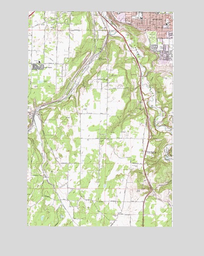
Spokane SW, WA USGS Topographic Map
Click on map above to begin viewing in our Map Viewer.

This topographic map contains these locations and features:
Feature Name Type Latitude Longitude GNIS ID View Map
All Saints Middle SchoolSchoolN47.6243°W117.3883°1502993View Map
Comstock SchoolSchoolN47.6241°W117.4213°1504098View Map
CowlesLocaleN47.6099°W117.4413°1511748View Map
Fowlers Northwest 40 AirportAirportN47.5207°W117.4627°1533979View Map
Geiger HeightsPopulated PlaceN47.5927°W117.4908°1512235View Map
Hamblen Elementary SchoolSchoolN47.6179°W117.3803°1530918View Map
Hangman ValleyValleyN47.6243°W117.4391°1505371View Map
High Drive ParkwayParkN47.6185°W117.4210°1505499View Map
Homeport AirportAirportN47.5238°W117.4705°1533978View Map
Jefferson Elementary SchoolSchoolN47.6217°W117.4091°1530947View Map
KCKO-AM (Spokane)TowerN47.6016°W117.3780°1534301View Map
KEYF-AM (Dishman)TowerN47.5993°W117.3783°1534246View Map
KJRB-AM (Spokane)TowerN47.6043°W117.3874°1534302View Map
KSPO-AM (Dishman)TowerN47.5993°W117.3783°1534245View Map
Magpie Flats HeliportAirportN47.5554°W117.4955°1533832View Map
Manito Golf Country ClubLocaleN47.6104°W117.3933°1533167View Map
MarshallPopulated PlaceN47.5649°W117.4994°1509691View Map
Marshall CreekStreamN47.6121°W117.4297°1513161View Map
Marshall Post OfficePost OfficeN47.5637°W117.4957°2781725View Map
Minnie CreekStreamN47.5579°W117.4924°1506729View Map
Mullan Hill Airport (historical)AirportN47.5546°W117.4127°1533975View Map
Mullan Military Road Historical MonumentParkN47.5435°W117.3974°1506886View Map
OverlookLocaleN47.5960°W117.4485°1511830View Map
Ox Meadows AirportAirportN47.5818°W117.4372°1533970View Map
Rosa ButteSummitN47.5218°W117.4019°1507911View Map
Southside Montessori Elementary SchoolSchoolN47.6248°W117.4026°1514825View Map
Spokane CountyCivilN47.6207°W117.4039°1529225View Map
Spokane County Fire District 3BuildingN47.5505°W117.4388°2643785View Map
Spokane County Fire District 3 Station 34BuildingN47.5841°W117.4980°2643784View Map
Spokane Memorial GardensCemeteryN47.5984°W117.4415°1508603View Map
Spokane South DivisionCivilN47.5505°W117.4250°1939558View Map
Windsor Elementary SchoolSchoolN47.5956°W117.4903°1531195View Map

Note: Coordinates in the location and feature list above are referenced to NAD83 datum.


Copyright (C) 2008-2024 Ryan Niemi / Sunset Dynamics ... All Rights Reserved