TopoQuest Logo
Do you find TopoQuest useful?
Help keep TopoQuest running and adding new maps/features by donating!
Bitcoin:  19c7KJd3qBynnjoSw5npx9KScwjBe4ifkT
Litecoin:  LXs6TkuXGGXo1vDsWCkWVdjQX94eUKd6ui
Home View Maps Find Maps Find Places Resources & Links


Spring Garden, Illinois Topographic Map

USGS Map Title: Spring Garden, IL
USGS Map MRC: 38088B7
DRG (GeoTIFF) Download: o38088b7.tif


Neighboring USGS Topographic Map Quads:


  Mount Vernon, IL  
38088C8
 

  Opdyke, IL  
38088C7
 

  Bluford, IL  
38088C6
 

  Ina, IL  
38088B8
 

  Spring Garden, IL  
38088B7
 

  Dahlgren, IL  
38088B6
 

  Rend Lake Dam, IL  
38088A8
 

  Ewing, IL  
38088A7
 

  Macedonia, IL  
38088A6


Map MRC Location:

N39°
W89°
N39°
W88°
H8 H7 H6 H5 H4 H3 H2 H1
G8 G7 G6 G5 G4 G3 G2 G1
F8 F7 F6 F5 F4 F3 F2 F1
E8 E7 E6 E5 E4 E3 E2 E1
D8 D7 D6 D5 D4 D3 D2 D1
C8 C7 C6 C5 C4 C3 C2 C1
B8 B7 B6 B5 B4 B3 B2 B1
A8 A7 A6 A5 A4 A3 A2 A1
N38°
W89°
N38°
W88°

Spring Garden, IL USGS 1:24K Topographic Map Preview:
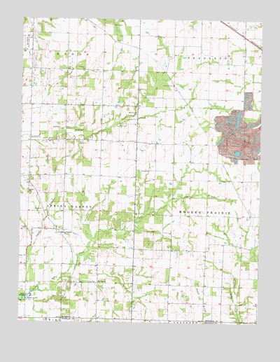
Spring Garden, IL USGS Topographic Map
Click on map above to begin viewing in our Map Viewer.

This topographic map contains these locations and features:
Feature Name Type Latitude Longitude GNIS ID View Map
Arlington School (historical)SchoolN38.1695°W88.7595°1705649View Map
Birkhead School (historical)SchoolN38.1403°W88.7965°1705650View Map
Burlington School (historical)SchoolN38.1987°W88.7589°1705651View Map
Carroll CemeteryCemeteryN38.1714°W88.8628°405637View Map
Fitzgerrell CemeteryCemeteryN38.1623°W88.8712°408413View Map
Grothoff CemeteryCemeteryN38.1878°W88.8073°409531View Map
Ham Grove School (historical)SchoolN38.2323°W88.8001°1705653View Map
Hams Grove CemeteryCemeteryN38.2414°W88.8262°409679View Map
Hams Grove ChurchChurchN38.2112°W88.8151°409729View Map
Harris Grove (historical)Populated PlaceN38.2175°W88.7906°1815678View Map
Hope CemeteryCemeteryN38.1414°W88.8342°410505View Map
Hopper School (historical)SchoolN38.2003°W88.8328°1736205View Map
Hungry Hill School (historical)SchoolN38.2000°W88.8695°1736207View Map
Jones BranchStreamN38.1759°W88.7973°411201View Map
King Oil FieldOilfieldN38.2275°W88.8667°425079View Map
Knowles CemeteryCemeteryN38.1789°W88.8709°411589View Map
McKinney CemeteryCemeteryN38.1717°W88.8459°2045717View Map
Moores Prairie ChurchChurchN38.2012°W88.8703°413795View Map
Moores Prairie Post Office (historical)Post OfficeN38.1575°W88.7681°1815696View Map
Moores Prairie TownhallBuildingN38.1689°W88.7595°1736219View Map
Mulberry School (historical)SchoolN38.1417°W88.8709°1736223View Map
New Hope ChurchChurchN38.1414°W88.8334°414421View Map
New Hope School (historical)SchoolN38.1403°W88.8334°1736225View Map
Pleasant Grove School (historical)SchoolN38.2295°W88.8698°1705656View Map
Poplar BranchStreamN38.1353°W88.8748°416027View Map
Providence ChurchChurchN38.2295°W88.8426°416251View Map
Rentchler CemeteryCemeteryN38.2228°W88.7962°416537View Map
Richardson Farm CemeteryCemeteryN38.2350°W88.7989°1815713View Map
Rosewood School (historical)SchoolN38.1406°W88.7592°1705658View Map
Round Knob CemeteryCemeteryN38.2045°W88.8534°416988View Map
Saint Elmo School (historical)SchoolN38.1692°W88.8001°1705659View Map
Shady Grove School (historical)SchoolN38.2292°W88.8326°1705660View Map
Smith CemeteryCemeteryN38.2062°W88.8251°418619View Map
Smith CemeteryCemeteryN38.2431°W88.8051°418620View Map
Spring GardenPopulated PlaceN38.1631°W88.8556°418959View Map
Toney Point School (historical)SchoolN38.1989°W88.7951°1705662View Map
Township of Moores PrairieCivilN38.1696°W88.7596°429392View Map
Township of Spring GardenCivilN38.1702°W88.8727°429787View Map
Warren CemeteryCemeteryN38.2475°W88.8276°420533View Map

Note: Coordinates in the location and feature list above are referenced to NAD83 datum.


Copyright (C) 2008-2024 Ryan Niemi / Sunset Dynamics ... All Rights Reserved