TopoQuest Logo
Do you find TopoQuest useful?
Help keep TopoQuest running and adding new maps/features by donating!
Bitcoin:  19c7KJd3qBynnjoSw5npx9KScwjBe4ifkT
Litecoin:  LXs6TkuXGGXo1vDsWCkWVdjQX94eUKd6ui
Home View Maps Find Maps Find Places Resources & Links


Bluford, Illinois Topographic Map

USGS Map Title: Bluford, IL
USGS Map MRC: 38088C6
DRG (GeoTIFF) Download: o38088c6.tif


Neighboring USGS Topographic Map Quads:


  Harmony, IL  
38088D7
 

  Shields, IL  
38088D6
 

  Crisp, IL  
38088D5
 

  Opdyke, IL  
38088C7
 

  Bluford, IL  
38088C6
 

  Wayne City, IL  
38088C5
 

  Spring Garden, IL  
38088B7
 

  Dahlgren, IL  
38088B6
 

  Belle Prairie City, IL  
38088B5


Map MRC Location:

N39°
W89°
N39°
W88°
H8 H7 H6 H5 H4 H3 H2 H1
G8 G7 G6 G5 G4 G3 G2 G1
F8 F7 F6 F5 F4 F3 F2 F1
E8 E7 E6 E5 E4 E3 E2 E1
D8 D7 D6 D5 D4 D3 D2 D1
C8 C7 C6 C5 C4 C3 C2 C1
B8 B7 B6 B5 B4 B3 B2 B1
A8 A7 A6 A5 A4 A3 A2 A1
N38°
W89°
N38°
W88°

Bluford, IL USGS 1:24K Topographic Map Preview:
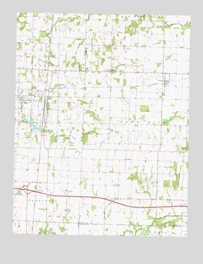
Bluford, IL USGS Topographic Map
Click on map above to begin viewing in our Map Viewer.

This topographic map contains these locations and features:
Feature Name Type Latitude Longitude GNIS ID View Map
Bear CreekStreamN38.3637°W88.7314°404016View Map
BlufordPopulated PlaceN38.3309°W88.7259°404631View Map
Bluford Elementary SchoolSchoolN38.3242°W88.7431°404632View Map
Bluford Oil FieldOilfieldN38.3503°W88.7328°424657View Map
Bluford Post OfficePost OfficeN38.3273°W88.7451°2788338View Map
Bruce CemeteryCemeteryN38.3517°W88.6384°404995View Map
Cub BranchStreamN38.3592°W88.7339°406874View Map
Egbert CemeteryCemeteryN38.3428°W88.6809°407812View Map
First Baptist Church of BlufordChurchN38.3253°W88.7451°1985435View Map
Grove School (historical)SchoolN38.2984°W88.6456°1705874View Map
Illinois Central ReservoirReservoirN38.3114°W88.7376°410763View Map
Illinois Central Reservoir DamDamN38.3087°W88.7323°1691135View Map
Interchange 89CrossingN38.2750°W88.7406°1815686View Map
KeenesPopulated PlaceN38.3381°W88.6431°411346View Map
Keenes Post OfficePost OfficeN38.3380°W88.6426°2788747View Map
Laird CemeteryCemeteryN38.2631°W88.7114°1815701View Map
Laird ChurchChurchN38.2637°W88.7114°411693View Map
Long Prairie ChurchChurchN38.2781°W88.6753°412601View Map
Long Prairie School (historical)SchoolN38.2706°W88.6748°1705878View Map
Markham CityPopulated PlaceN38.3303°W88.7223°1705854View Map
Markham City Oil FieldOilfieldN38.2989°W88.7123°425166View Map
Markham City Oil FieldOilfieldN38.3437°W88.7051°425167View Map
MiddletonPopulated PlaceN38.2931°W88.6698°422978View Map
Mount Olive CemeteryCemeteryN38.3017°W88.7076°1815698View Map
Mount Olive ChurchChurchN38.3012°W88.7078°414015View Map
Mount Zion Baptist ChurchChurchN38.2806°W88.6503°414122View Map
Mount Zion CemeteryCemeteryN38.2806°W88.6512°1953073View Map
Number Nine School (historical)SchoolN38.2570°W88.7026°1705856View Map
Oakdale School (historical)SchoolN38.3725°W88.7201°1705857View Map
Oakland School (historical)SchoolN38.3481°W88.6812°1705885View Map
Pine Knot School (historical)SchoolN38.3570°W88.6437°1705888View Map
Salem CemeteryCemeteryN38.3100°W88.6801°1953074View Map
Salem ChurchChurchN38.3103°W88.6809°417869View Map
Salem School (historical)SchoolN38.3170°W88.6789°1705892View Map
Scrub Hill School (historical)SchoolN38.2981°W88.6270°1705893View Map
Six Mile Post Office (historical)Post OfficeN38.3656°W88.6537°1823920View Map
Township of Four MileCivilN38.3143°W88.6546°429020View Map
Village of BlufordCivilN38.3256°W88.7355°2398145View Map
Village of KeenesCivilN38.3386°W88.6419°2398331View Map
Webber Grove School (historical)SchoolN38.3448°W88.7289°1705859View Map
Webber Township Fire Protection DistrictBuildingN38.3304°W88.7297°2640242View Map
Webber Township High SchoolSchoolN38.3239°W88.7451°1815719View Map
Williamson School (historical)SchoolN38.2795°W88.7259°1705860View Map
Witherspoon School (historical)SchoolN38.3137°W88.7198°1705861View Map
Wood CemeteryCemeteryN38.3556°W88.6709°421409View Map

Note: Coordinates in the location and feature list above are referenced to NAD83 datum.


Copyright (C) 2008-2024 Ryan Niemi / Sunset Dynamics ... All Rights Reserved