TopoQuest Logo
Do you find TopoQuest useful?
Help keep TopoQuest running and adding new maps/features by donating!
Bitcoin:  19c7KJd3qBynnjoSw5npx9KScwjBe4ifkT
Litecoin:  LXs6TkuXGGXo1vDsWCkWVdjQX94eUKd6ui
Home View Maps Find Maps Find Places Resources & Links


Blacktail Mountain, Montana Topographic Map

USGS Map Title: Blacktail Mountain, MT
USGS Map MRC: 46111A1
DRG (GeoTIFF) Download: o46111a1.tif


Neighboring USGS Topographic Map Quads:


  Sixmile Mountain, MT  
46111B2
 

  Francis, MT  
46111B1
 

  Sixteen, MT  
46110B8
 

  Maudlow, MT  
46111A2
 

  Blacktail Mountain, MT  
46111A1
 

  Hatfield Mountain, MT  
46110A8
 

  Horseshoe Creek, MT  
45111H2
 

  Flathead Pass, MT  
45111H1
 

  Sacagawea Peak, MT  
45110H8


Map MRC Location:

N47°
W112°
N47°
W111°
H8 H7 H6 H5 H4 H3 H2 H1
G8 G7 G6 G5 G4 G3 G2 G1
F8 F7 F6 F5 F4 F3 F2 F1
E8 E7 E6 E5 E4 E3 E2 E1
D8 D7 D6 D5 D4 D3 D2 D1
C8 C7 C6 C5 C4 C3 C2 C1
B8 B7 B6 B5 B4 B3 B2 B1
A8 A7 A6 A5 A4 A3 A2 A1
N46°
W112°
N46°
W111°

Blacktail Mountain, MT USGS 1:24K Topographic Map Preview:
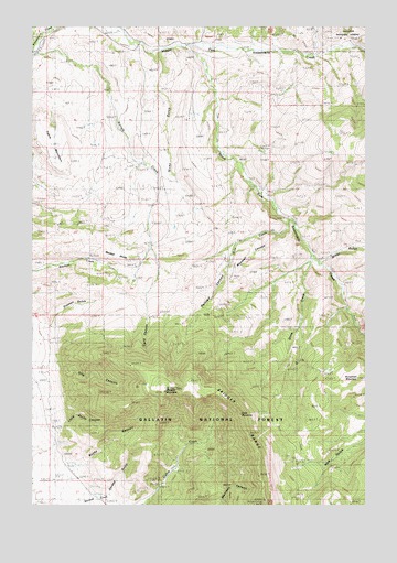
Blacktail Mountain, MT USGS Topographic Map
Click on map above to begin viewing in our Map Viewer.

This topographic map contains these locations and features:
Feature Name Type Latitude Longitude GNIS ID View Map
Adolph CreekStreamN46.1180°W111.1247°778874View Map
Blacktail DivideRidgeN46.0635°W111.0899°780066View Map
Blacktail MountainSummitN46.0297°W111.0761°780073View Map
Garden GulchValleyN46.0022°W111.1000°783826View Map
Hatfield RanchLocaleN46.1202°W111.0458°784621View Map
Horsethief MountainSummitN46.0330°W111.0036°785082View Map
Jensen RanchLocaleN46.1185°W111.0152°785461View Map
Josephine School (historical)SchoolN46.1205°W111.0636°785577View Map
Lang CanyonValleyN46.0505°W111.0827°806208View Map
Maxwell CanyonValleyN46.0697°W111.0355°806207View Map
Miller GulchValleyN46.0638°W111.0169°787419View Map
Morgan CemeteryCemeteryN46.0091°W111.1110°787680View Map
Morgan RanchLocaleN46.0024°W111.1047°787686View Map
Mule CreekStreamN46.0744°W111.0288°787837View Map
Nicks GulchValleyN46.1188°W111.0774°787996View Map
Olie CanyonValleyN46.0352°W111.1155°788435View Map
Painted CanyonValleyN46.0658°W111.0513°788588View Map
Quaw CreekStreamN46.0652°W111.0197°789285View Map
Rocky CanyonValleyN46.0122°W111.1044°789722View Map
South Fork Sixteenmile CreekStreamN46.1241°W111.0969°791048View Map
Stanton GulchValleyN46.0472°W111.1188°791434View Map
Table MountainSummitN46.0869°W111.1149°791847View Map
Zade MountainSummitN46.0260°W111.0502°793629View Map

Note: Coordinates in the location and feature list above are referenced to NAD83 datum.


Copyright (C) 2008-2025 Ryan Niemi / Sunset Dynamics ... All Rights Reserved