TopoQuest Logo
Do you find TopoQuest useful?
Help keep TopoQuest running and adding new maps/features by donating!
Bitcoin:  19c7KJd3qBynnjoSw5npx9KScwjBe4ifkT
Litecoin:  LXs6TkuXGGXo1vDsWCkWVdjQX94eUKd6ui
Home View Maps Find Maps Find Places Resources & Links


Springport, Michigan Topographic Map

USGS Map Title: Springport, MI
USGS Map MRC: 42084D6
DRG (GeoTIFF) Download: o42084d6.tif


Neighboring USGS Topographic Map Quads:


  Charlotte, MI  
42084E7
 

  Eaton Rapids, MI  
42084E6
 

  Aurelius, MI  
42084E5
 

  Duck Lake, MI  
42084D7
 

  Springport, MI  
42084D6
 

  Onondaga, MI  
42084D5
 

  Northwest Albion, MI  
42084C7
 

  Northeast Albion, MI  
42084C6
 

  Parma, MI  
42084C5


Map MRC Location:

N43°
W85°
N43°
W84°
H8 H7 H6 H5 H4 H3 H2 H1
G8 G7 G6 G5 G4 G3 G2 G1
F8 F7 F6 F5 F4 F3 F2 F1
E8 E7 E6 E5 E4 E3 E2 E1
D8 D7 D6 D5 D4 D3 D2 D1
C8 C7 C6 C5 C4 C3 C2 C1
B8 B7 B6 B5 B4 B3 B2 B1
A8 A7 A6 A5 A4 A3 A2 A1
N42°
W85°
N42°
W84°

Springport, MI USGS 1:24K Topographic Map Preview:
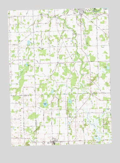
Springport, MI USGS Topographic Map
Click on map above to begin viewing in our Map Viewer.

This topographic map contains these locations and features:
Feature Name Type Latitude Longitude GNIS ID View Map
Bell SchoolSchoolN42.3820°W84.7344°621045View Map
Bly LakeLakeN42.4698°W84.7253°621660View Map
Boody SchoolSchoolN42.4945°W84.7367°621719View Map
Bradford SchoolSchoolN42.4439°W84.6672°621845View Map
Burgess Landing Strip (historical)AirportN42.4953°W84.7056°2109983View Map
Carter DrainCanalN42.4675°W84.6994°2109981View Map
Center SchoolSchoolN42.3778°W84.6603°622983View Map
CharlesworthPopulated PlaceN42.4506°W84.6894°623113View Map
Charlesworth Post Office (historical)Post OfficeN42.4506°W84.6894°2575090View Map
Charlesworth Station (historical)LocaleN42.4506°W84.6892°2575064View Map
Cooper LakeLakeN42.4150°W84.6758°623787View Map
Crawford SchoolSchoolN42.4081°W84.6680°624039View Map
Devils LakeLakeN42.4373°W84.7378°624595View Map
Eaton Rapids Kingdom HallChurchN42.4653°W84.6592°2574756View Map
Eaton Rapids Medical CenterHospitalN42.4952°W84.6586°2574782View Map
Favorite SchoolSchoolN42.4656°W84.7191°625858View Map
First Baptist ChurchChurchN42.4939°W84.6575°2574758View Map
Fox Woods Golf CourseLocaleN42.4547°W84.6514°2574784View Map
Grace Baptist ChurchChurchN42.3803°W84.6983°2632561View Map
Griffith ChurchChurchN42.4222°W84.6358°2109976View Map
Griffith LakeLakeN42.4070°W84.6306°627431View Map
Gurley LakeLakeN42.4131°W84.7065°627545View Map
Gurley Lake DrainCanalN42.4395°W84.6966°627546View Map
Hamlin District Number Fifteen School Historical MarkerParkN42.4802°W84.6347°2569703View Map
Hamlin Hills Golf Course (historical)LocaleN42.4603°W84.6522°2574783View Map
Hamlin SchoolSchoolN42.4800°W84.6347°627687View Map
Hamlin Township Fire RescueBuildingN42.4730°W84.6590°2635954View Map
Hobart DrainCanalN42.4825°W84.6555°628360View Map
Holibaugh HillsSummitN42.4148°W84.6853°627610View Map
Island City AcademySchoolN42.4739°W84.6586°2574753View Map
Jackson District Library-Springport BranchBuildingN42.3786°W84.6986°2632559View Map
Jerusalem HillsSummitN42.3881°W84.7186°629269View Map
Kettler LakeLakeN42.4447°W84.6277°2109977View Map
Knight SchoolSchoolN42.4873°W84.6647°629820View Map
Loomis LakeLakeN42.4244°W84.6974°631030View Map
Maple Air Manor Airfield (historical)AirportN42.4661°W84.7125°2109982View Map
McGivrd DrainCanalN42.4400°W84.6461°2109978View Map
Montague LakesLakeN42.3798°W84.6409°632591View Map
Oakwood CemeteryCemeteryN42.4953°W84.6644°2109980View Map
Otter CreekStreamN42.3925°W84.6472°634184View Map
Peace ChapelChurchN42.4986°W84.6419°2109979View Map
Peacock DrainCanalN42.4495°W84.7122°634519View Map
Pierson CemeteryCemeteryN42.4009°W84.6790°2109901View Map
Reynolds SchoolSchoolN42.4409°W84.6503°635828View Map
Segar SchoolSchoolN42.4211°W84.7341°637555View Map
Sheldon SchoolSchoolN42.4084°W84.6994°637723View Map
Shiner DrainCanalN42.4975°W84.7261°637804View Map
Spicerville Post Office (historical)Post OfficeN42.4917°W84.6889°2575070View Map
Spicerville SchoolSchoolN42.4909°W84.6941°638506View Map
SpringportPopulated PlaceN42.3784°W84.6986°638630View Map
Springport / Clarence Township Fire DepartmentBuildingN42.3788°W84.6992°2636103View Map
Springport High SchoolSchoolN42.3775°W84.7039°2632557View Map
Springport Middle SchoolSchoolN42.3775°W84.7089°2632558View Map
Springport Motor SpeedwayLocaleN42.4194°W84.7181°2632554View Map
Springport Post OfficePost OfficeN42.3789°W84.6986°2632560View Map
Springport Station (historical)LocaleN42.3781°W84.6922°2632553View Map
Springport Township Police DepartmentBuildingN42.3785°W84.6975°2632555View Map
Springport Village HallBuildingN42.3785°W84.6986°2632556View Map
Steel LakeLakeN42.4495°W84.7284°638775View Map
Township of HamlinCivilN42.4635°W84.6602°1626424View Map
Township of SpringportCivilN42.3782°W84.6595°1627112View Map
United Methodist ChurchChurchN42.3781°W84.7000°2632562View Map
Village of SpringportCivilN42.3783°W84.6965°2399880View Map
Wesleyan Church of Eaton RapidsChurchN42.4800°W84.6603°2574757View Map
WIBM-FM (Jackson)TowerN42.3923°W84.6666°1625725View Map
Wilcox SchoolSchoolN42.4686°W84.7486°1616439View Map
Willow CreekStreamN42.4300°W84.6603°1616529View Map
WSYM-TV (Lansing)TowerN42.4675°W84.6516°1625790View Map

Note: Coordinates in the location and feature list above are referenced to NAD83 datum.


Copyright (C) 2008-2025 Ryan Niemi / Sunset Dynamics ... All Rights Reserved