TopoQuest Logo
Do you find TopoQuest useful?
Help keep TopoQuest running and adding new maps/features by donating!
Bitcoin:  19c7KJd3qBynnjoSw5npx9KScwjBe4ifkT
Litecoin:  LXs6TkuXGGXo1vDsWCkWVdjQX94eUKd6ui
Home View Maps Find Maps Find Places Resources & Links


Aurelius, Michigan Topographic Map

USGS Map Title: Aurelius, MI
USGS Map MRC: 42084E5
DRG (GeoTIFF) Download: o42084e5.tif


Neighboring USGS Topographic Map Quads:


  Dimondale, MI  
42084F6
 

  Lansing South, MI  
42084F5
 

  East Lansing, MI  
42084F4
 

  Eaton Rapids, MI  
42084E6
 

  Aurelius, MI  
42084E5
 

  Mason, MI  
42084E4
 

  Springport, MI  
42084D6
 

  Onondaga, MI  
42084D5
 

  Leslie, MI  
42084D4


Map MRC Location:

N43°
W85°
N43°
W84°
H8 H7 H6 H5 H4 H3 H2 H1
G8 G7 G6 G5 G4 G3 G2 G1
F8 F7 F6 F5 F4 F3 F2 F1
E8 E7 E6 E5 E4 E3 E2 E1
D8 D7 D6 D5 D4 D3 D2 D1
C8 C7 C6 C5 C4 C3 C2 C1
B8 B7 B6 B5 B4 B3 B2 B1
A8 A7 A6 A5 A4 A3 A2 A1
N42°
W85°
N42°
W84°

Aurelius, MI USGS 1:24K Topographic Map Preview:
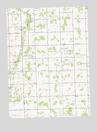
Aurelius, MI USGS Topographic Map
Click on map above to begin viewing in our Map Viewer.

This topographic map contains these locations and features:
Feature Name Type Latitude Longitude GNIS ID View Map
Abbott DrainCanalN42.6203°W84.5661°619784View Map
AureliusPopulated PlaceN42.5242°W84.5222°620350View Map
Aurelius and Delhi DrainCanalN42.5973°W84.5741°620351View Map
Aurelius Baptist ChurchChurchN42.5236°W84.5194°2635003View Map
Aurelius Post Office (historical)Post OfficeN42.5242°W84.5222°2634307View Map
Aurelius Township HallBuildingN42.5256°W84.5222°2635000View Map
Bergeon Field (historical)AirportN42.5678°W84.5078°1624030View Map
Blakslee DrainCanalN42.6184°W84.5703°621563View Map
Branson Bay Golf CourseLocaleN42.5764°W84.5917°2635002View Map
Bunker CemeteryCemeteryN42.5536°W84.6044°622256View Map
Columbia CreekStreamN42.5717°W84.6047°623633View Map
Columbia Creek ParkParkN42.5692°W84.5886°623634View Map
Columbia Road Baptist ChurchChurchN42.5825°W84.5436°2635001View Map
County Line DrainCanalN42.5450°W84.5966°623888View Map
Fowler CemeteryCemeteryN42.5400°W84.5822°626356View Map
Fowler DrainStreamN42.5003°W84.5964°626359View Map
Grace ChurchChurchN42.5814°W84.6216°627043View Map
Grand River County ParkParkN42.6092°W84.5897°627111View Map
Greenwood CemeteryCemeteryN42.5136°W84.5230°627377View Map
Gretton DrainCanalN42.5678°W84.5314°627416View Map
Grovenburg ChurchChurchN42.6220°W84.5825°627477View Map
Hart BranchCanalN42.6086°W84.5500°627869View Map
Holley and Day DrainCanalN42.6175°W84.5311°619753View Map
Jehovah's WitnessesChurchN42.6210°W84.5438°2635032View Map
Kenfield DrainCanalN42.5711°W84.5325°629582View Map
Markham CemeteryCemeteryN42.6038°W84.5819°631579View Map
Marshall and Hayes DrainCanalN42.5567°W84.5430°631631View Map
Mud LakeLakeN42.5245°W84.5483°632929View Map
Munger CemeteryCemeteryN42.5748°W84.6214°633120View Map
North AureliusPopulated PlaceN42.5820°W84.5430°633471View Map
North Aurelius CemeteryCemeteryN42.5817°W84.5389°2633604View Map
North Aurelius Elementary SchoolSchoolN42.5856°W84.5242°633472View Map
North Aurelius Post Office (historical)Post OfficeN42.5819°W84.5431°2634294View Map
Oaks DrainCanalN42.5181°W84.5383°633899View Map
Osborne DrainCanalN42.5639°W84.5280°634129View Map
Petreville Post Office (historical)Post OfficeN42.5356°W84.6214°2575073View Map
PetrievillePopulated PlaceN42.5356°W84.6214°1617783View Map
Plains CemeteryCemeteryN42.5100°W84.5942°2633612View Map
Plains ChurchChurchN42.5098°W84.5944°635072View Map
Robbins ChurchChurchN42.5528°W84.5986°636030View Map
Skinner CemeteryCemeteryN42.6236°W84.6222°638061View Map
Skinner Extension DrainStreamN42.6228°W84.6044°638064View Map
Topliff DrainCanalN42.5545°W84.5778°1614964View Map
Township of AureliusCivilN42.5531°W84.5426°1625864View Map
West Aurelius DrainCanalN42.5611°W84.5464°1616012View Map
West Columbia ChurchChurchN42.5828°W84.5200°1616094View Map
Windmill Mobile Home ParkPopulated PlaceN42.6242°W84.5444°2634563View Map
Wright and Potter DrainCanalN42.5781°W84.5350°1616830View Map

Note: Coordinates in the location and feature list above are referenced to NAD83 datum.


Copyright (C) 2008-2025 Ryan Niemi / Sunset Dynamics ... All Rights Reserved