TopoQuest Logo
Do you find TopoQuest useful?
Help keep TopoQuest running and adding new maps/features by donating!
Bitcoin:  19c7KJd3qBynnjoSw5npx9KScwjBe4ifkT
Litecoin:  LXs6TkuXGGXo1vDsWCkWVdjQX94eUKd6ui
Home View Maps Find Maps Find Places Resources & Links


Bladenboro, North Carolina Topographic Map

USGS Map Title: Bladenboro, NC
USGS Map MRC: 34078E7
DRG (GeoTIFF) Download: o34078e7.tif


Neighboring USGS Topographic Map Quads:


  Northeast Lumberton, NC  
34078F8
 

  Tar Heel, NC  
34078F7
 

  Dublin, NC  
34078F6
 

  Southeast Lumberton, NC  
34078E8
 

  Bladenboro, NC  
34078E7
 

  Abbottsburg, NC  
34078E6
 

  Evergreen, NC  
34078D8
 

  Chadbourn NE, NC  
34078D7
 

  Clarkton, NC  
34078D6


Map MRC Location:

N35°
W79°
N35°
W78°
H8 H7 H6 H5 H4 H3 H2 H1
G8 G7 G6 G5 G4 G3 G2 G1
F8 F7 F6 F5 F4 F3 F2 F1
E8 E7 E6 E5 E4 E3 E2 E1
D8 D7 D6 D5 D4 D3 D2 D1
C8 C7 C6 C5 C4 C3 C2 C1
B8 B7 B6 B5 B4 B3 B2 B1
A8 A7 A6 A5 A4 A3 A2 A1
N34°
W79°
N34°
W78°

Bladenboro, NC USGS 1:24K Topographic Map Preview:
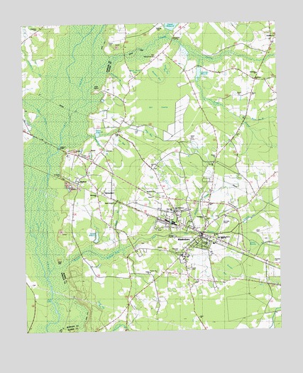
Bladenboro, NC USGS Topographic Map
Click on map above to begin viewing in our Map Viewer.

This topographic map contains these locations and features:
Feature Name Type Latitude Longitude GNIS ID View Map
Bear Ford SwampStreamN34.6191°W78.8056°1025116View Map
Bethlehem ChurchChurchN34.6046°W78.7603°981201View Map
Big Bethel ChurchChurchN34.5568°W78.8106°1004377View Map
BladenboroPopulated PlaceN34.5388°W78.7875°981574View Map
Bladenboro AirportAirportN34.5459°W78.7763°1025857View Map
Bladenboro CemeteryCemeteryN34.5313°W78.7999°981575View Map
Bladenboro Church of GodChurchN34.5413°W78.7941°2505906View Map
Bladenboro Fire DepartmentBuildingN34.5406°W78.7917°2638753View Map
Bladenboro High SchoolSchoolN34.5302°W78.7970°1004371View Map
Bladenboro Industrial ParkLocaleN34.5570°W78.7745°2505172View Map
Bladenboro Police DepartmentBuildingN34.5376°W78.7887°2131058View Map
Bladenboro Post OfficePost OfficeN34.5382°W78.7854°1024971View Map
Bladenboro Rescue SquadBuildingN34.5449°W78.7818°2720542View Map
Blue Pond BayFlatN34.6035°W78.8206°1025171View Map
Boots SwampStreamN34.6077°W78.7881°1025177View Map
Bridger MillpondReservoirN34.5383°W78.8396°981875View Map
Bryant CemeteryCemeteryN34.5960°W78.7697°982076View Map
Bryant SwampStreamN34.5229°W78.8642°1025191View Map
Bryant Swamp CanalCanalN34.5354°W78.8225°982081View Map
Bryant Swamp ChurchChurchN34.5524°W78.8300°1004379View Map
Buckhorn BranchStreamN34.5782°W78.8434°982133View Map
ButtersPopulated PlaceN34.5604°W78.8484°982340View Map
Butters Census Designated PlaceCensusN34.5603°W78.8490°2402739View Map
Cow IslandCapeN34.5977°W78.8392°1025261View Map
Crawley SwampStreamN34.6016°W78.8439°1025268View Map
Deaver BaySwampN34.5241°W78.7764°984038View Map
Edwards CemeteryCemeteryN34.6241°W78.8064°1025303View Map
Faulk CemeteryCemeteryN34.5743°W78.8350°985018View Map
First Baptist ChurchChurchN34.5358°W78.7910°2505819View Map
Fox BaySwampN34.5991°W78.8061°985353View Map
Friendship ChurchChurchN34.6182°W78.7506°985431View Map
Galeed ChurchChurchN34.5238°W78.8139°1004372View Map
Good News Baptist ChurchChurchN34.5529°W78.8029°2633868View Map
Grace ChurchChurchN34.5054°W78.7903°1004375View Map
Hester BaySwampN34.5941°W78.7578°986668View Map
Hester CemeteryCemeteryN34.5785°W78.7931°986669View Map
Hester Millpond DamDamN34.6235°W78.8031°998102View Map
Hickory Grove ChurchChurchN34.6116°W78.8095°986699View Map
Hines CemeteryCemeteryN34.5402°W78.7617°986842View Map
Hog BaySwampN34.5810°W78.8128°986874View Map
Jack LakeLakeN34.5146°W78.8622°987467View Map
Jackson SwampStreamN34.6199°W78.8445°1025421View Map
Jim BaySwampN34.5754°W78.8267°987602View Map
Lewis CemeteryCemeteryN34.5249°W78.7934°988381View Map
Lewis CemeteryCemeteryN34.6168°W78.8320°988383View Map
Little SwampStreamN34.5721°W78.8614°1025484View Map
Mare BranchStreamN34.5843°W78.7667°989329View Map
Marsh CanalCanalN34.6166°W78.8134°989366View Map
Meadow BaySwampN34.6052°W78.8081°989661View Map
Mill SwampSwampN34.5916°W78.8053°989988View Map
Moccasin BranchStreamN34.6052°W78.8375°1025551View Map
Monroe SchoolSchoolN34.5382°W78.7800°990146View Map
Mount Galled ChurchChurchN34.5232°W78.8125°990377View Map
Nance CemeteryCemeteryN34.5804°W78.8289°990854View Map
Nance MillpondReservoirN34.5803°W78.8383°990855View Map
New Light ChurchChurchN34.5485°W78.8014°991065View Map
Northside ChurchChurchN34.5460°W78.7875°1004380View Map
Oaky SwampSwampN34.5366°W78.7647°991502View Map
Pine Crest CemeteryCemeteryN34.5320°W78.8000°1004370View Map
Pitman Road MissionChurchN34.5049°W78.7903°992425View Map
Redding BaySwampN34.5749°W78.8434°993143View Map
Reedy BranchStreamN34.5327°W78.8286°1025642View Map
RichardsonPopulated PlaceN34.5566°W78.8359°993306View Map
Richardson ChurchChurchN34.5554°W78.8389°1004376View Map
Roanoke CemeteryCemeteryN34.5285°W78.7533°993409View Map
Round Branch ChurchChurchN34.5668°W78.8125°993739View Map
Saint Luke ChurchChurchN34.5379°W78.7822°1004374View Map
Sand Hill BaySwampN34.5129°W78.8375°994219View Map
Sand Hill BaySwampN34.6063°W78.8053°994220View Map
Shingleford CrossingPopulated PlaceN34.6185°W78.8011°1022608View Map
Singletary BridgeBridgeN34.5743°W78.8572°994860View Map
Singletary CemeteryCemeteryN34.5638°W78.8564°994861View Map
Singletary CemeteryCemeteryN34.6232°W78.8672°994862View Map
Singletary MillpondReservoirN34.6046°W78.7882°994865View Map
Spaulding Monroe Middle SchoolSchoolN34.5374°W78.7797°1004373View Map
Town of BladenboroCivilN34.5409°W78.7947°2405277View Map
Township of BladenboroCivilN34.5439°W78.7947°1026423View Map
Tuckleberry BranchStreamN34.6041°W78.8589°996302View Map
Wateree CreekStreamN34.5399°W78.7953°996847View Map
West Bladenboro ChurchChurchN34.5485°W78.8003°1004378View Map
Wolf HillSummitN34.5299°W78.8575°1025807View Map
Zion Hill ChurchChurchN34.5677°W78.7811°997793View Map

Note: Coordinates in the location and feature list above are referenced to NAD83 datum.


Copyright (C) 2008-2024 Ryan Niemi / Sunset Dynamics ... All Rights Reserved