TopoQuest Logo
Do you find TopoQuest useful?
Help keep TopoQuest running and adding new maps/features by donating!
Bitcoin:  19c7KJd3qBynnjoSw5npx9KScwjBe4ifkT
Litecoin:  LXs6TkuXGGXo1vDsWCkWVdjQX94eUKd6ui
Home View Maps Find Maps Find Places Resources & Links


Stanton, Iowa Topographic Map

USGS Map Title: Stanton, IA
USGS Map MRC: 40095H1
DRG (GeoTIFF) Download: o40095h1.tif


Neighboring USGS Topographic Map Quads:


  Red Oak North, IA  
41095A2
 

  Wallin, IA  
41095A1
 

  Morton Mills, IA  
41094A8
 

  Red Oak South, IA  
40095H2
 

  Stanton, IA  
40095H1
 

  Villisca, IA  
40094H8
 

  Stanton SW, IA  
40095G2
 

  Clarinda North, IA  
40095G1
 

  Hawleyville, IA  
40094G8


Map MRC Location:

N41°
W96°
N41°
W95°
H8 H7 H6 H5 H4 H3 H2 H1
G8 G7 G6 G5 G4 G3 G2 G1
F8 F7 F6 F5 F4 F3 F2 F1
E8 E7 E6 E5 E4 E3 E2 E1
D8 D7 D6 D5 D4 D3 D2 D1
C8 C7 C6 C5 C4 C3 C2 C1
B8 B7 B6 B5 B4 B3 B2 B1
A8 A7 A6 A5 A4 A3 A2 A1
N40°
W96°
N40°
W95°

Stanton, IA USGS 1:24K Topographic Map Preview:
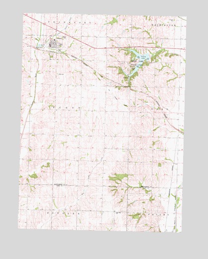
Stanton, IA USGS Topographic Map
Click on map above to begin viewing in our Map Viewer.

This topographic map contains these locations and features:
Feature Name Type Latitude Longitude GNIS ID View Map
Anderson ParkParkN40.9789°W95.0953°454179View Map
Arlington CemeteryCemeteryN40.9975°W95.0097°454231View Map
City of StantonCivilN40.9810°W95.1030°2395952View Map
Clarinda Junction (historical)Populated PlaceN40.9322°W95.0011°464289View Map
Erickson PrairieAreaN40.9611°W95.0614°1968655View Map
Evangelical Covenant ChurchChurchN40.9814°W95.1003°1968753View Map
Little Tarkio CreekStreamN40.9808°W95.1144°458516View Map
Mamre CemeteryCemeteryN40.9864°W95.0911°458750View Map
Mamrelund CemeteryCemeteryN40.9811°W95.0959°1968778View Map
Mamrelund Lutheran ChurchChurchN40.9822°W95.1000°1968754View Map
North Page CemeteryCemeteryN40.8858°W95.0514°459611View Map
StantonPopulated PlaceN40.9817°W95.1042°461955View Map
StantonLocaleN40.9778°W95.1017°1968748View Map
Stanton Care CenterHospitalN40.9792°W95.0997°1968751View Map
Stanton Community LibraryBuildingN40.9811°W95.1036°1968750View Map
Stanton Elementary SchoolSchoolN40.9847°W95.1006°1968752View Map
Stanton Fire DepartmentBuildingN40.9786°W95.1045°2371660View Map
Stanton Middle / High SchoolSchoolN40.9846°W95.1007°2719745View Map
Stanton Post OfficePost OfficeN40.9833°W95.1003°1968792View Map
Swedish Heritage and Cultural CenterBuildingN40.9822°W95.1017°1968749View Map
Township of ScottCivilN40.9440°W95.0991°468675View Map
United Farmers Mercantile Coop ElevatorLocaleN40.9778°W95.1017°1968747View Map
Viking LakeReservoirN40.9739°W95.0354°462570View Map
Viking Lake State ParkParkN40.9725°W95.0375°462571View Map

Note: Coordinates in the location and feature list above are referenced to NAD83 datum.


Copyright (C) 2008-2024 Ryan Niemi / Sunset Dynamics ... All Rights Reserved