TopoQuest Logo
Do you find TopoQuest useful?
Help keep TopoQuest running and adding new maps/features by donating!
Bitcoin:  19c7KJd3qBynnjoSw5npx9KScwjBe4ifkT
Litecoin:  LXs6TkuXGGXo1vDsWCkWVdjQX94eUKd6ui
Home View Maps Find Maps Find Places Resources & Links


Villisca, Iowa Topographic Map

USGS Map Title: Villisca, IA
USGS Map MRC: 40094H8
DRG (GeoTIFF) Download: o40094h8.tif


Neighboring USGS Topographic Map Quads:


  Wallin, IA  
41095A1
 

  Morton Mills, IA  
41094A8
 

  Carbon, IA  
41094A7
 

  Stanton, IA  
40095H1
 

  Villisca, IA  
40094H8
 

  Brooks, IA  
40094H7
 

  Clarinda North, IA  
40095G1
 

  Hawleyville, IA  
40094G8
 

  Guss, IA  
40094G7


Map MRC Location:

N41°
W95°
N41°
W94°
H8 H7 H6 H5 H4 H3 H2 H1
G8 G7 G6 G5 G4 G3 G2 G1
F8 F7 F6 F5 F4 F3 F2 F1
E8 E7 E6 E5 E4 E3 E2 E1
D8 D7 D6 D5 D4 D3 D2 D1
C8 C7 C6 C5 C4 C3 C2 C1
B8 B7 B6 B5 B4 B3 B2 B1
A8 A7 A6 A5 A4 A3 A2 A1
N40°
W95°
N40°
W94°

Villisca, IA USGS 1:24K Topographic Map Preview:
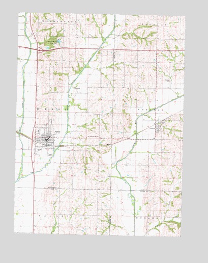
Villisca, IA USGS Topographic Map
Click on map above to begin viewing in our Map Viewer.

This topographic map contains these locations and features:
Feature Name Type Latitude Longitude GNIS ID View Map
Advent Christian ChurchChurchN40.9292°W94.9791°1968735View Map
Axe Murder HouseBuildingN40.9311°W94.9761°1968733View Map
Bakers Cut CemeteryCemeteryN40.9083°W94.9586°1968775View Map
Carlisle CemeteryCemeteryN40.9226°W94.9837°455167View Map
City of NodawayCivilN40.9365°W94.8954°2395241View Map
City of VilliscaCivilN40.9298°W94.9819°2397142View Map
Clarinda Regular Baptist ChurchChurchN40.9372°W94.8950°1968957View Map
Dunns CreekStreamN40.9730°W94.9928°456068View Map
Findley CemeteryCemeteryN40.9578°W94.9574°456592View Map
Hacklebarney Woods County ParkParkN40.9836°W94.9753°1822914View Map
Middle Nodaway RiverStreamN40.9047°W94.9986°459044View Map
Mount Calvary Lutheran ChurchChurchN40.9308°W94.9741°1968736View Map
NodawayPopulated PlaceN40.9372°W94.8950°459537View Map
NodawayLocaleN40.9400°W94.8919°1968959View Map
Nodaway CemeteryCemeteryN40.9628°W94.8861°459538View Map
Nodaway Elevator Incorporated ElevatorLocaleN40.9372°W94.8950°1968956View Map
Nodaway Play ParkParkN40.9372°W94.8950°1968955View Map
Nodaway Post OfficePost OfficeN40.9372°W94.8950°1968958View Map
Nodaway Volunteer Fire DepartmentBuildingN40.9367°W94.8944°2577262View Map
Olson/Linn MuseumBuildingN40.9311°W94.9761°1968734View Map
Pierce Family CemeteryCemeteryN40.8778°W94.9003°1968890View Map
Presbyterian ChurchChurchN40.9308°W94.9772°1968737View Map
Red Oak Internal Medicine ClinicHospitalN40.9283°W94.9772°1968742View Map
Rosehill CemeteryCemeteryN40.9375°W94.9586°1968777View Map
Ross Grove Post Office (historical)Post OfficeN40.9222°W94.9503°1968660View Map
Saint Josephs Catholic ChurchChurchN40.9347°W94.9833°1968738View Map
Sylvia Enarson Elementary SchoolSchoolN40.9333°W94.9819°1968744View Map
Township of EastCivilN40.9438°W94.9853°467751View Map
United Methodist ChurchChurchN40.9303°W94.9769°1968739View Map
VilliscaLocaleN40.9250°W94.9772°1968746View Map
VilliscaPopulated PlaceN40.9297°W94.9761°462574View Map
Villisca Ambulance ServiceBuildingN40.9298°W94.9769°2599786View Map
Villisca CemeteryCemeteryN40.9383°W94.9744°462575View Map
Villisca City HallBuildingN40.9289°W94.9775°1968731View Map
Villisca Community Junior - Senior High SchoolSchoolN40.9300°W94.9751°1968745View Map
Villisca Country ClubLocaleN40.9453°W94.9836°1968743View Map
Villisca Elevator Incorporated ElevatorLocaleN40.9264°W94.9850°1968788View Map
Villisca Family Health CenterHospitalN40.9292°W94.9739°1968741View Map
Villisca Fire DepartmentBuildingN40.9298°W94.9769°2577292View Map
Villisca Good Samaritan CenterHospitalN40.9333°W94.9836°1968740View Map
Villisca Post OfficePost OfficeN40.9275°W94.9775°1968730View Map
Villisca Public LibraryBuildingN40.9303°W94.9775°1968732View Map

Note: Coordinates in the location and feature list above are referenced to NAD83 datum.


Copyright (C) 2008-2024 Ryan Niemi / Sunset Dynamics ... All Rights Reserved