TopoQuest Logo
Do you find TopoQuest useful?
Help keep TopoQuest running and adding new maps/features by donating!
Bitcoin:  19c7KJd3qBynnjoSw5npx9KScwjBe4ifkT
Litecoin:  LXs6TkuXGGXo1vDsWCkWVdjQX94eUKd6ui
Home View Maps Find Maps Find Places Resources & Links


Blair Lake, Oregon Topographic Map

USGS Map Title: Blair Lake, OR
USGS Map MRC: 43122G2
DRG (GeoTIFF) Download: o43122g2.tif


Neighboring USGS Topographic Map Quads:


  Sardine Butte, OR  
43122H3
 

  Grasshopper Mountain, OR  
43122H2
 

  Chucksney Mountain, OR  
43122H1
 

  Huckleberry Mountain, OR  
43122G3
 

  Blair Lake, OR  
43122G2
 

  Waldo Mountain, OR  
43122G1
 

  McCredie Springs, OR  
43122F3
 

  Mount David Douglas, OR  
43122F2
 

  Waldo Lake, OR  
43122F1


Map MRC Location:

N44°
W123°
N44°
W122°
H8 H7 H6 H5 H4 H3 H2 H1
G8 G7 G6 G5 G4 G3 G2 G1
F8 F7 F6 F5 F4 F3 F2 F1
E8 E7 E6 E5 E4 E3 E2 E1
D8 D7 D6 D5 D4 D3 D2 D1
C8 C7 C6 C5 C4 C3 C2 C1
B8 B7 B6 B5 B4 B3 B2 B1
A8 A7 A6 A5 A4 A3 A2 A1
N43°
W123°
N43°
W122°

Blair Lake, OR USGS 1:24K Topographic Map Preview:
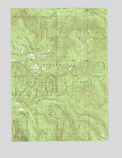
Blair Lake, OR USGS Topographic Map
Click on map above to begin viewing in our Map Viewer.

This topographic map contains these locations and features:
Feature Name Type Latitude Longitude GNIS ID View Map
Alice CreekStreamN43.7582°W122.2206°1153392View Map
Beal PrairieFlatN43.8271°W122.2328°1137620View Map
Blair LakeLakeN43.8345°W122.2392°1138241View Map
Blair Lake Recreation SiteLocaleN43.8360°W122.2414°1167117View Map
Blair Lake TrailTrailN43.8187°W122.1814°1138242View Map
Blair MeadowsFlatN43.8396°W122.2378°1138243View Map
Boomer CreekStreamN43.7860°W122.2336°1138434View Map
Brock CreekStreamN43.8748°W122.2181°1138641View Map
Captain CreekStreamN43.8726°W122.2125°1139365View Map
Captain PrairieFlatN43.8351°W122.2031°1139366View Map
Cayuse CreekStreamN43.8723°W122.1884°1139484View Map
Claire PrairieAreaN43.8207°W122.1303°1134668View Map
Curley CreekStreamN43.7885°W122.2395°1140561View Map
Delate CreekStreamN43.7898°W122.1995°1134672View Map
Devils LakeLakeN43.8287°W122.2124°1140962View Map
Etta PrairieFlatN43.8226°W122.1348°1141906View Map
Fisher CreekStreamN43.8721°W122.1623°1142174View Map
Fisher PrairieAreaN43.8165°W122.1873°1134670View Map
Furnish CreekStreamN43.7901°W122.1959°1142540View Map
Glade CreekStreamN43.8729°W122.1898°1142758View Map
Griffing PrairieAreaN43.8254°W122.1303°1134671View Map
Koch CreekStreamN43.7873°W122.2206°1153504View Map
Long PrairieFlatN43.8255°W122.1616°1145433View Map
Mule CreekStreamN43.7882°W122.2439°1146627View Map
Mule MountainSummitN43.8332°W122.2243°1146640View Map
Mule Mountain LookoutSummitN43.8110°W122.2086°1146641View Map
North PrairieFlatN43.8404°W122.1600°1147054View Map
Pitch CreekStreamN43.7885°W122.2167°1147778View Map
Pocher CreekStreamN43.7957°W122.1789°1156740View Map
Ranger CreekStreamN43.7726°W122.1700°1148209View Map
Salmon Creek TrailTrailN43.7762°W122.1489°1148978View Map
Salt Rock PrairieFlatN43.8252°W122.1673°1149004View Map
Spring MeadowFlatN43.8248°W122.2267°1150192View Map
Spring PrairieFlatN43.8202°W122.2200°1150194View Map
Triangle CreekStreamN43.7910°W122.2031°1134673View Map
Winnie PrairieAreaN43.8207°W122.1692°1134669View Map

Note: Coordinates in the location and feature list above are referenced to NAD83 datum.


Copyright (C) 2008-2025 Ryan Niemi / Sunset Dynamics ... All Rights Reserved