TopoQuest Logo
Do you find TopoQuest useful?
Help keep TopoQuest running and adding new maps/features by donating!
Bitcoin:  19c7KJd3qBynnjoSw5npx9KScwjBe4ifkT
Litecoin:  LXs6TkuXGGXo1vDsWCkWVdjQX94eUKd6ui
Home View Maps Find Maps Find Places Resources & Links


Waldo Mountain, Oregon Topographic Map

USGS Map Title: Waldo Mountain, OR
USGS Map MRC: 43122G1
DRG (GeoTIFF) Download: o43122g1.tif


Neighboring USGS Topographic Map Quads:


  Grasshopper Mountain, OR  
43122H2
 

  Chucksney Mountain, OR  
43122H1
 

  Packsaddle Mountain, OR  
43121H8
 

  Blair Lake, OR  
43122G2
 

  Waldo Mountain, OR  
43122G1
 

  Irish Mountain, OR  
43121G8
 

  Mount David Douglas, OR  
43122F2
 

  Waldo Lake, OR  
43122F1
 

  The Twins, OR  
43121F8


Map MRC Location:

N44°
W123°
N44°
W122°
H8 H7 H6 H5 H4 H3 H2 H1
G8 G7 G6 G5 G4 G3 G2 G1
F8 F7 F6 F5 F4 F3 F2 F1
E8 E7 E6 E5 E4 E3 E2 E1
D8 D7 D6 D5 D4 D3 D2 D1
C8 C7 C6 C5 C4 C3 C2 C1
B8 B7 B6 B5 B4 B3 B2 B1
A8 A7 A6 A5 A4 A3 A2 A1
N43°
W123°
N43°
W122°

Waldo Mountain, OR USGS 1:24K Topographic Map Preview:
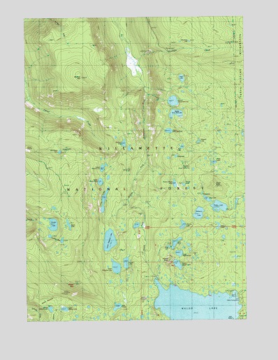
Waldo Mountain, OR USGS Topographic Map
Click on map above to begin viewing in our Map Viewer.

This topographic map contains these locations and features:
Feature Name Type Latitude Longitude GNIS ID View Map
Billy LakeLakeN43.8238°W122.0074°1153384View Map
Brittany LakeLakeN43.7790°W122.0330°1153389View Map
Cervus LakeLakeN43.7877°W122.0170°1153387View Map
Conim LakeLakeN43.7658°W122.0442°1153390View Map
Dans LakeLakeN43.7822°W122.0362°1135344View Map
East Quinn LakeLakeN43.8089°W122.0790°1153398View Map
Eastern Brook LakeLakeN43.8061°W122.0413°1141654View Map
Eddeeleo LakesLakeN43.7773°W122.0761°1966236View Map
Edna LakeLakeN43.8174°W122.0403°1153385View Map
Emma LakeLakeN43.8057°W122.0362°1120502View Map
Erma Bell LakesLakeN43.8335°W122.0439°1966237View Map
Ernie LakeLakeN43.7802°W122.0447°1153391View Map
Fields LakeLakeN43.8016°W122.0261°1135345View Map
Gander LakeLakeN43.7896°W122.1106°1142567View Map
Gosling LakesLakeN43.7829°W122.1067°1142877View Map
Harvey LakeLakeN43.7890°W122.0370°1143348View Map
Helen LakeLakeN43.8148°W122.0187°1158285View Map
Islet PointCapeN43.7510°W122.0095°1135343View Map
Lake ChetloLakeN43.7556°W122.0746°1139620View Map
Lake KiwaLakeN43.7818°W122.0411°1144654View Map
Long LakeLakeN43.7995°W122.0814°1145417View Map
Lower Eddeeleo LakeLakeN43.7829°W122.0787°1145617View Map
Lower Erma Bell LakeLakeN43.8402°W122.0416°1145620View Map
Lower Quinn LakeLakeN43.8128°W122.0824°1145633View Map
Lower Rigdon LakeLakeN43.7774°W122.0391°1145635View Map
Lower Salmon LakeLakeN43.7548°W122.1125°1145638View Map
Mickey LakeLakeN43.7808°W122.0338°1153388View Map
Middle Erma Bell LakeLakeN43.8350°W122.0400°1146134View Map
Moolack FlatFlatN43.8373°W122.0859°1153393View Map
Moolack LakeLakeN43.8230°W122.0699°1146411View Map
Moolack MountainSummitN43.8500°W122.0938°1146412View Map
Mud LakeLakeN43.8214°W122.0368°1146569View Map
North Torrey LakeLakeN43.7979°W122.0064°1153386View Map
North Waldo Boat RampLocaleN43.7602°W122.0063°2668627View Map
North Waldo Recreation SiteLocaleN43.7582°W122.0039°1135346View Map
Otter LakeLakeN43.8496°W122.0366°1147292View Map
Quinn LakesLakeN43.8096°W122.0836°1966238View Map
Rigdon ButteSummitN43.7739°W122.0449°1148438View Map
Round LakeLakeN43.7738°W122.0694°1148765View Map
Salmon LakesLakeN43.7548°W122.1089°1966239View Map
Skookum CreekStreamN43.8562°W122.0642°1149607View Map
Skookum Creek Recreation SiteLocaleN43.8612°W122.0448°1149612View Map
Skookum LakeLakeN43.8648°W122.0322°1149614View Map
Swan LakeLakeN43.7897°W122.1018°1150761View Map
Taylor BurnAreaN43.8137°W122.0345°1167092View Map
Taylor Burn Guard StationLocaleN43.8132°W122.0328°1150907View Map
Taylor Burn Recreation SiteLocaleN43.8132°W122.0328°1926277View Map
Taylor ButteSummitN43.8049°W122.0180°1150908View Map
Torrey LakeLakeN43.7965°W122.0161°1128173View Map
Upper Eddeeleo LakeLakeN43.7719°W122.0752°1151673View Map
Upper Erma Bell LakeLakeN43.8279°W122.0443°1151674View Map
Upper Quinn LakeLakeN43.8072°W122.0836°1151696View Map
Upper Rigdon LakeLakeN43.7729°W122.0402°1151699View Map
Upper Salmon LakeLakeN43.7548°W122.1046°1151701View Map
Wahanna LakeLakeN43.7937°W122.0277°1151806View Map
Waldo Lake WildernessReserveN43.7834°W122.0820°1987628View Map
Waldo MeadowsFlatN43.7582°W122.1150°1135342View Map
Waldo Meadows Guard StationLocaleN43.7598°W122.1109°1151820View Map
Waldo MountainSummitN43.7650°W122.0989°1151821View Map
Whig LakeLakeN43.7996°W122.0227°1152180View Map
Williams LakeLakeN43.8232°W122.0275°1153383View Map
Winchester Forest Camp (historical)LocaleN43.8187°W122.1220°1152477View Map
Winchester LakeLakeN43.8195°W122.1066°1152478View Map
Winchester TrailTrailN43.7815°W122.0900°1152480View Map

Note: Coordinates in the location and feature list above are referenced to NAD83 datum.


Copyright (C) 2008-2024 Ryan Niemi / Sunset Dynamics ... All Rights Reserved