TopoQuest Logo
Do you find TopoQuest useful?
Help keep TopoQuest running and adding new maps/features by donating!
Bitcoin:  19c7KJd3qBynnjoSw5npx9KScwjBe4ifkT
Litecoin:  LXs6TkuXGGXo1vDsWCkWVdjQX94eUKd6ui
Home View Maps Find Maps Find Places Resources & Links


Steel Hill, New Mexico Topographic Map

USGS Map Title: Steel Hill, NM
USGS Map MRC: 33107E3
DRG (GeoTIFF) Download: o33107e3.tif


Neighboring USGS Topographic Map Quads:


  Blue Mountain, NM  
33107F4
 

  San Juan Peak, NM  
33107F3
 

  Hickman Ranch, NM  
33107F2
 

  Vicks Peak, NM  
33107E4
 

  Steel Hill, NM  
33107E3
 

  Black Hill, NM  
33107E2
 

  Monticello, NM  
33107D4
 

  Sierra Fijardo, NM  
33107D3
 

  Romero Canyon, NM  
33107D2


Map MRC Location:

N34°
W108°
N34°
W107°
H8 H7 H6 H5 H4 H3 H2 H1
G8 G7 G6 G5 G4 G3 G2 G1
F8 F7 F6 F5 F4 F3 F2 F1
E8 E7 E6 E5 E4 E3 E2 E1
D8 D7 D6 D5 D4 D3 D2 D1
C8 C7 C6 C5 C4 C3 C2 C1
B8 B7 B6 B5 B4 B3 B2 B1
A8 A7 A6 A5 A4 A3 A2 A1
N33°
W108°
N33°
W107°

Steel Hill, NM USGS 1:24K Topographic Map Preview:
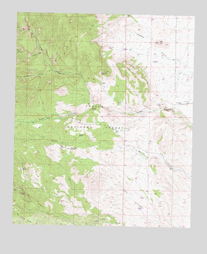
Steel Hill, NM USGS Topographic Map
Click on map above to begin viewing in our Map Viewer.

This topographic map contains these locations and features:
Feature Name Type Latitude Longitude GNIS ID View Map
Bell HillSummitN33.6090°W107.2761°903730View Map
Cedar TankReservoirN33.6249°W107.2982°914147View Map
Cerra de las CabrasSummitN33.5453°W107.3364°904902View Map
Cuervo TankReservoirN33.5172°W107.2837°914202View Map
Cuervo WindmillLocaleN33.5112°W107.2853°1991450View Map
Headquaters Water WellWellN33.5726°W107.2589°922015View Map
Humpfer TankReservoirN33.5975°W107.2790°914149View Map
Indian CreekStreamN33.5712°W107.3195°907203View Map
La Cabra WindmillLocaleN33.5178°W107.3275°937114View Map
Milligan TankReservoirN33.5327°W107.3697°914150View Map
Nogal Canyon RanchLocaleN33.5731°W107.2586°909106View Map
Nogalita SpringSpringN33.5692°W107.3214°909112View Map
PankeyMineN33.5867°W107.3734°917697View Map
Panky MineMineN33.5865°W107.3734°909468View Map
Pine Tree SpringSpringN33.6053°W107.3111°1991443View Map
Rabbit Eye SpringSpringN33.5900°W107.3154°909951View Map
Rabbit Eye Water WellWellN33.5681°W107.2836°925760View Map
Rincon WindmillLocaleN33.6045°W107.2975°1991445View Map
Roberts CanyonValleyN33.6015°W107.3567°910344View Map
San Jose CabinLocaleN33.5070°W107.3459°914206View Map
San Jose SpringSpringN33.5184°W107.3678°1991447View Map
Springtime CanyonValleyN33.5917°W107.3503°911345View Map
Steel HillSummitN33.5945°W107.2992°911400View Map
Steel TankReservoirN33.6228°W107.2817°914148View Map

Note: Coordinates in the location and feature list above are referenced to NAD83 datum.


Copyright (C) 2008-2024 Ryan Niemi / Sunset Dynamics ... All Rights Reserved