TopoQuest Logo
Do you find TopoQuest useful?
Help keep TopoQuest running and adding new maps/features by donating!
Bitcoin:  19c7KJd3qBynnjoSw5npx9KScwjBe4ifkT
Litecoin:  LXs6TkuXGGXo1vDsWCkWVdjQX94eUKd6ui
Home View Maps Find Maps Find Places Resources & Links


Stidham, Oklahoma Topographic Map

USGS Map Title: Stidham, OK
USGS Map MRC: 35095C6
DRG (GeoTIFF) Download: o35095c6.tif


Neighboring USGS Topographic Map Quads:


  Hoffman, OK  
35095D7
 

  Pierce, OK  
35095D6
 

  Checotah, OK  
35095D5
 

  Raiford, OK  
35095C7
 

  Stidham, OK  
35095C6
 

  Eufaula, OK  
35095C5
 

  Indianola, OK  
35095B7
 

  Canadian, OK  
35095B6
 

  Longtown, OK  
35095B5


Map MRC Location:

N36°
W96°
N36°
W95°
H8 H7 H6 H5 H4 H3 H2 H1
G8 G7 G6 G5 G4 G3 G2 G1
F8 F7 F6 F5 F4 F3 F2 F1
E8 E7 E6 E5 E4 E3 E2 E1
D8 D7 D6 D5 D4 D3 D2 D1
C8 C7 C6 C5 C4 C3 C2 C1
B8 B7 B6 B5 B4 B3 B2 B1
A8 A7 A6 A5 A4 A3 A2 A1
N35°
W96°
N35°
W95°

Stidham, OK USGS 1:24K Topographic Map Preview:
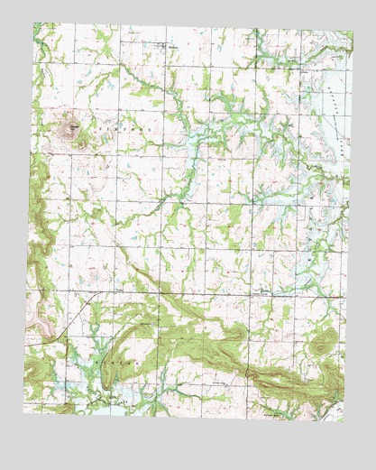
Stidham, OK USGS Topographic Map
Click on map above to begin viewing in our Map Viewer.

This topographic map contains these locations and features:
Feature Name Type Latitude Longitude GNIS ID View Map
Artussee Indian ChurchChurchN35.2604°W95.6714°1089723View Map
Badger HillSummitN35.3418°W95.7353°1089784View Map
Carters CornerPopulated PlaceN35.2895°W95.6630°1100265View Map
Charles CemeteryCemeteryN35.2754°W95.6457°1091210View Map
Eufaula DivisionCivilN35.3025°W95.6756°1937710View Map
Evans Cemetery (historical)CemeteryN35.2626°W95.7253°1847450View Map
FamePopulated PlaceN35.3623°W95.6458°1100405View Map
Fame CemeteryCemeteryN35.3667°W95.6301°1092760View Map
Hutton CemeteryCemeteryN35.3331°W95.6777°1094036View Map
McIntosh CountyCivilN35.3737°W95.6668°1101836View Map
Moore CemeteryCemeteryN35.3718°W95.6636°1095327View Map
Muskogee ChurchChurchN35.2798°W95.7005°1095718View Map
Polk CemeteryCemeteryN35.2708°W95.6255°1096806View Map
Remsey CemeteryCemeteryN35.3727°W95.7132°1097160View Map
Scott CemeteryCemeteryN35.2572°W95.6578°1097880View Map
StidhamPopulated PlaceN35.3687°W95.6997°1098534View Map
Town of StidhamCivilN35.3686°W95.7008°2413336View Map
Township of SimpsonCivilN35.3418°W95.7114°1824638View Map
VivianPopulated PlaceN35.2898°W95.7164°1100913View Map
Vivian Area Fire Protection Association HeadquartersBuildingN35.2890°W95.6833°2657240View Map
Vivian Area Fire Protection Association Oak GroveBuildingN35.2662°W95.7335°2657233View Map
Vivian ChurchChurchN35.2893°W95.7230°1099276View Map
Washington Cemetery (historical)CemeteryN35.2612°W95.6961°1847449View Map

Note: Coordinates in the location and feature list above are referenced to NAD83 datum.


Copyright (C) 2008-2024 Ryan Niemi / Sunset Dynamics ... All Rights Reserved