TopoQuest Logo
Do you find TopoQuest useful?
Help keep TopoQuest running and adding new maps/features by donating!
Bitcoin:  19c7KJd3qBynnjoSw5npx9KScwjBe4ifkT
Litecoin:  LXs6TkuXGGXo1vDsWCkWVdjQX94eUKd6ui
Home View Maps Find Maps Find Places Resources & Links


Stockholm, South Dakota Topographic Map

USGS Map Title: Stockholm, SD
USGS Map MRC: 45096A7
DRG (GeoTIFF) Download: o45096a7.tif


Neighboring USGS Topographic Map Quads:


  Antelope Valley, SD  
45096B8
 

  Twin Brooks, SD  
45096B7
 

  Milbank West, SD  
45096B6
 

  South Shore, SD  
45096A8
 

  Stockholm, SD  
45096A7
 

  LaBolt, SD  
45096A6
 

  Kranzburg, SD  
44096H8
 

  Goodwin, SD  
44096H7
 

  Tunerville, SD  
44096H6


Map MRC Location:

N46°
W97°
N46°
W96°
H8 H7 H6 H5 H4 H3 H2 H1
G8 G7 G6 G5 G4 G3 G2 G1
F8 F7 F6 F5 F4 F3 F2 F1
E8 E7 E6 E5 E4 E3 E2 E1
D8 D7 D6 D5 D4 D3 D2 D1
C8 C7 C6 C5 C4 C3 C2 C1
B8 B7 B6 B5 B4 B3 B2 B1
A8 A7 A6 A5 A4 A3 A2 A1
N45°
W97°
N45°
W96°

Stockholm, SD USGS 1:24K Topographic Map Preview:
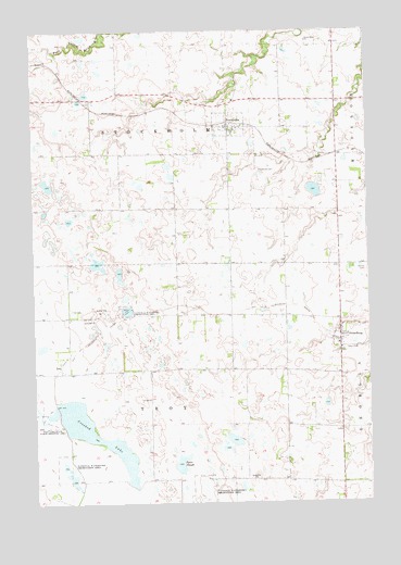
Stockholm, SD USGS Topographic Map
Click on map above to begin viewing in our Map Viewer.

This topographic map contains these locations and features:
Feature Name Type Latitude Longitude GNIS ID View Map
Bethel CemeteryCemeteryN45.0625°W96.7507°1253888View Map
Brown Earth ChurchChurchN45.1222°W96.7720°1265620View Map
Brown Earth Indian Church CemeteryCemeteryN45.1211°W96.7722°2773682View Map
Crooked LakeLakeN45.0177°W96.8520°1254553View Map
Grant County Mini-Library IIIBuildingN45.0997°W96.8017°2723682View Map
Pyror SloughLakeN45.0103°W96.8209°1257252View Map
StockholmPopulated PlaceN45.0997°W96.8020°1258361View Map
Stockholm CemeteryCemeteryN45.0880°W96.7912°1258362View Map
Stockholm Fire DepartmentBuildingN45.0998°W96.7972°2580821View Map
Stockholm Post OfficePost OfficeN45.0997°W96.8017°2711903View Map
StrandburgPopulated PlaceN45.0441°W96.7606°1258391View Map
Strandburg Post Office (historical)Post OfficeN45.0440°W96.7610°2711904View Map
Tabor CemeteryCemeteryN45.0407°W96.7586°1258492View Map
Tabor Lutheran ChurchChurchN45.0405°W96.7612°1263815View Map
Tabor Lutheran Church CemeteryCemeteryN45.0409°W96.7600°2773693View Map
Town of StockholmCivilN45.1018°W96.7998°1267593View Map
Town of StrandburgCivilN45.0441°W96.7604°1267594View Map
Township of StockholmCivilN45.1067°W96.8227°1268515View Map
Township of TroyCivilN45.0202°W96.8218°1268518View Map
TroyPopulated PlaceN45.0375°W96.8653°1258625View Map
Troy CemeteryCemeteryN45.0513°W96.8617°1258626View Map
Troy Lake State Public Shooting AreaParkN45.0236°W96.8723°1258628View Map
Troy Post Office (historical)Post OfficeN45.0497°W96.8742°1267127View Map

Note: Coordinates in the location and feature list above are referenced to NAD83 datum.


Copyright (C) 2008-2024 Ryan Niemi / Sunset Dynamics ... All Rights Reserved