TopoQuest Logo
Do you find TopoQuest useful?
Help keep TopoQuest running and adding new maps/features by donating!
Bitcoin:  19c7KJd3qBynnjoSw5npx9KScwjBe4ifkT
Litecoin:  LXs6TkuXGGXo1vDsWCkWVdjQX94eUKd6ui
Home View Maps Find Maps Find Places Resources & Links


South Shore, South Dakota Topographic Map

USGS Map Title: South Shore, SD
USGS Map MRC: 45096A8
DRG (GeoTIFF) Download: o45096a8.tif


Neighboring USGS Topographic Map Quads:


  Still Lake NE, SD  
45097B1
 

  Antelope Valley, SD  
45096B8
 

  Twin Brooks, SD  
45096B7
 

  Still Lake SE, SD  
45097A1
 

  South Shore, SD  
45096A8
 

  Stockholm, SD  
45096A7
 

  Watertown East, SD  
44097H1
 

  Kranzburg, SD  
44096H8
 

  Goodwin, SD  
44096H7


Map MRC Location:

N46°
W97°
N46°
W96°
H8 H7 H6 H5 H4 H3 H2 H1
G8 G7 G6 G5 G4 G3 G2 G1
F8 F7 F6 F5 F4 F3 F2 F1
E8 E7 E6 E5 E4 E3 E2 E1
D8 D7 D6 D5 D4 D3 D2 D1
C8 C7 C6 C5 C4 C3 C2 C1
B8 B7 B6 B5 B4 B3 B2 B1
A8 A7 A6 A5 A4 A3 A2 A1
N45°
W97°
N45°
W96°

South Shore, SD USGS 1:24K Topographic Map Preview:
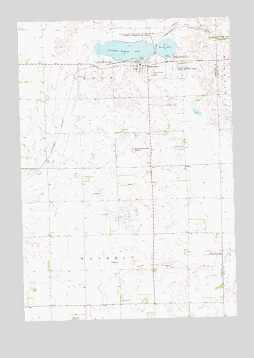
South Shore, SD USGS Topographic Map
Click on map above to begin viewing in our Map Viewer.

This topographic map contains these locations and features:
Feature Name Type Latitude Longitude GNIS ID View Map
Hanson State Public Shooting AreaParkN45.0891°W96.9053°1255424View Map
Jellis GraveCemeteryN45.0150°W96.9950°2681624View Map
Lakeview CemeteryCemeteryN45.1032°W96.9333°2681585View Map
Larson State Public Shooting AreaParkN45.1036°W96.9103°1256060View Map
Our Savior’s Lutheran Church of South ShoreChurchN45.1055°W96.9314°2681576View Map
Punished Womans LakeLakeN45.1122°W96.9369°1257244View Map
Punished Womans Lake State Public Shooting AreaParkN45.1175°W96.9287°1257245View Map
Punished Womans MoundSummitN45.0705°W96.9330°1257246View Map
Round LakeLakeN45.1127°W96.9129°1257499View Map
South Punished Womans State Public Shooting AreaParkN45.1075°W96.9409°1258210View Map
South ShorePopulated PlaceN45.1058°W96.9287°1258216View Map
South Shore Ambulance ServiceBuildingN45.1060°W96.9280°2659021View Map
South Shore Fire DepartmentBuildingN45.1060°W96.9282°2580669View Map
South Shore Post OfficePost OfficeN45.1062°W96.9289°2711892View Map
Town of South ShoreCivilN45.1015°W96.9301°1267579View Map
Township of LeolaCivilN45.1071°W96.9447°1268160View Map
Township of WaverlyCivilN45.0080°W96.9451°1268159View Map

Note: Coordinates in the location and feature list above are referenced to NAD83 datum.


Copyright (C) 2008-2025 Ryan Niemi / Sunset Dynamics ... All Rights Reserved