TopoQuest Logo
Do you find TopoQuest useful?
Help keep TopoQuest running and adding new maps/features by donating!
Bitcoin:  19c7KJd3qBynnjoSw5npx9KScwjBe4ifkT
Litecoin:  LXs6TkuXGGXo1vDsWCkWVdjQX94eUKd6ui
Home View Maps Find Maps Find Places Resources & Links


Stockton, New Jersey Topographic Map

USGS Map Title: Stockton, NJ
USGS Map MRC: 40074D8
DRG (GeoTIFF) Download: o40074d8.tif


Neighboring USGS Topographic Map Quads:


  Frenchtown, NJ  
40075E1
 

  Pittstown, NJ  
40074E8
 

  Flemington, NJ  
40074E7
 

  Lumberville, PA  
40075D1
 

  Stockton, NJ  
40074D8
 

  Hopewell, NJ  
40074D7
 

  Buckingham, PA  
40075C1
 

  Lambertville, NJ  
40074C8
 

  Pennington, NJ  
40074C7


Map MRC Location:

N41°
W75°
N41°
W74°
H8 H7 H6 H5 H4 H3 H2 H1
G8 G7 G6 G5 G4 G3 G2 G1
F8 F7 F6 F5 F4 F3 F2 F1
E8 E7 E6 E5 E4 E3 E2 E1
D8 D7 D6 D5 D4 D3 D2 D1
C8 C7 C6 C5 C4 C3 C2 C1
B8 B7 B6 B5 B4 B3 B2 B1
A8 A7 A6 A5 A4 A3 A2 A1
N40°
W75°
N40°
W74°

Stockton, NJ USGS 1:24K Topographic Map Preview:
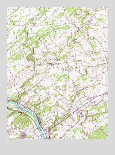
Stockton, NJ USGS Topographic Map
Click on map above to begin viewing in our Map Viewer.

This topographic map contains these locations and features:
Feature Name Type Latitude Longitude GNIS ID View Map
Ace GreenhousesBuildingN40.4789°W74.9214°2678223View Map
AlexaukenPopulated PlaceN40.3895°W74.9391°874284View Map
Alexauken CreekStreamN40.3771°W74.9524°874285View Map
Amwell ChurchChurchN40.3846°W74.8832°874337View Map
Barber CemeteryCemeteryN40.4187°W74.9279°874485View Map
Borough of StocktonCivilN40.4061°W74.9758°885409View Map
Boss RoadLocaleN40.4284°W74.8843°882988View Map
BownePopulated PlaceN40.4198°W74.9127°874875View Map
BrookvillePopulated PlaceN40.4007°W74.9660°874972View Map
Center BridgePopulated PlaceN40.4004°W74.9796°1171423View Map
Delaware Township Elementary SchoolSchoolN40.4462°W74.9361°2373806View Map
Delaware Township Police DepartmentBuildingN40.4370°W74.9533°2730889View Map
Dilts CornerPopulated PlaceN40.4126°W74.9346°875922View Map
Eagle IslandIslandN40.4107°W74.9996°876030View Map
ESC SchoolSchoolN40.3856°W74.9179°2372215View Map
Green Sergeant Covered BridgeBridgeN40.4443°W74.9657°876791View Map
Hal H Clark CountyFlatN40.3948°W74.9679°1202641View Map
HeadquartersLocaleN40.4434°W74.9229°877026View Map
Hendrick IslandIslandN40.4082°W74.9963°1192602View Map
Holcombe Riverview CemeteryCemeteryN40.3828°W74.9532°879725View Map
Lambertville - New Hope Ambulance and Rescue SquadBuildingN40.3752°W74.9426°2660064View Map
Lambertville Police DepartmentBuildingN40.3780°W74.9472°2730874View Map
Lambertville QuarryMineN40.3939°W74.9583°2724944View Map
LimeportLocaleN40.3829°W74.9663°1208267View Map
LocktownPopulated PlaceN40.4848°W74.9699°877882View Map
Lower Amwell ChurchChurchN40.4487°W74.9129°877955View Map
Mount AiryPopulated PlaceN40.3987°W74.9071°878514View Map
Mount GilboaSummitN40.3890°W74.9560°876608View Map
Phillips MillLocaleN40.3829°W74.9663°1208266View Map
Plum BrookStreamN40.4588°W74.9675°879377View Map
PrallsvillePopulated PlaceN40.4118°W74.9866°879475View Map
Rabbit RunStreamN40.3754°W74.9566°1184568View Map
RosemontPopulated PlaceN40.4273°W74.9899°879825View Map
Rosemont Post OfficePost OfficeN40.4274°W74.9927°2781487View Map
Sand BrookPopulated PlaceN40.4693°W74.9168°880245View Map
Sandy RidgePopulated PlaceN40.4232°W74.9524°883589View Map
Sandy Ridge ChurchChurchN40.4234°W74.9535°880262View Map
Schiller PondReservoirN40.3797°W74.8995°884304View Map
Schiller Pond DamDamN40.3801°W74.9010°884303View Map
SergeantsvillePopulated PlaceN40.4459°W74.9435°880475View Map
Sergeantsville Post OfficePost OfficeN40.4460°W74.9427°2781490View Map
Sergeantsville Volunteer Fire CompanyBuildingN40.4449°W74.9441°2613876View Map
Solebury SchoolSchoolN40.3809°W74.9663°1187986View Map
Solebury SchoolSchoolN40.3798°W74.9888°1187985View Map
South Hunterdon Regional High SchoolSchoolN40.3870°W74.8901°2372186View Map
StocktonPopulated PlaceN40.4079°W74.9782°880913View Map
Stockton Elementary SchoolSchoolN40.4049°W74.9756°2372295View Map
Stockton Fire CompanyBuildingN40.4043°W74.9762°2613772View Map
The Landing AirportAirportN40.4810°W74.9603°884742View Map
Township of DelawareCivilN40.4444°W74.9542°882182View Map
Township of West AmwellCivilN40.3792°W74.8955°882181View Map
West Amwell Fire Company Station 1BuildingN40.3962°W74.9096°2613838View Map
West Amwell SchoolSchoolN40.3871°W74.9196°881674View Map
West Amwell Township Elementary SchoolSchoolN40.3870°W74.9202°2372387View Map
West Amwell Township Police DepartmentBuildingN40.3961°W74.9097°2730863View Map
Wickecheoke CreekStreamN40.4092°W74.9865°881819View Map

Note: Coordinates in the location and feature list above are referenced to NAD83 datum.


Copyright (C) 2008-2024 Ryan Niemi / Sunset Dynamics ... All Rights Reserved