TopoQuest Logo
Do you find TopoQuest useful?
Help keep TopoQuest running and adding new maps/features by donating!
Bitcoin:  19c7KJd3qBynnjoSw5npx9KScwjBe4ifkT
Litecoin:  LXs6TkuXGGXo1vDsWCkWVdjQX94eUKd6ui
Home View Maps Find Maps Find Places Resources & Links


Stone Lake, Wisconsin Topographic Map

USGS Map Title: Stone Lake, WI
USGS Map MRC: 45091G5
DRG (GeoTIFF) Download: o45091g5.tif


Neighboring USGS Topographic Map Quads:


  Springbrook, WI  
45091H6
 

  Bean Lake, WI  
45091H5
 

  Reserve, WI  
45091H4
 

  Potato Lake, WI  
45091G6
 

  Stone Lake, WI  
45091G5
 

  Hauer, WI  
45091G4
 

  Nobleton, WI  
45091F6
 

  Birchwood, WI  
45091F5
 

  Edgewater, WI  
45091F4


Map MRC Location:

N46°
W92°
N46°
W91°
H8 H7 H6 H5 H4 H3 H2 H1
G8 G7 G6 G5 G4 G3 G2 G1
F8 F7 F6 F5 F4 F3 F2 F1
E8 E7 E6 E5 E4 E3 E2 E1
D8 D7 D6 D5 D4 D3 D2 D1
C8 C7 C6 C5 C4 C3 C2 C1
B8 B7 B6 B5 B4 B3 B2 B1
A8 A7 A6 A5 A4 A3 A2 A1
N45°
W92°
N45°
W91°

Stone Lake, WI USGS 1:24K Topographic Map Preview:
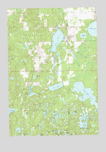
Stone Lake, WI USGS Topographic Map
Click on map above to begin viewing in our Map Viewer.

This topographic map contains these locations and features:
Feature Name Type Latitude Longitude GNIS ID View Map
Camp LakeLakeN45.7541°W91.5624°1562626View Map
Deep LakeLakeN45.7511°W91.5423°1563810View Map
Evangelical Lutheran ChurchChurchN45.8458°W91.5371°2054320View Map
Evergreen CemeteryCemeteryN45.8351°W91.5369°1564762View Map
Horseshoe LakeLakeN45.8075°W91.5886°1566740View Map
Lakewood Lodge AirportAirportN45.7759°W91.5572°2444108View Map
Little Dugan LakeLakeN45.8261°W91.6222°1568243View Map
Little Sand LakeLakeN45.8474°W91.5193°1568404View Map
Little Sissabagama LakeLakeN45.7625°W91.5177°1568415View Map
Little Stone LakeLakeN45.8552°W91.5532°1568430View Map
Loyhead LakeLakeN45.7694°W91.5602°1568776View Map
Mallard LakeLakeN45.7500°W91.5481°1568918View Map
Mud LakeLakeN45.7738°W91.5015°1569990View Map
Ole LakeLakeN45.7560°W91.6122°1570794View Map
Osprey LakeLakeN45.7797°W91.5714°2771781View Map
Otter LakeLakeN45.7542°W91.5489°1570913View Map
Pickerel LakeLakeN45.7719°W91.6022°1571326View Map
Pine Island LakeLakeN45.7524°W91.5726°1571475View Map
Pine Knoll School (historical)SchoolN45.8041°W91.5927°1833858View Map
Reflection LakeLakeN45.8065°W91.6204°2771802View Map
Saddle LakeLakeN45.7711°W91.5337°1572803View Map
Sawmill LakeLakeN45.7536°W91.5565°1573750View Map
Scoot LakeLakeN45.7597°W91.5821°1573831View Map
Sissabagama CreekStreamN45.8491°W91.5104°1574206View Map
Sissabagama LakeLakeN45.7909°W91.5180°1574207View Map
Slim CreekStreamN45.7761°W91.6124°1574274View Map
Slim Creek 2WP220 DamDamN45.7916°W91.5985°1792070View Map
Slim Creek DamDamN45.7913°W91.5982°1833875View Map
Slim Creek FlowageLakeN45.7900°W91.5943°1574275View Map
Slim Creek Flowage 17ReservoirN45.7912°W91.5906°1792071View Map
Slim LakeLakeN45.7977°W91.5588°1574276View Map
Snag LakeLakeN45.8175°W91.5616°2771841View Map
Spring LakeLakeN45.8270°W91.5582°1574676View Map
Stone LakeLakeN45.8430°W91.5554°1574926View Map
Stone LakePopulated PlaceN45.8455°W91.5404°1574928View Map
Stone Lake Census Designated PlaceCensusN45.8444°W91.5500°2586556View Map
Stone Lake Elementary SchoolSchoolN45.8470°W91.5378°1833804View Map
Stone Lake Post OfficePost OfficeN45.8463°W91.5399°2054319View Map
Stone Lake TownhallBuildingN45.8600°W91.5821°1833886View Map
Stone Lake Volunteer Fire DepartmentBuildingN45.8548°W91.5407°2054322View Map
Stone Lake Water TowerTowerN45.8461°W91.5357°2054321View Map
Town of Stone LakeCivilN45.8567°W91.6013°1584232View Map
West LakeLakeN45.7710°W91.5749°1576525View Map
Wolf LakeLakeN45.7632°W91.5634°1576941View Map

Note: Coordinates in the location and feature list above are referenced to NAD83 datum.


Copyright (C) 2008-2025 Ryan Niemi / Sunset Dynamics ... All Rights Reserved