TopoQuest Logo
Do you find TopoQuest useful?
Help keep TopoQuest running and adding new maps/features by donating!
Bitcoin:  19c7KJd3qBynnjoSw5npx9KScwjBe4ifkT
Litecoin:  LXs6TkuXGGXo1vDsWCkWVdjQX94eUKd6ui
Home View Maps Find Maps Find Places Resources & Links


Sturgeon Bay East, Wisconsin Topographic Map

USGS Map Title: Sturgeon Bay East, WI
USGS Map MRC: 44087G3
DRG (GeoTIFF) Download: o44087g3.tif


Neighboring USGS Topographic Map Quads:


  Idlewild, WI  
44087H4
 

  Institute, WI  
44087H3
 

  Jacksonport, WI  
44087H2
 

  Sturgeon Bay West, WI  
44087G4
 

  Sturgeon Bay East, WI  
44087G3
 

  Jacksonport SW, WI  
44087G2
 

  Forestville, WI  
44087F4
 

  Algoma NE, WI  
44087F3


Map MRC Location:

N45°
W88°
N45°
W87°
H8 H7 H6 H5 H4 H3 H2 H1
G8 G7 G6 G5 G4 G3 G2 G1
F8 F7 F6 F5 F4 F3 F2 F1
E8 E7 E6 E5 E4 E3 E2 E1
D8 D7 D6 D5 D4 D3 D2 D1
C8 C7 C6 C5 C4 C3 C2 C1
B8 B7 B6 B5 B4 B3 B2 B1
A8 A7 A6 A5 A4 A3 A2 A1
N44°
W88°
N44°
W87°

Sturgeon Bay East, WI USGS 1:24K Topographic Map Preview:
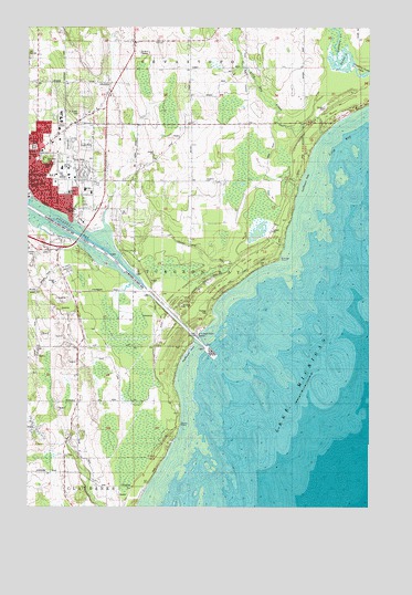
Sturgeon Bay East, WI USGS Topographic Map
Click on map above to begin viewing in our Map Viewer.

This topographic map contains these locations and features:
Feature Name Type Latitude Longitude GNIS ID View Map
Amity FieldParkN44.8436°W87.3732°1577928View Map
Big Hill ParkParkN44.8400°W87.3687°1577926View Map
Cherry SchoolSchoolN44.8606°W87.3723°1562990View Map
Christ the King Episcopal ChurchChurchN44.8356°W87.3737°1838042View Map
City of Sturgeon BayCivilN44.8236°W87.3670°1584239View Map
Coast Guard Station Sturgeon BayMilitaryN44.7943°W87.3135°2512463View Map
Door County CourthouseBuildingN44.8339°W87.3734°1838044View Map
Door County FairgroundsParkN44.8444°W87.3587°1838045View Map
Door County Memorial HospitalHospitalN44.8328°W87.3536°1838047View Map
Door County Memorial Hospital HeliportAirportN44.8322°W87.3532°1582227View Map
Door County MuseumBuildingN44.8350°W87.3748°1838048View Map
Dunes LakeLakeN44.8662°W87.2600°1577271View Map
Emergency Services of Door CountyBuildingN44.8328°W87.3519°2698277View Map
First Church of Christ ScientistChurchN44.8342°W87.3715°1838050View Map
Garland ParkParkN44.8406°W87.3712°1577924View Map
Geisel CreekStreamN44.8664°W87.2615°1577238View Map
Gilbert FarmsLocaleN44.8506°W87.3119°2711200View Map
Gospel Tabernacle Assembly of God ChurchChurchN44.8322°W87.3734°1838055View Map
Hope United Church of ChristChurchN44.8347°W87.3651°1838057View Map
Lilly BayBayN44.8422°W87.2579°1568035View Map
Lilly Bay CreekStreamN44.8472°W87.2670°1568036View Map
Louisiana Street - Seventh Avenue Historic DistrictParkN44.8372°W87.3723°1838059View Map
Memorial FieldParkN44.8347°W87.3629°1838060View Map
Mud LakeLakeN44.8658°W87.2604°1569930View Map
Peninsula Christian SchoolSchoolN44.8347°W87.3536°2716472View Map
Peot FarmsLocaleN44.8739°W87.2761°2711212View Map
Pierh LightBuildingN44.7919°W87.3090°1577918View Map
Pinney LakeLakeN44.8344°W87.2968°2761478View Map
Portage ParkParkN44.8006°W87.3084°1571800View Map
Portage PointCapeN44.8144°W87.2832°1571801View Map
Prince of Peace Lutheran ChurchChurchN44.8356°W87.3520°1838065View Map
Quarterdeck MarinaHarborN44.8239°W87.3732°1577917View Map
Robertson OrchardsLocaleN44.7944°W87.3731°2631609View Map
Rocky PointCapeN44.7711°W87.3193°1572504View Map
Saint Joseph CemeteryCemeteryN44.8518°W87.3565°1577927View Map
Saint Joseph SchoolSchoolN44.8372°W87.3748°1577921View Map
Saint Josephs ConventChurchN44.8369°W87.3748°1838070View Map
Saint Josephs Roman Catholic ChurchChurchN44.8367°W87.3745°1838071View Map
Seventh Day Adventist Church (historical)ChurchN44.8383°W87.3748°1838074View Map
Shiloh ChurchChurchN44.7894°W87.3715°1574046View Map
Silverdale School (historical)SchoolN44.7767°W87.3559°1574167View Map
Snug Harbor Yacht BasinLocaleN44.8225°W87.3512°1577920View Map
Steep Creek FarmLocaleN44.7631°W87.3597°2711225View Map
Stevens HillPopulated PlaceN44.8403°W87.3695°1574875View Map
Sturgeon Bay Canal LightBuildingN44.7944°W87.3126°1577919View Map
Sturgeon Bay City JailBuildingN44.8353°W87.3748°1838078View Map
Sturgeon Bay Fire Department - East StationBuildingN44.8347°W87.3741°2697862View Map
Sturgeon Bay High SchoolSchoolN44.8359°W87.3631°1838079View Map
Sturgeon Bay Moravian ChurchChurchN44.8325°W87.3718°1838080View Map
Sturgeon Bay Police DepartmentBuildingN44.8346°W87.3744°2759564View Map
Sturgeon Bay Ship CanalCanalN44.8006°W87.3220°1577485View Map
Sunrise Elementary SchoolSchoolN44.8324°W87.3601°1577922View Map
Sunset Elementary SchoolSchoolN44.8448°W87.3721°1577923View Map
United Methodist Church of Sturgeon BayChurchN44.8356°W87.3693°1838083View Map
Walker Middle SchoolSchoolN44.8361°W87.3626°1577925View Map
WDOR-AM (Sturgeon Bay)TowerN44.8272°W87.3579°1584520View Map
Wood OrchardLocaleN44.8586°W87.3592°2711232View Map

Note: Coordinates in the location and feature list above are referenced to NAD83 datum.


Copyright (C) 2008-2025 Ryan Niemi / Sunset Dynamics ... All Rights Reserved