TopoQuest Logo
Do you find TopoQuest useful?
Help keep TopoQuest running and adding new maps/features by donating!
Bitcoin:  19c7KJd3qBynnjoSw5npx9KScwjBe4ifkT
Litecoin:  LXs6TkuXGGXo1vDsWCkWVdjQX94eUKd6ui
Home View Maps Find Maps Find Places Resources & Links


Forestville, Wisconsin Topographic Map

USGS Map Title: Forestville, WI
USGS Map MRC: 44087F4
DRG (GeoTIFF) Download: o44087f4.tif


Neighboring USGS Topographic Map Quads:


  Little Sturgeon, WI  
44087G5
 

  Sturgeon Bay West, WI  
44087G4
 

  Sturgeon Bay East, WI  
44087G3
 

  Brussels, WI  
44087F5
 

  Forestville, WI  
44087F4
 

  Algoma NE, WI  
44087F3
 

  Casco, WI  
44087E5
 

  Algoma, WI  
44087E4


Map MRC Location:

N45°
W88°
N45°
W87°
H8 H7 H6 H5 H4 H3 H2 H1
G8 G7 G6 G5 G4 G3 G2 G1
F8 F7 F6 F5 F4 F3 F2 F1
E8 E7 E6 E5 E4 E3 E2 E1
D8 D7 D6 D5 D4 D3 D2 D1
C8 C7 C6 C5 C4 C3 C2 C1
B8 B7 B6 B5 B4 B3 B2 B1
A8 A7 A6 A5 A4 A3 A2 A1
N44°
W88°
N44°
W87°

Forestville, WI USGS 1:24K Topographic Map Preview:
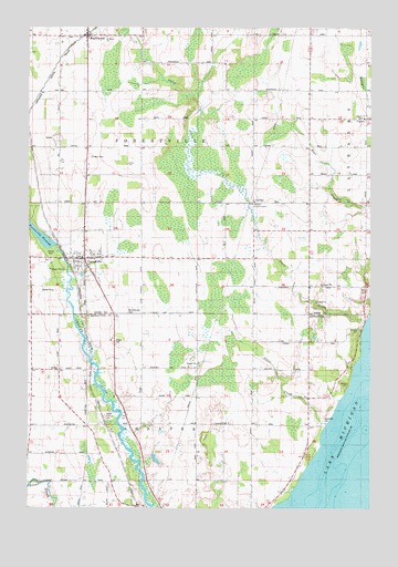
Forestville, WI USGS Topographic Map
Click on map above to begin viewing in our Map Viewer.

This topographic map contains these locations and features:
Feature Name Type Latitude Longitude GNIS ID View Map
Brockhausen CemeteryCemeteryN44.6759°W87.4639°1562228View Map
CarnotPopulated PlaceN44.7050°W87.4187°1562724View Map
Carnot FieldAirportN44.6395°W87.4194°2444127View Map
Cherry Lane OrchardsLocaleN44.7061°W87.4728°2711233View Map
Clark FarmsLocaleN44.7489°W87.4072°2711196View Map
Door County Library Forestville BranchBuildingN44.6892°W87.4800°2711350View Map
Door County ParkParkN44.6925°W87.4918°1577958View Map
Door Quarry SouthMineN44.7300°W87.4900°2633494View Map
East Maplewood SchoolSchoolN44.7400°W87.4290°1564353View Map
Forest ChapelChurchN44.7044°W87.4173°1577957View Map
ForestvillePopulated PlaceN44.6900°W87.4793°1565146View Map
Forestville 1885C70 DamDamN44.6931°W87.4912°1792148View Map
Forestville FlowageReservoirN44.6931°W87.4912°1565149View Map
Forestville Post OfficePost OfficeN44.6897°W87.4811°2710599View Map
Forestville Wastewater Treatment PlantLocaleN44.6839°W87.4803°2709435View Map
Foscoro Airport (historical)AirportN44.6808°W87.3806°1581853View Map
Gigstad FarmsLocaleN44.7347°W87.4011°2711201View Map
Harmann FarmsLocaleN44.6661°W87.3992°2710470View Map
Jorgensen - Stoller AirportAirportN44.6366°W87.4407°2444126View Map
Kirchman FarmsLocaleN44.6508°W87.4158°2710476View Map
KodanPopulated PlaceN44.6611°W87.4979°1577681View Map
Kodan SchoolSchoolN44.6542°W87.4890°1567596View Map
Krause G5896 1 DamDamN44.6383°W87.4551°1792548View Map
Lakeview SchoolSchoolN44.6975°W87.3787°1567809View Map
MaplewoodPopulated PlaceN44.7475°W87.4793°1569010View Map
Mathison FarmsLocaleN44.7431°W87.3756°2711204View Map
Olson FarmLocaleN44.6997°W87.3961°2711205View Map
Peninsula DairyLocaleN44.6889°W87.3939°2710465View Map
Saint Mary CemeteryCemeteryN44.7163°W87.4779°1573267View Map
Saint Marys ChurchChurchN44.7478°W87.4712°1577963View Map
Silver CreekStreamN44.6467°W87.3920°1574103View Map
Southern Door Volunteer Fire DepartmentBuildingN44.6902°W87.4791°2697729View Map
Steiner FarmLocaleN44.6450°W87.4906°2710480View Map
Stony CreekStreamN44.6739°W87.3779°1574949View Map
Stony Creek VineyardsLocaleN44.6833°W87.4106°2710467View Map
Tanum ChurchChurchN44.7186°W87.3776°1577964View Map
Town of AhnapeeCivilN44.6395°W87.4624°1582661View Map
Town of ForestvilleCivilN44.7193°W87.4582°1583218View Map
VignesPopulated PlaceN44.7261°W87.3776°1576093View Map
Village of ForestvilleCivilN44.6907°W87.4786°1583217View Map
Vistren FarmsLocaleN44.7275°W87.3847°2711210View Map
Woodside CemeteryCemeteryN44.6480°W87.3920°1577027View Map
Woodside SchoolSchoolN44.6608°W87.4081°1577034View Map

Note: Coordinates in the location and feature list above are referenced to NAD83 datum.


Copyright (C) 2008-2025 Ryan Niemi / Sunset Dynamics ... All Rights Reserved