TopoQuest Logo
Do you find TopoQuest useful?
Help keep TopoQuest running and adding new maps/features by donating!
Bitcoin:  19c7KJd3qBynnjoSw5npx9KScwjBe4ifkT
Litecoin:  LXs6TkuXGGXo1vDsWCkWVdjQX94eUKd6ui
Home View Maps Find Maps Find Places Resources & Links


Substitute Point, Oregon Topographic Map

USGS Map Title: Substitute Point, OR
USGS Map MRC: 44121A8
DRG (GeoTIFF) Download: o44121a8.tif


Neighboring USGS Topographic Map Quads:


  Belknap Springs, OR  
44122B1
 

  Linton Lake, OR  
44121B8
 

  North Sister, OR  
44121B7
 

  French Mountain, OR  
44122A1
 

  Substitute Point, OR  
44121A8
 

  South Sister, OR  
44121A7
 

  Chucksney Mountain, OR  
43122H1
 

  Packsaddle Mountain, OR  
43121H8
 

  Elk Lake, OR  
43121H7


Map MRC Location:

N45°
W122°
N45°
W121°
H8 H7 H6 H5 H4 H3 H2 H1
G8 G7 G6 G5 G4 G3 G2 G1
F8 F7 F6 F5 F4 F3 F2 F1
E8 E7 E6 E5 E4 E3 E2 E1
D8 D7 D6 D5 D4 D3 D2 D1
C8 C7 C6 C5 C4 C3 C2 C1
B8 B7 B6 B5 B4 B3 B2 B1
A8 A7 A6 A5 A4 A3 A2 A1
N44°
W122°
N44°
W121°

Substitute Point, OR USGS 1:24K Topographic Map Preview:
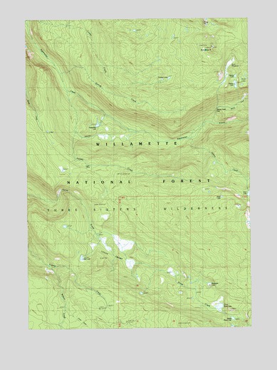
Substitute Point, OR USGS Topographic Map
Click on map above to begin viewing in our Map Viewer.

This topographic map contains these locations and features:
Feature Name Type Latitude Longitude GNIS ID View Map
Buck MeadowsFlatN44.1064°W121.8873°1118197View Map
Buck Meadows TrailTrailN44.1123°W121.8864°1118198View Map
Cedar SwampSwampN44.0342°W121.9477°1118765View Map
Dillion LakeLakeN44.0284°W121.9709°1119940View Map
Drury LakeLakeN44.0528°W121.8919°1133216View Map
Foley Ridge TrailTrailN44.1207°W121.9048°1142287View Map
George CreekStreamN44.1026°W121.9809°1121095View Map
Harvey CreekStreamN44.0960°W121.9781°1121645View Map
Honey CreekStreamN44.0826°W121.8962°1143691View Map
Honey Creek FallsFallsN44.0873°W121.8945°1131993View Map
Honey LakesLakeN44.1012°W121.8800°1143694View Map
Horse Creek TrailTrailN44.0332°W121.9211°1143760View Map
Horse LakesLakeN44.0040°W121.8845°1132066View Map
Ingram CampLocaleN44.0654°W121.9653°1122253View Map
Kidney LakeLakeN44.0981°W121.8835°1122720View Map
Louise Creek TrailTrailN44.0946°W121.9267°1145575View Map
Lower Horse LakeLakeN44.0084°W121.8939°1123566View Map
Mesa CreekStreamN44.0835°W121.8762°1146112View Map
Middle Horse LakeLakeN44.0035°W121.8866°1124121View Map
Moonlight LakeLakeN44.0173°W121.8995°1124325View Map
Nash LakeLakeN44.0537°W121.8752°1146730View Map
Nash Lake TrailTrailN44.0537°W121.9070°1146731View Map
Separation Creek CutoffTrailN44.1040°W121.9778°1126743View Map
Separation Creek TrailTrailN44.0768°W121.9212°1149239View Map
Separation LakeLakeN44.0822°W121.9612°1126744View Map
Sphinx CreekStreamN44.0760°W121.9100°1150123View Map
Square LakeLakeN44.1013°W121.8835°1127467View Map
Substitute PointSummitN44.1134°W121.8963°1158509View Map
Three Sisters WildernessReserveN44.0412°W121.9005°1132759View Map
Tokatee LakesLakeN44.1007°W121.9209°1128140View Map
Water Holes TrailTrailN44.0068°W121.9536°1151938View Map
Wildcat CreekStreamN44.0262°W121.9889°1152346View Map

Note: Coordinates in the location and feature list above are referenced to NAD83 datum.


Copyright (C) 2008-2025 Ryan Niemi / Sunset Dynamics ... All Rights Reserved