TopoQuest Logo
Do you find TopoQuest useful?
Help keep TopoQuest running and adding new maps/features by donating!
Bitcoin:  19c7KJd3qBynnjoSw5npx9KScwjBe4ifkT
Litecoin:  LXs6TkuXGGXo1vDsWCkWVdjQX94eUKd6ui
Home View Maps Find Maps Find Places Resources & Links


Sullivan City, Texas Topographic Map

USGS Map Title: Sullivan City, TX
USGS Map MRC: 26098C5
DRG (GeoTIFF) Download: o26098c5.tif


Neighboring USGS Topographic Map Quads:


  Sagunada Ranch, TX  
26098D6
 

  Camp Garcia, TX  
26098D5
 

  McCook, TX  
26098D4
 

  La Grulla, TX  
26098C6
 

  Sullivan City, TX  
26098C5
 

  Citrus City, TX  
26098C4
 

  Los Ebanos NW, TX  
26098B6
 

  Los Ebanos, TX  
26098B5
 

  La Joya, TX  
26098B4


Map MRC Location:

N27°
W99°
N27°
W98°
H8 H7 H6 H5 H4 H3 H2 H1
G8 G7 G6 G5 G4 G3 G2 G1
F8 F7 F6 F5 F4 F3 F2 F1
E8 E7 E6 E5 E4 E3 E2 E1
D8 D7 D6 D5 D4 D3 D2 D1
C8 C7 C6 C5 C4 C3 C2 C1
B8 B7 B6 B5 B4 B3 B2 B1
A8 A7 A6 A5 A4 A3 A2 A1
N26°
W99°
N26°
W98°

Sullivan City, TX USGS 1:24K Topographic Map Preview:
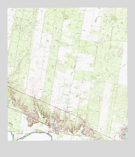
Sullivan City, TX USGS Topographic Map
Click on map above to begin viewing in our Map Viewer.

This topographic map contains these locations and features:
Feature Name Type Latitude Longitude GNIS ID View Map
Benavides Colonia Number 2Populated PlaceN26.2815°W98.5653°2009869View Map
Benavides Elementary SchoolSchoolN26.3046°W98.5581°1986003View Map
Benevides ColoniaPopulated PlaceN26.2723°W98.5584°2009870View Map
Blue Star Enterprises Number 2 ColoniaPopulated PlaceN26.2915°W98.5603°2009883View Map
Buena Vista Census Designated PlaceCensusN26.2941°W98.6109°2584614View Map
Buena Vista ColoniaPopulated PlaceN26.2942°W98.6114°2011267View Map
Casa Blanca Census Designated PlaceCensusN26.2976°W98.6103°2584617View Map
City of Sullivan CityCivilN26.2752°W98.5644°2411996View Map
Cobby LakeLakeN26.2883°W98.6227°1333041View Map
Colonia RafaelPopulated PlaceN26.2815°W98.5672°2010482View Map
Colonia San MiguelPopulated PlaceN26.2753°W98.5614°2010433View Map
CuevitasPopulated PlaceN26.2628°W98.5781°1333792View Map
Cuevitas Banco Number 96LeveeN26.2587°W98.5806°1333793View Map
Cuevitas Census Designated PlaceCensusN26.2585°W98.5787°2408631View Map
El Faro School (historical)SchoolN26.2745°W98.5522°1335186View Map
El Toro RanchLocaleN26.3648°W98.5634°1335281View Map
Havana Census Designated PlaceCensusN26.2507°W98.5090°2408356View Map
Kathy CreekStreamN26.2601°W98.5781°1338959View Map
La Aurora ColoniaPopulated PlaceN26.2703°W98.5553°2011149View Map
La Burrita CreekStreamN26.2778°W98.5931°1340575View Map
La Hermosa ColoniaPopulated PlaceN26.2715°W98.5603°2011169View Map
La Paloma Ranchettes Census Designated PlaceCensusN26.3148°W98.6230°2584667View Map
Las Cuevas ColoniaPopulated PlaceN26.2765°W98.5692°2011083View Map
Las Cuevas Number 2 ColoniaPopulated PlaceN26.2784°W98.5684°2011084View Map
Nina Census Designated PlaceCensusN26.2811°W98.5810°2584702View Map
Nina ColoniaPopulated PlaceN26.2815°W98.5814°2010806View Map
Quesada Census Designated PlaceCensusN26.2815°W98.5820°2584718View Map
Quesada ColoniaPopulated PlaceN26.2823°W98.5822°2010818View Map
Rancho ColoniaPopulated PlaceN26.3065°W98.5564°2010941View Map
Saint Clair Acres ColoniaPopulated PlaceN26.2715°W98.5553°2010585View Map
Saint Claire Fisher ColoniaPopulated PlaceN26.2773°W98.5553°2010586View Map
San Guillermo ChurchChurchN26.2817°W98.5625°1346354View Map
Santos Banco Number 95LeveeN26.2592°W98.5950°1346692View Map
Sullivan CityPopulated PlaceN26.2776°W98.5636°1348049View Map
Sullivan City HallBuildingN26.2675°W98.5604°2753638View Map
Sullivan City Post OfficePost OfficeN26.2733°W98.5593°2732209View Map
Sullivan City Volunteer Fire DepartmentBuildingN26.2720°W98.5595°2551384View Map
Vales ColoniaPopulated PlaceN26.2753°W98.5664°2011542View Map
Valle Vista ColoniaPopulated PlaceN26.3084°W98.5584°2011547View Map
Villa Estates ColoniaPopulated PlaceN26.2734°W98.5703°2011559View Map

Note: Coordinates in the location and feature list above are referenced to NAD83 datum.


Copyright (C) 2008-2025 Ryan Niemi / Sunset Dynamics ... All Rights Reserved