TopoQuest Logo
Do you find TopoQuest useful?
Help keep TopoQuest running and adding new maps/features by donating!
Bitcoin:  19c7KJd3qBynnjoSw5npx9KScwjBe4ifkT
Litecoin:  LXs6TkuXGGXo1vDsWCkWVdjQX94eUKd6ui
Home View Maps Find Maps Find Places Resources & Links


Sulphur South, Oklahoma Topographic Map

USGS Map Title: Sulphur South, OK
USGS Map MRC: 34096D8
DRG (GeoTIFF) Download: o34096d8.tif


Neighboring USGS Topographic Map Quads:


  Davis, OK  
34097E1
 

  Sulphur North, OK  
34096E8
 

  Roff South, OK  
34096E7
 

  Dougherty, OK  
34097D1
 

  Sulphur South, OK  
34096D8
 

  Mill Creek, OK  
34096D7
 

  Gene Autry, OK  
34097C1
 

  Nebo, OK  
34096C8
 

  Troy, OK  
34096C7


Map MRC Location:

N35°
W97°
N35°
W96°
H8 H7 H6 H5 H4 H3 H2 H1
G8 G7 G6 G5 G4 G3 G2 G1
F8 F7 F6 F5 F4 F3 F2 F1
E8 E7 E6 E5 E4 E3 E2 E1
D8 D7 D6 D5 D4 D3 D2 D1
C8 C7 C6 C5 C4 C3 C2 C1
B8 B7 B6 B5 B4 B3 B2 B1
A8 A7 A6 A5 A4 A3 A2 A1
N34°
W97°
N34°
W96°

Sulphur South, OK USGS 1:24K Topographic Map Preview:
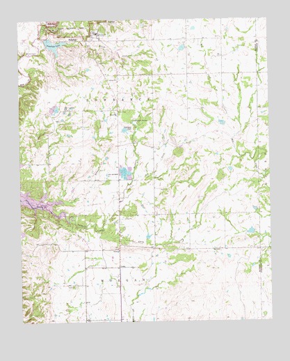
Sulphur South, OK USGS Topographic Map
Click on map above to begin viewing in our Map Viewer.

This topographic map contains these locations and features:
Feature Name Type Latitude Longitude GNIS ID View Map
Bromide HillSummitN34.4951°W96.9820°1101924View Map
Bromide SpringSpringN34.4968°W96.9831°1101925View Map
Buckhorn CemeteryCemeteryN34.4623°W96.9514°1090624View Map
Buckhorn CreekStreamN34.4173°W96.9733°1090626View Map
Cedar Blue Volunteer Fire DepartmentBuildingN34.4475°W96.9861°2657161View Map
Central ChurchChurchN34.4048°W96.9508°1091160View Map
Chili CreekStreamN34.4173°W96.9731°1091295View Map
Cliff Bromide SpringsSpringN34.4954°W96.9825°1101929View Map
Cliffside TrailTrailN34.4948°W96.9708°1101930View Map
DrakePopulated PlaceN34.3979°W96.9508°1100365View Map
Drake CemeteryCemeteryN34.3898°W96.9731°1092186View Map
Dry BranchStreamN34.4245°W96.9786°1092210View Map
Dry CreekStreamN34.4304°W96.9475°1092218View Map
East Murray DivisionCivilN34.4925°W96.9598°1937701View Map
Fletcher CemeteryCemeteryN34.4887°W96.8908°1092897View Map
Lowrance LakeReservoirN34.4544°W96.9475°1095035View Map
Lowrance SpringsSpringN34.4587°W96.9431°1095037View Map
Mill Creek Watershed 10 DamDamN34.4884°W96.9170°1757623View Map
Mill Creek Watershed 10 ReservoirReservoirN34.4884°W96.9170°1757624View Map
Mill Creek Watershed 14 DamDamN34.4568°W96.8986°1757619View Map
Mill Creek Watershed 14 ReservoirReservoirN34.4568°W96.8986°1757620View Map
Mill Creek Watershed 16 DamDamN34.4118°W96.8836°1757617View Map
Mill Creek Watershed 16 ReservoirReservoirN34.4118°W96.8836°1757618View Map
Mill Creek Watershed 8 DamDamN34.4951°W96.8953°1757627View Map
Mill Creek Watershed 8 ReservoirReservoirN34.4951°W96.8953°1757628View Map
Mount AirySummitN34.4998°W96.9614°1102752View Map
Robbers RoostSummitN34.4951°W96.9828°1101948View Map
Rock Prarie Fire DepartmentBuildingN34.4039°W96.9116°2657255View Map
State Veterans HospitalHospitalN34.4943°W96.9617°1098508View Map
Sulphur Asphalt SpringSpringN34.4926°W96.9664°1101951View Map
Sulphur Bromide SpringSpringN34.4948°W96.9731°1100117View Map
Township of LowranceCivilN34.4681°W96.9420°1824990View Map
Township of MorganCivilN34.3806°W96.9531°1824991View Map
Veterans LakeReservoirN34.4897°W96.9825°1099249View Map
Veterans Lake DamDamN34.4901°W96.9870°1755601View Map
Wilson CreekStreamN34.4909°W96.9756°1099891View Map

Note: Coordinates in the location and feature list above are referenced to NAD83 datum.


Copyright (C) 2008-2025 Ryan Niemi / Sunset Dynamics ... All Rights Reserved