TopoQuest Logo
Do you find TopoQuest useful?
Help keep TopoQuest running and adding new maps/features by donating!
Bitcoin:  19c7KJd3qBynnjoSw5npx9KScwjBe4ifkT
Litecoin:  LXs6TkuXGGXo1vDsWCkWVdjQX94eUKd6ui
Home View Maps Find Maps Find Places Resources & Links


Sumnerville, Michigan Topographic Map

USGS Map Title: Sumnerville, MI
USGS Map MRC: 41086H2
DRG (GeoTIFF) Download: o41086h2.tif


Neighboring USGS Topographic Map Quads:


  Sodus, MI  
42086A3
 

  Sister Lakes, MI  
42086A2
 

  Twin Lakes, MI  
42086A1
 

  Berrien Springs, MI  
41086H3
 

  Sumnerville, MI  
41086H2
 

  Dowagiac, MI  
41086H1
 

  Niles West, MI  
41086G3
 

  Niles East, MI  
41086G2
 

  Edwardsburg, MI  
41086G1


Map MRC Location:

N42°
W87°
N42°
W86°
H8 H7 H6 H5 H4 H3 H2 H1
G8 G7 G6 G5 G4 G3 G2 G1
F8 F7 F6 F5 F4 F3 F2 F1
E8 E7 E6 E5 E4 E3 E2 E1
D8 D7 D6 D5 D4 D3 D2 D1
C8 C7 C6 C5 C4 C3 C2 C1
B8 B7 B6 B5 B4 B3 B2 B1
A8 A7 A6 A5 A4 A3 A2 A1
N41°
W87°
N41°
W86°

Sumnerville, MI USGS 1:24K Topographic Map Preview:
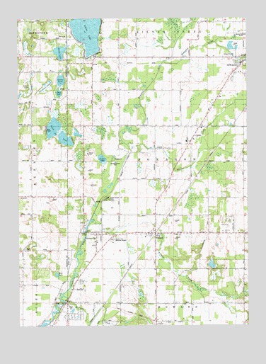
Sumnerville, MI USGS Topographic Map
Click on map above to begin viewing in our Map Viewer.

This topographic map contains these locations and features:
Feature Name Type Latitude Longitude GNIS ID View Map
Allen SchoolSchoolN41.8842°W86.1656°619987View Map
Apostolic Lighthouse ChurchChurchN41.9844°W86.1542°2414346View Map
Arthur Dodd Memorial ParkParkN41.9125°W86.2147°2402167View Map
Bernhart LakeLakeN41.9723°W86.2339°621164View Map
Boot LakeLakeN41.9698°W86.2275°621726View Map
Brush LakeLakeN41.9864°W86.2269°622143View Map
California SchoolSchoolN41.9917°W86.1517°622460View Map
Champlain SchoolSchoolN41.9345°W86.1764°623060View Map
Crystal Springs CampgroundLocaleN41.9273°W86.2020°624186View Map
Curtis LakeLakeN41.9749°W86.2265°624237View Map
Dowagiac ChurchChurchN41.9519°W86.1528°2109404View Map
Dowagiac CreekStreamN41.9820°W86.1711°624844View Map
Evergreen CemeteryCemeteryN41.9122°W86.1660°2109403View Map
Franklin CemeteryCemeteryN41.9711°W86.2236°2374164View Map
Franklin ChurchChurchN41.9709°W86.2239°626412View Map
Franklin SchoolSchoolN41.9839°W86.2375°626419View Map
Hampshire Country ClubLocaleN41.9153°W86.1389°2414353View Map
Hampshire Street SchoolSchoolN41.9117°W86.1483°627703View Map
Indian LakeLakeN41.9958°W86.2118°628997View Map
Indian Lake Hills Golf CourseLocaleN41.9931°W86.2250°2377489View Map
Indian Lake Volunteer Fire DepartmentBuildingN41.9849°W86.2066°2414311View Map
Jehovah's WitnessesChurchN41.9836°W86.1486°2414327View Map
Mayflower SchoolSchoolN41.9564°W86.2139°631777View Map
McKinzie CreekStreamN41.8848°W86.2250°631967View Map
Methodist Episcopal ChurchChurchN41.9114°W86.1733°2402215View Map
Mission Hills Memorial GardensCemeteryN41.9103°W86.1992°2109405View Map
Morris ChapelChurchN41.9062°W86.2461°632709View Map
Morris Chapel CemeteryCemeteryN41.9064°W86.2464°2374171View Map
Morris Chapel Church Historical MarkerParkN41.9061°W86.2472°2374129View Map
Mud LakeLakeN41.8961°W86.2293°632893View Map
National SchoolSchoolN41.9375°W86.2433°633229View Map
Old Rugged Cross/Methodist Episcopal Church Historical MarkerParkN41.9117°W86.1728°2402221View Map
Peavine CreekStreamN41.9487°W86.1917°634539View Map
Peavine SchoolSchoolN41.9553°W86.1620°634540View Map
PokagonPopulated PlaceN41.9125°W86.1764°635203View Map
Pokagon Band of Potawatomi Indian Tribal OfficeBuildingN41.9472°W86.1933°2414310View Map
Pokagon CreekStreamN41.9170°W86.2114°635204View Map
Pokagon Post Office (historical)Post OfficeN41.9125°W86.1764°2402191View Map
Pokagon StationLocaleN41.9125°W86.1758°2402190View Map
Pokagon Tribal Police DepartmentBuildingN41.9534°W86.1502°2737614View Map
Pokagon Volunteer Fire DepartmentBuildingN41.9125°W86.1771°2635980View Map
Pucker Street SchoolSchoolN41.9020°W86.2483°635501View Map
Rodgers CemeteryCemeteryN41.9169°W86.2150°2402232View Map
Rodgers LakeLakeN41.9431°W86.2043°636106View Map
School LakeLakeN41.9714°W86.2436°637372View Map
Smith LakeLakeN41.9557°W86.2308°638157View Map
SumnervillePopulated PlaceN41.9117°W86.2075°639066View Map
Sumnerville Baptist ChurchChurchN41.9311°W86.2142°2402246View Map
Sumnerville CemeteryCemeteryN41.9103°W86.2050°2402233View Map
Sumnerville Cemetery Historical MarkerParkN41.9122°W86.2050°2402220View Map
Sumnerville Mounds Historical MarkerParkN41.9122°W86.2050°2402219View Map
Sumnerville Post Office (historical)Post OfficeN41.9117°W86.2075°2402176View Map
Township of PokagonCivilN41.9399°W86.1666°1626922View Map
Union Church and Cemetery Historical MarkerParkN41.9303°W86.2056°2374132View Map

Note: Coordinates in the location and feature list above are referenced to NAD83 datum.


Copyright (C) 2008-2024 Ryan Niemi / Sunset Dynamics ... All Rights Reserved