TopoQuest Logo
Do you find TopoQuest useful?
Help keep TopoQuest running and adding new maps/features by donating!
Bitcoin:  19c7KJd3qBynnjoSw5npx9KScwjBe4ifkT
Litecoin:  LXs6TkuXGGXo1vDsWCkWVdjQX94eUKd6ui
Home View Maps Find Maps Find Places Resources & Links


Sunnyside, Wisconsin Topographic Map

USGS Map Title: Sunnyside, WI
USGS Map MRC: 46092E1
DRG (GeoTIFF) Download: o46092e1.tif


Neighboring USGS Topographic Map Quads:


  West Duluth, MN  
46092F2
 

  Superior, WI  
46092F1
 

  Parkland, WI  
46091F8
 

  Borea, WI  
46092E2
 

  Sunnyside, WI  
46092E1
 

  South Range, WI  
46091E8
 

  Patzau, WI  
46092D2
 

  Amnicon Lake, WI  
46092D1
 

  Lyman Lake, WI  
46091D8


Map MRC Location:

N47°
W93°
N47°
W92°
H8 H7 H6 H5 H4 H3 H2 H1
G8 G7 G6 G5 G4 G3 G2 G1
F8 F7 F6 F5 F4 F3 F2 F1
E8 E7 E6 E5 E4 E3 E2 E1
D8 D7 D6 D5 D4 D3 D2 D1
C8 C7 C6 C5 C4 C3 C2 C1
B8 B7 B6 B5 B4 B3 B2 B1
A8 A7 A6 A5 A4 A3 A2 A1
N46°
W93°
N46°
W92°

Sunnyside, WI USGS 1:24K Topographic Map Preview:
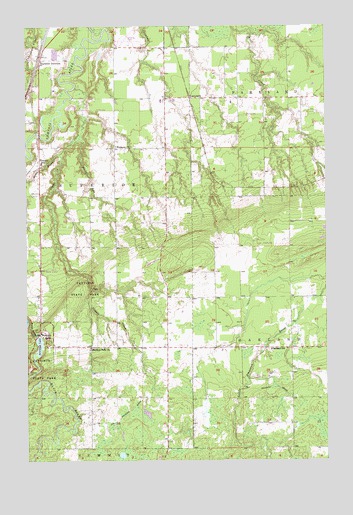
Sunnyside, WI USGS Topographic Map
Click on map above to begin viewing in our Map Viewer.

This topographic map contains these locations and features:
Feature Name Type Latitude Longitude GNIS ID View Map
Big Manitou FallsFallsN46.5361°W92.1213°1561749View Map
Birch CreekStreamN46.6228°W92.0306°2772325View Map
Boylston JunctionPopulated PlaceN46.6141°W92.1196°1577525View Map
Carlson AirportAirportN46.6207°W92.0809°1582231View Map
Concrete School (historical)SchoolN46.5761°W92.0666°1846512View Map
Copper CreekStreamN46.6074°W92.1046°1563389View Map
Four CornersPopulated PlaceN46.5326°W92.0667°2741528View Map
Four Corners Elementary SchoolSchoolN46.5336°W92.0741°2713304View Map
Interfalls LakeLakeN46.5332°W92.1201°1566944View Map
Manitou Falls ChurchChurchN46.5324°W92.0988°1568935View Map
Maranatha AcademySchoolN46.5857°W92.1188°1570173View Map
Oakland SchoolSchoolN46.5319°W92.0232°1570706View Map
Pattison State ParkParkN46.5267°W92.1222°1571086View Map
Pattison State Park WP433 DamDamN46.5349°W92.1219°1791908View Map
Rocky GorgeValleyN46.5405°W92.1249°1572500View Map
Rocky RunStreamN46.5924°W92.1030°1572512View Map
Stony BrookStreamN46.5888°W92.1107°1574942View Map
SunnysidePopulated PlaceN46.6041°W92.0566°1577845View Map
Superior Township Volunteer Fire DepartmentBuildingN46.5477°W92.1203°2696888View Map
Wesleyan ChurchChurchN46.5902°W92.0877°1576437View Map

Note: Coordinates in the location and feature list above are referenced to NAD83 datum.


Copyright (C) 2008-2025 Ryan Niemi / Sunset Dynamics ... All Rights Reserved