TopoQuest Logo
Do you find TopoQuest useful?
Help keep TopoQuest running and adding new maps/features by donating!
Bitcoin:  19c7KJd3qBynnjoSw5npx9KScwjBe4ifkT
Litecoin:  LXs6TkuXGGXo1vDsWCkWVdjQX94eUKd6ui
Home View Maps Find Maps Find Places Resources & Links


Borea, Wisconsin Topographic Map

USGS Map Title: Borea, WI
USGS Map MRC: 46092E2
DRG (GeoTIFF) Download: o46092e2.tif


Neighboring USGS Topographic Map Quads:


  Esko, MN  
46092F3
 

  West Duluth, MN  
46092F2
 

  Superior, WI  
46092F1
 

  Frogner, MN  
46092E3
 

  Borea, WI  
46092E2
 

  Sunnyside, WI  
46092E1
 

  Foxboro, WI  
46092D3
 

  Patzau, WI  
46092D2
 

  Amnicon Lake, WI  
46092D1


Map MRC Location:

N47°
W93°
N47°
W92°
H8 H7 H6 H5 H4 H3 H2 H1
G8 G7 G6 G5 G4 G3 G2 G1
F8 F7 F6 F5 F4 F3 F2 F1
E8 E7 E6 E5 E4 E3 E2 E1
D8 D7 D6 D5 D4 D3 D2 D1
C8 C7 C6 C5 C4 C3 C2 C1
B8 B7 B6 B5 B4 B3 B2 B1
A8 A7 A6 A5 A4 A3 A2 A1
N46°
W93°
N46°
W92°

Borea, WI USGS 1:24K Topographic Map Preview:
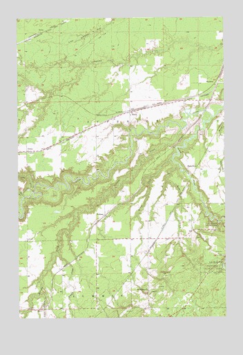
Borea, WI USGS Topographic Map
Click on map above to begin viewing in our Map Viewer.

This topographic map contains these locations and features:
Feature Name Type Latitude Longitude GNIS ID View Map
AntonPopulated PlaceN46.6191°W92.2355°1577493View Map
Balsam CreekStreamN46.5783°W92.1513°1561139View Map
Black RiverStreamN46.5836°W92.1327°1561881View Map
Black RiverPopulated PlaceN46.5622°W92.1474°1577517View Map
BoreaPopulated PlaceN46.5855°W92.1824°1577520View Map
BoylstonPopulated PlaceN46.5974°W92.1288°1577524View Map
Clear CreekStreamN46.5544°W92.2402°641269View Map
Clear CreekStreamN46.5544°W92.2402°1563145View Map
DedhamPopulated PlaceN46.5422°W92.1980°1577568View Map
DeweyPopulated PlaceN46.5694°W92.2449°1577570View Map
Empire CreekStreamN46.5269°W92.2263°1564642View Map
Little Balsam CreekStreamN46.5099°W92.2352°1568169View Map
Little Manitou FallsFallsN46.5222°W92.1260°1568312View Map
Miller CreekStreamN46.5661°W92.1566°1569512View Map
Mud CreekStreamN46.5502°W92.2477°1569897View Map
Mud CreekStreamN46.5502°W92.2477°648201View Map
Rock CreekStreamN46.5630°W92.1527°1572428View Map
Saint Aloysius ChurchChurchN46.5111°W92.1724°1572826View Map
Town of SuperiorCivilN46.5863°W92.1671°1584259View Map

Note: Coordinates in the location and feature list above are referenced to NAD83 datum.


Copyright (C) 2008-2025 Ryan Niemi / Sunset Dynamics ... All Rights Reserved