TopoQuest Logo
Do you find TopoQuest useful?
Help keep TopoQuest running and adding new maps/features by donating!
Bitcoin:  19c7KJd3qBynnjoSw5npx9KScwjBe4ifkT
Litecoin:  LXs6TkuXGGXo1vDsWCkWVdjQX94eUKd6ui
Home View Maps Find Maps Find Places Resources & Links


Sunset Pass, Arizona Topographic Map

USGS Map Title: Sunset Pass, AZ
USGS Map MRC: 34110G8
DRG (GeoTIFF) Download: o34110g8.tif


Neighboring USGS Topographic Map Quads:


  Chavez Mountain NE, AZ  
34111H1
 

  West Sunset Mountain, AZ  
34110H8
 

  Rock Station, AZ  
34110H7
 

  Chavez Mountain East, AZ  
34111G1
 

  Sunset Pass, AZ  
34110G8
 

  Pump Ranch Tank, AZ  
34110G7
 

  Quayle Hill, AZ  
34111F1
 

  Hamilton Crossing, AZ  
34110F8
 

  Chevelon Butte, AZ  
34110F7


Map MRC Location:

N35°
W111°
N35°
W110°
H8 H7 H6 H5 H4 H3 H2 H1
G8 G7 G6 G5 G4 G3 G2 G1
F8 F7 F6 F5 F4 F3 F2 F1
E8 E7 E6 E5 E4 E3 E2 E1
D8 D7 D6 D5 D4 D3 D2 D1
C8 C7 C6 C5 C4 C3 C2 C1
B8 B7 B6 B5 B4 B3 B2 B1
A8 A7 A6 A5 A4 A3 A2 A1
N34°
W111°
N34°
W110°

Sunset Pass, AZ USGS 1:24K Topographic Map Preview:
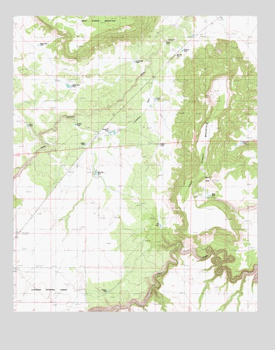
Sunset Pass, AZ USGS Topographic Map
Click on map above to begin viewing in our Map Viewer.

This topographic map contains these locations and features:
Feature Name Type Latitude Longitude GNIS ID View Map
Birch TankReservoirN34.7992°W110.8996°40849View Map
Caliche TankReservoirN34.8291°W110.9687°41896View Map
Chaucey TankReservoirN34.8603°W110.9142°41892View Map
Dick Hart TankReservoirN34.8088°W110.9583°28468View Map
East Sunset MountainSummitN34.8409°W110.8999°28787View Map
Echinique DrawValleyN34.7514°W110.9415°28809View Map
Eckles TankReservoirN34.8205°W110.9258°40847View Map
Elk TankReservoirN34.7864°W110.9253°40851View Map
Fannin TankReservoirN34.8398°W110.9280°40504View Map
Fisher TankReservoirN34.8205°W110.9637°40853View Map
Gravel Pit TankReservoirN34.8259°W110.9490°40854View Map
Hidden TankReservoirN34.7588°W110.9523°40850View Map
Limestone WashStreamN34.8534°W110.9332°41894View Map
Lower Red TankReservoirN34.8556°W110.9385°41899View Map
Mesita KnollSummitN34.8064°W110.8999°40852View Map
Mule TankReservoirN34.8288°W110.9931°41897View Map
Red TanksReservoirN34.8454°W110.9711°33527View Map
Rincon TankReservoirN34.8216°W110.8838°40848View Map
Robins TankReservoirN34.8636°W110.9228°41893View Map
Sunset PassGapN34.8528°W110.9246°34974View Map
Table MountainSummitN34.8059°W110.9171°38096View Map
Upper Red TankReservoirN34.8627°W110.9877°41898View Map

Note: Coordinates in the location and feature list above are referenced to NAD83 datum.


Copyright (C) 2008-2025 Ryan Niemi / Sunset Dynamics ... All Rights Reserved