TopoQuest Logo
Do you find TopoQuest useful?
Help keep TopoQuest running and adding new maps/features by donating!
Bitcoin:  19c7KJd3qBynnjoSw5npx9KScwjBe4ifkT
Litecoin:  LXs6TkuXGGXo1vDsWCkWVdjQX94eUKd6ui
Home View Maps Find Maps Find Places Resources & Links


Supply, Virginia Topographic Map

USGS Map Title: Supply, VA
USGS Map MRC: 38077A2
DRG (GeoTIFF) Download: o38077a2.tif


Neighboring USGS Topographic Map Quads:


  Rappahannock Academy, VA  
38077B3
 

  Port Royal, VA  
38077B2
 

  Rollins Fork, VA  
38077B1
 

  Bowling Green, VA  
38077A3
 

  Supply, VA  
38077A2
 

  Loretto, VA  
38077A1
 

  Penola, VA  
37077H3
 

  Sparta, VA  
37077H2
 

  Cauthornville, VA  
37077H1


Map MRC Location:

N39°
W78°
N39°
W77°
H8 H7 H6 H5 H4 H3 H2 H1
G8 G7 G6 G5 G4 G3 G2 G1
F8 F7 F6 F5 F4 F3 F2 F1
E8 E7 E6 E5 E4 E3 E2 E1
D8 D7 D6 D5 D4 D3 D2 D1
C8 C7 C6 C5 C4 C3 C2 C1
B8 B7 B6 B5 B4 B3 B2 B1
A8 A7 A6 A5 A4 A3 A2 A1
N38°
W78°
N38°
W77°

Supply, VA USGS 1:24K Topographic Map Preview:
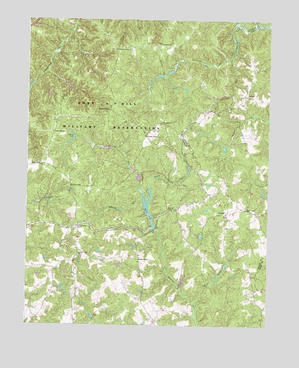
Supply, VA USGS Topographic Map
Click on map above to begin viewing in our Map Viewer.

This topographic map contains these locations and features:
Feature Name Type Latitude Longitude GNIS ID View Map
BrandywinePopulated PlaceN38.1151°W77.1805°1477139View Map
Broomstraw TrailTrailN38.0574°W77.1889°1463895View Map
Christopher ForkPopulated PlaceN38.0407°W77.2228°1477203View Map
Daniel CornerPopulated PlaceN38.0776°W77.1878°1477245View Map
Eagles Nest CemeteryCemeteryN38.0440°W77.1453°1739343View Map
Ebenezer ChurchChurchN38.0935°W77.1366°1466158View Map
Enon ChurchChurchN38.0885°W77.1458°1466317View Map
Goldmans CornerPopulated PlaceN38.1135°W77.2055°1477358View Map
Haynes CemeteryCemeteryN38.0248°W77.2378°1739350View Map
Hickory ForkPopulated PlaceN38.0568°W77.2275°1499550View Map
Holmes PondReservoirN38.0770°W77.2260°1468172View Map
Jacks ForkPopulated PlaceN38.0479°W77.1361°1477441View Map
Jones CornerPopulated PlaceN38.0268°W77.1911°1477451View Map
Jones PondReservoirN38.0326°W77.1946°1739357View Map
Kay CemeteryCemeteryN38.0690°W77.1636°1468917View Map
Liberty ForkPopulated PlaceN38.0468°W77.1758°1499662View Map
Martins CornerPopulated PlaceN38.0879°W77.2075°1477523View Map
Mashbox RunStreamN38.0526°W77.1894°1470151View Map
Mason SwampStreamN38.0087°W77.1628°1470164View Map
Mount Zion ChurchChurchN38.0290°W77.2228°1471144View Map
NaulaklaPopulated PlaceN38.0829°W77.1808°1477569View Map
P D Pitts DamDamN38.0168°W77.1697°1489396View Map
PassingLocaleN38.0460°W77.1466°1472097View Map
Penny CornerPopulated PlaceN38.0790°W77.2366°1477616View Map
Portage RunStreamN38.0587°W77.1725°1472678View Map
Portobago RunStreamN38.1090°W77.1450°1472686View Map
Rollins CemeteryCemeteryN38.0148°W77.1884°1739383View Map
Salem Church (historical)ChurchN38.0529°W77.1539°1739391View Map
Shady Grove RunStreamN38.0568°W77.1855°1474205View Map
SupplyLocaleN38.0943°W77.1361°1475345View Map
Sycamore School (historical)SchoolN38.0504°W77.1594°1739400View Map
Upper ZionPopulated PlaceN38.0654°W77.2430°1477834View Map
White LakeReservoirN38.0457°W77.1867°1476589View Map
White LakeReservoirN38.0401°W77.1680°1489342View Map
White Lake DamDamN38.0399°W77.1825°1489341View Map
Whites (historical)Populated PlaceN38.0379°W77.1844°1739403View Map

Note: Coordinates in the location and feature list above are referenced to NAD83 datum.


Copyright (C) 2008-2024 Ryan Niemi / Sunset Dynamics ... All Rights Reserved