TopoQuest Logo
Do you find TopoQuest useful?
Help keep TopoQuest running and adding new maps/features by donating!
Bitcoin:  19c7KJd3qBynnjoSw5npx9KScwjBe4ifkT
Litecoin:  LXs6TkuXGGXo1vDsWCkWVdjQX94eUKd6ui
Home View Maps Find Maps Find Places Resources & Links


Swan Point, Maryland Topographic Map

USGS Map Title: Swan Point, MD
USGS Map MRC: 39076B3
DRG (GeoTIFF) Download: o39076b3.tif


Neighboring USGS Topographic Map Quads:


  Middle River, MD  
39076C4
 

  Gunpowder Neck, MD  
39076C3
 

  Hanesville, MD  
39076C2
 

  Sparrows Point, MD  
39076B4
 

  Swan Point, MD  
39076B3
 

  Rock Hall, MD  
39076B2
 

  Gibson Island, MD  
39076A4
 

  Love Point, MD  
39076A3
 

  Langford Creek, MD  
39076A2


Map MRC Location:

N40°
W77°
N40°
W76°
H8 H7 H6 H5 H4 H3 H2 H1
G8 G7 G6 G5 G4 G3 G2 G1
F8 F7 F6 F5 F4 F3 F2 F1
E8 E7 E6 E5 E4 E3 E2 E1
D8 D7 D6 D5 D4 D3 D2 D1
C8 C7 C6 C5 C4 C3 C2 C1
B8 B7 B6 B5 B4 B3 B2 B1
A8 A7 A6 A5 A4 A3 A2 A1
N39°
W77°
N39°
W76°

Swan Point, MD USGS 1:24K Topographic Map Preview:
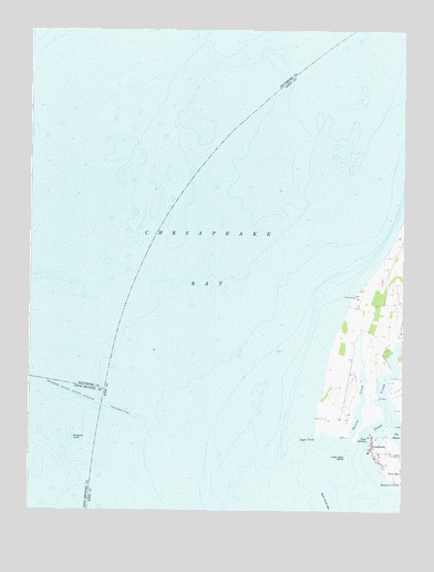
Swan Point, MD USGS Topographic Map
Click on map above to begin viewing in our Map Viewer.

This topographic map contains these locations and features:
Feature Name Type Latitude Longitude GNIS ID View Map
Brewerton Channel Eastern ExtensionChannelN39.1557°W76.3608°583373View Map
Deep LandingLocaleN39.1446°W76.2600°590079View Map
GratitudePopulated PlaceN39.1407°W76.2600°590355View Map
Gratitude Post Office (historical)Post OfficeN39.1418°W76.2608°595427View Map
Gratitude Yacht HarborLocaleN39.1426°W76.2611°595198View Map
Harts PointCapeN39.1457°W76.2608°593905View Map
Little Neck FarmsPopulated PlaceN39.1651°W76.2586°591922View Map
Little Neck IslandIslandN39.1387°W76.2683°585494View Map
Ninefoot KnollBarN39.1443°W76.3605°586197View Map
Osprey Point MarinaLocaleN39.1430°W76.2520°2503543View Map
Swan CreekStreamN39.1412°W76.2633°587648View Map
Swan Creek MarinaLocaleN39.1448°W76.2594°2503677View Map
Swan Island (historical)IslandN39.1279°W76.2750°593915View Map
Swan PointCapeN39.1451°W76.2780°587659View Map
Swan Point BarBarN39.1276°W76.2755°587660View Map
Tavern CreekStreamN39.1440°W76.2669°587704View Map
Windmill PointCapeN39.1334°W76.2508°588294View Map

Note: Coordinates in the location and feature list above are referenced to NAD83 datum.


Copyright (C) 2008-2024 Ryan Niemi / Sunset Dynamics ... All Rights Reserved