TopoQuest Logo
Do you find TopoQuest useful?
Help keep TopoQuest running and adding new maps/features by donating!
Bitcoin:  19c7KJd3qBynnjoSw5npx9KScwjBe4ifkT
Litecoin:  LXs6TkuXGGXo1vDsWCkWVdjQX94eUKd6ui
Home View Maps Find Maps Find Places Resources & Links


Sweetwater, Florida Topographic Map

USGS Map Title: Sweetwater, FL
USGS Map MRC: 27081D6
DRG (GeoTIFF) Download: o27081d6.tif


Neighboring USGS Topographic Map Quads:


  Wauchula, FL  
27081E7
 

  Griffins Corner, FL  
27081E6
 

  Avon Park, FL  
27081E5
 

  Zolfo Springs, FL  
27081D7
 

  Sweetwater, FL  
27081D6
 

  Crewsville, FL  
27081D5
 

  Gardner, FL  
27081C7
 

  Crewsville SW, FL  
27081C6
 

  Crewsville SE, FL  
27081C5


Map MRC Location:

N28°
W82°
N28°
W81°
H8 H7 H6 H5 H4 H3 H2 H1
G8 G7 G6 G5 G4 G3 G2 G1
F8 F7 F6 F5 F4 F3 F2 F1
E8 E7 E6 E5 E4 E3 E2 E1
D8 D7 D6 D5 D4 D3 D2 D1
C8 C7 C6 C5 C4 C3 C2 C1
B8 B7 B6 B5 B4 B3 B2 B1
A8 A7 A6 A5 A4 A3 A2 A1
N27°
W82°
N27°
W81°

Sweetwater, FL USGS 1:24K Topographic Map Preview:
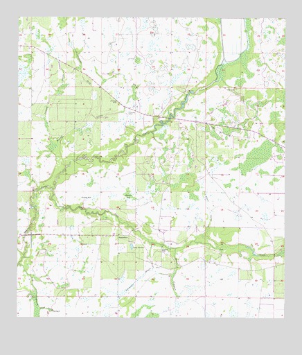
Sweetwater, FL USGS Topographic Map
Click on map above to begin viewing in our Map Viewer.

This topographic map contains these locations and features:
Feature Name Type Latitude Longitude GNIS ID View Map
Adeline BaySwampN27.4263°W81.6970°277695View Map
Fish BranchStreamN27.3978°W81.7490°282473View Map
Fivemile GullyStreamN27.4600°W81.7159°282529View Map
Grass Valley RanchLocaleN27.4533°W81.6950°2702354View Map
Jackson BranchStreamN27.4384°W81.7273°284671View Map
Lake FlorenceLakeN27.4050°W81.6962°282589View Map
Mercer BranchStreamN27.4042°W81.6756°286718View Map
Mineral BranchGutN27.4542°W81.7212°286952View Map
Oak CreekStreamN27.4289°W81.7337°294281View Map
Parks CreekStreamN27.4023°W81.6390°300133View Map
Punch GullyStreamN27.4075°W81.6667°289376View Map
Sand GullyStreamN27.3787°W81.7401°290519View Map
SweetwaterPopulated PlaceN27.4095°W81.7026°294941View Map
Sweetwater BranchGutN27.3912°W81.6934°291940View Map
Sweetwater ChurchChurchN27.4064°W81.7020°300134View Map
Zolfo Springs DairyLocaleN27.4947°W81.7139°2702359View Map
Zolfo Springs DivisionCivilN27.4820°W81.6889°1935983View Map

Note: Coordinates in the location and feature list above are referenced to NAD83 datum.


Copyright (C) 2008-2025 Ryan Niemi / Sunset Dynamics ... All Rights Reserved