TopoQuest Logo
Do you find TopoQuest useful?
Help keep TopoQuest running and adding new maps/features by donating!
Bitcoin:  19c7KJd3qBynnjoSw5npx9KScwjBe4ifkT
Litecoin:  LXs6TkuXGGXo1vDsWCkWVdjQX94eUKd6ui
Home View Maps Find Maps Find Places Resources & Links


Blockton, Iowa Topographic Map

USGS Map Title: Blockton, IA
USGS Map MRC: 40094E4
DRG (GeoTIFF) Download: o40094e4.tif


Neighboring USGS Topographic Map Quads:


  Conway, IA  
40094F5
 

  Maloy, IA  
40094F4
 

  Benton, IA  
40094F3
 

  Sheridan, MO  
40094E5
 

  Blockton, IA  
40094E4
 

  Blockton SE, MO  
40094E3
 

  Parnell East, MO  
40094D5
 

  Grant City, MO  
40094D4
 

  Allendale, MO  
40094D3


Map MRC Location:

N41°
W95°
N41°
W94°
H8 H7 H6 H5 H4 H3 H2 H1
G8 G7 G6 G5 G4 G3 G2 G1
F8 F7 F6 F5 F4 F3 F2 F1
E8 E7 E6 E5 E4 E3 E2 E1
D8 D7 D6 D5 D4 D3 D2 D1
C8 C7 C6 C5 C4 C3 C2 C1
B8 B7 B6 B5 B4 B3 B2 B1
A8 A7 A6 A5 A4 A3 A2 A1
N40°
W95°
N40°
W94°

Blockton, IA USGS 1:24K Topographic Map Preview:
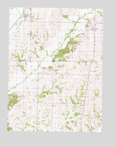
Blockton, IA USGS Topographic Map
Click on map above to begin viewing in our Map Viewer.

This topographic map contains these locations and features:
Feature Name Type Latitude Longitude GNIS ID View Map
BlocktonPopulated PlaceN40.6155°W94.4772°454691View Map
Blockton (historical)LocaleN40.6172°W94.4808°1968885View Map
Blockton Baptist ChurchChurchN40.6155°W94.4772°1968884View Map
Blockton Christian ChurchChurchN40.6155°W94.4772°1968883View Map
Blockton City HallBuildingN40.6155°W94.4772°1968882View Map
Blockton Fire Department and Ambulance ServiceBuildingN40.6162°W94.4797°2577364View Map
Blockton Post OfficePost OfficeN40.6155°W94.4772°1968881View Map
Bozzaris Post Office (historical)Post OfficeN40.5086°W94.4519°466520View Map
City of BlocktonCivilN40.6168°W94.4779°2394192View Map
City of ReddingCivilN40.6068°W94.3863°2396339View Map
Crestland Co-op ElevatorLocaleN40.6155°W94.4772°1968880View Map
Fairview CemeteryCemeteryN40.5917°W94.4058°1822840View Map
Hass School (historical)SchoolN40.5144°W94.3975°730115View Map
Honey Grove CemeteryCemeteryN40.5583°W94.4377°743217View Map
Honey Grove School (historical)SchoolN40.5572°W94.4361°719767View Map
IrenaPopulated PlaceN40.5497°W94.3913°740956View Map
John Andrews Dam LakeReservoirN40.5162°W94.4771°760766View Map
Kemp Lake DamDamN40.5167°W94.4752°760765View Map
Lone Star School (historical)SchoolN40.5211°W94.4413°721478View Map
Maloy - Redding First Response TeamBuildingN40.6048°W94.3913°2599884View Map
Methodist ChurchChurchN40.6047°W94.3877°1969432View Map
Pleasant Ridge SchoolSchoolN40.5322°W94.4788°724603View Map
Pleasant Valley School (historical)SchoolN40.5589°W94.4930°724636View Map
ReddingPopulated PlaceN40.6047°W94.3877°460563View Map
Redding (historical)LocaleN40.6047°W94.3877°1969433View Map
Redding CemeteryCemeteryN40.6035°W94.3779°1969457View Map
Redding Post OfficePost OfficeN40.6040°W94.3883°466519View Map
Rosehill CemeteryCemeteryN40.6122°W94.4725°1822842View Map
Tent ChapelChurchN40.5747°W94.4708°1822841View Map
Tent Chapel CemeteryCemeteryN40.5750°W94.4706°1969458View Map
Township of ClintonCivilN40.6054°W94.4147°467627View Map
Township of FletchallCivilN40.5209°W94.4034°767540View Map
Victory SchoolSchoolN40.5580°W94.4038°728199View Map
Village of IrenaCivilN40.5403°W94.3899°2398273View Map
Warden Lake Dam - NorthDamN40.5550°W94.4419°762516View Map
Warden Lake Dam - SouthDamN40.5517°W94.4436°762509View Map
Zollman LakeReservoirN40.5306°W94.4647°761954View Map
Zollman Lake DamDamN40.5300°W94.4636°761953View Map

Note: Coordinates in the location and feature list above are referenced to NAD83 datum.


Copyright (C) 2008-2025 Ryan Niemi / Sunset Dynamics ... All Rights Reserved