TopoQuest Logo
Do you find TopoQuest useful?
Help keep TopoQuest running and adding new maps/features by donating!
Bitcoin:  19c7KJd3qBynnjoSw5npx9KScwjBe4ifkT
Litecoin:  LXs6TkuXGGXo1vDsWCkWVdjQX94eUKd6ui
Home View Maps Find Maps Find Places Resources & Links


Table Mountain, Oregon Topographic Map

USGS Map Title: Table Mountain, OR
USGS Map MRC: 45117G2
DRG (GeoTIFF) Download: o45117g2.tif


Neighboring USGS Topographic Map Quads:


  Flora, OR  
45117H3
 

  Paradise, OR  
45117H2
 

  Teepee Butte, OR  
45117H1
 

  Shamrock Creek, OR  
45117G3
 

  Table Mountain, OR  
45117G2
 

  Billy Meadows, OR  
45117G1
 

  Sled Springs, OR  
45117F3
 

  Roberts Butte, OR  
45117F2
 

  Greenwood Butte, OR  
45117F1


Map MRC Location:

N46°
W118°
N46°
W117°
H8 H7 H6 H5 H4 H3 H2 H1
G8 G7 G6 G5 G4 G3 G2 G1
F8 F7 F6 F5 F4 F3 F2 F1
E8 E7 E6 E5 E4 E3 E2 E1
D8 D7 D6 D5 D4 D3 D2 D1
C8 C7 C6 C5 C4 C3 C2 C1
B8 B7 B6 B5 B4 B3 B2 B1
A8 A7 A6 A5 A4 A3 A2 A1
N45°
W118°
N45°
W117°

Table Mountain, OR USGS 1:24K Topographic Map Preview:
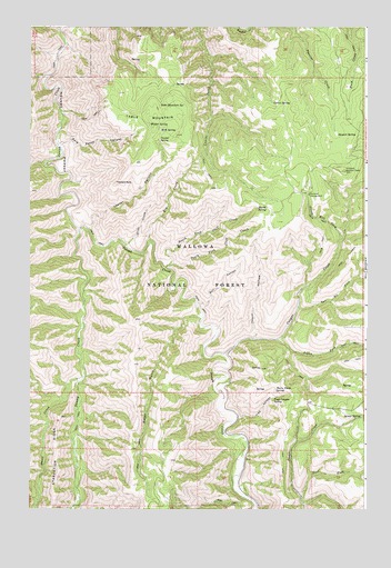
Table Mountain, OR USGS Topographic Map
Click on map above to begin viewing in our Map Viewer.

This topographic map contains these locations and features:
Feature Name Type Latitude Longitude GNIS ID View Map
Aspen ForkStreamN45.7943°W117.1571°1137328View Map
Baker GulchValleyN45.7993°W117.1860°1137430View Map
Baker SpringSpringN45.7704°W117.1954°1153099View Map
Corral SpringSpringN45.8552°W117.1601°1140155View Map
Cougar CreekStreamN45.7901°W117.1777°1140224View Map
Davis CreekStreamN45.7843°W117.2296°1140662View Map
Dog Fight CorralLocaleN45.8251°W117.1590°1156567View Map
Driveway SpringSpringN45.7512°W117.1927°1153098View Map
East Fork Sumac CreekStreamN45.7532°W117.1490°1141609View Map
Haystack RockSummitN45.8343°W117.2182°1143420View Map
Kirkland CabinLocaleN45.8379°W117.1352°1156574View Map
Kirkland CampgroundLocaleN45.8315°W117.1465°1144640View Map
Kirkland Lookout TowerTowerN45.8379°W117.1329°1163729View Map
Kirkland SpringSpringN45.8318°W117.1471°1153297View Map
Milk SpringSpringN45.8482°W117.2017°1146216View Map
Miller RidgeSummitN45.7788°W117.2113°1156568View Map
Myrtle SpringSpringN45.8279°W117.1655°1146717View Map
North Fork Cliff CreekStreamN45.8126°W117.1996°1146931View Map
Pole Patch CanyonValleyN45.8449°W117.2391°1147855View Map
Rim CreekStreamN45.8196°W117.2052°1148455View Map
Sleepy Bill ForkStreamN45.8207°W117.1338°1149675View Map
Slide CreekStreamN45.8185°W117.2146°1149707View Map
South Fork Cliff CreekStreamN45.8129°W117.1982°1149954View Map
Stewart SpringSpringN45.8469°W117.1362°1150424View Map
Sumac SpringSpringN45.7737°W117.1270°1150593View Map
Swamp CreekStreamN45.8226°W117.2318°1150747View Map
Table MountainSummitN45.8507°W117.2035°1150812View Map
Table Mountain SpringSpringN45.8546°W117.2020°1150819View Map
Thorn HollowValleyN45.7940°W117.1668°1151129View Map
Thorn Patch SpringSpringN45.7810°W117.1588°1151131View Map
Trap CanyonValleyN45.7735°W117.1727°1151385View Map
Trap Canyon SpringSpringN45.7781°W117.1596°1151386View Map
Two Bit ForkStreamN45.8021°W117.1502°1151604View Map
Vawter CanyonValleyN45.8226°W117.2282°1151740View Map
Vawter SpringSpringN45.8460°W117.2019°1151741View Map
Wilder SpringSpringN45.8499°W117.2055°1152355View Map

Note: Coordinates in the location and feature list above are referenced to NAD83 datum.


Copyright (C) 2008-2025 Ryan Niemi / Sunset Dynamics ... All Rights Reserved