TopoQuest Logo
Do you find TopoQuest useful?
Help keep TopoQuest running and adding new maps/features by donating!
Bitcoin:  19c7KJd3qBynnjoSw5npx9KScwjBe4ifkT
Litecoin:  LXs6TkuXGGXo1vDsWCkWVdjQX94eUKd6ui
Home View Maps Find Maps Find Places Resources & Links


Tabor, South Dakota Topographic Map

USGS Map Title: Tabor, SD
USGS Map MRC: 42097H6
DRG (GeoTIFF) Download: o42097h6.tif


Neighboring USGS Topographic Map Quads:


  Tripp SE, SD  
43097A7
 

  Kloucek Lake, SD  
43097A6
 

  Lesterville, SD  
43097A5
 

  Tyndall, SD  
42097H7
 

  Tabor, SD  
42097H6
 

  Tabor NE, SD  
42097H5
 

  Santee, NE  
42097G7
 

  Bon Homme Colony, SD  
42097G6
 

  Tabor SE, NE  
42097G5


Map MRC Location:

N43°
W98°
N43°
W97°
H8 H7 H6 H5 H4 H3 H2 H1
G8 G7 G6 G5 G4 G3 G2 G1
F8 F7 F6 F5 F4 F3 F2 F1
E8 E7 E6 E5 E4 E3 E2 E1
D8 D7 D6 D5 D4 D3 D2 D1
C8 C7 C6 C5 C4 C3 C2 C1
B8 B7 B6 B5 B4 B3 B2 B1
A8 A7 A6 A5 A4 A3 A2 A1
N42°
W98°
N42°
W97°

Tabor, SD USGS 1:24K Topographic Map Preview:
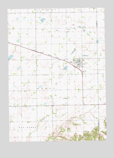
Tabor, SD USGS Topographic Map
Click on map above to begin viewing in our Map Viewer.

This topographic map contains these locations and features:
Feature Name Type Latitude Longitude GNIS ID View Map
Hruska LakeLakeN42.9434°W97.6770°1255696View Map
Hvezda Zapadu CemeteryCemeteryN42.9403°W97.6553°1255730View Map
Kubal LakeLakeN42.9892°W97.7059°1255978View Map
Pechous LakeLakeN42.9528°W97.7492°1256994View Map
Presbyterian CemeteryCemeteryN42.9737°W97.7346°2773567View Map
Ptaks National CemeteryCemeteryN42.9150°W97.6751°1257240View Map
Saint Wenceslaus Catholic CemeteryCemeteryN42.9507°W97.6577°2711287View Map
Saint Wenceslaus Catholic ChurchChurchN42.9506°W97.6585°2711285View Map
School Number 24 (historical)SchoolN42.9967°W97.7234°1264439View Map
School Number 25 (historical)SchoolN42.9967°W97.6656°1264435View Map
School Number 26 (historical)SchoolN42.9672°W97.6648°1264434View Map
School Number 27 (historical)SchoolN42.9669°W97.7231°1264438View Map
School Number 59 (historical)SchoolN42.9381°W97.7151°1264436View Map
School Number 62 (historical)SchoolN42.8953°W97.7151°1264437View Map
School Number 63 (historical)SchoolN42.8944°W97.6684°1264433View Map
TaborPopulated PlaceN42.9486°W97.6590°1258490View Map
Tabor Community Ambulance ServiceBuildingN42.9475°W97.6587°2658965View Map
Tabor Community CenterBuildingN42.9499°W97.6593°2728106View Map
Tabor Elementary SchoolSchoolN42.9510°W97.6584°2728423View Map
Tabor Fire DepartmentBuildingN42.9478°W97.6593°2580704View Map
Tabor Post OfficePost OfficeN42.9483°W97.6587°2711923View Map
Tabor Public LibraryBuildingN42.9499°W97.6593°2723776View Map
Town of TaborCivilN42.9477°W97.6594°1267598View Map
Township of Bon Homme (historical)CivilN42.8864°W97.7337°1269061View Map
Township of TaborCivilN42.9375°W97.6856°1269074View Map
Township of Tabor (historical)CivilN42.9747°W97.6526°1269063View Map
Unorganized Territory of Southeast Bon HommeCivilN42.9268°W97.7409°1267570View Map

Note: Coordinates in the location and feature list above are referenced to NAD83 datum.


Copyright (C) 2008-2024 Ryan Niemi / Sunset Dynamics ... All Rights Reserved