TopoQuest Logo
Do you find TopoQuest useful?
Help keep TopoQuest running and adding new maps/features by donating!
Bitcoin:  19c7KJd3qBynnjoSw5npx9KScwjBe4ifkT
Litecoin:  LXs6TkuXGGXo1vDsWCkWVdjQX94eUKd6ui
Home View Maps Find Maps Find Places Resources & Links


Tabor SE, Nebraska Topographic Map

USGS Map Title: Tabor SE, NE
USGS Map MRC: 42097G5
DRG (GeoTIFF) Download: o42097g5.tif


Neighboring USGS Topographic Map Quads:


  Tabor, SD  
42097H6
 

  Tabor NE, SD  
42097H5
 

  Yankton, SD  
42097H4
 

  Bon Homme Colony, SD  
42097G6
 

  Tabor SE, NE  
42097G5
 

  Gavins Point Dam, SD  
42097G4
 

  Lindy, NE  
42097F6
 

  Bloomfield NE, NE  
42097F5
 

  Crofton, NE  
42097F4


Map MRC Location:

N43°
W98°
N43°
W97°
H8 H7 H6 H5 H4 H3 H2 H1
G8 G7 G6 G5 G4 G3 G2 G1
F8 F7 F6 F5 F4 F3 F2 F1
E8 E7 E6 E5 E4 E3 E2 E1
D8 D7 D6 D5 D4 D3 D2 D1
C8 C7 C6 C5 C4 C3 C2 C1
B8 B7 B6 B5 B4 B3 B2 B1
A8 A7 A6 A5 A4 A3 A2 A1
N42°
W98°
N42°
W97°

Tabor SE, NE USGS 1:24K Topographic Map Preview:
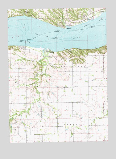
Tabor SE, NE USGS Topographic Map
Click on map above to begin viewing in our Map Viewer.

This topographic map contains these locations and features:
Feature Name Type Latitude Longitude GNIS ID View Map
Antelope Point (historical)CapeN42.8489°W97.6003°1263479View Map
Burbach CampgroundLocaleN42.8386°W97.5976°1884729View Map
Crofton United ChurchChurchN42.8008°W97.5501°828466View Map
Deep Water CampgroundLocaleN42.8353°W97.5326°1884727View Map
Deep Water Recreation AreaParkN42.8347°W97.5317°828643View Map
Fairview HeightsPopulated PlaceN42.8672°W97.5253°1263474View Map
Frankfort CemeteryCemeteryN42.8019°W97.5431°829383View Map
Frankfort SchoolSchoolN42.8189°W97.5245°829384View Map
Gavins PointCapeN42.8567°W97.5517°1255213View Map
Gavins Point Recreation AreaParkN42.8592°W97.5509°1255216View Map
Hideaway Acres State Recreation AreaParkN42.8333°W97.5031°1884726View Map
KQHU-FM (Yankton)TowerN42.8572°W97.5426°1259290View Map
Lesterville Recreation AreaParkN42.8661°W97.5867°1256100View Map
Lewis and Clark Lake State Recreation AreaParkN42.8361°W97.6003°1884913View Map
Midway Recreation AreaParkN42.8622°W97.5287°1256454View Map
Northshore DevelopmentPopulated PlaceN42.8667°W97.5281°1263473View Map
Oak Hills AdditionPopulated PlaceN42.8667°W97.5328°1263475View Map
Sand Island (historical)IslandN42.8625°W97.6181°1263480View Map
Sego Island (historical)IslandN42.8514°W97.5431°1263489View Map
Sioux Council Boy Scout ReservationParkN42.8722°W97.6017°1258085View Map
Steffan DamDamN42.7783°W97.5120°1769176View Map
Steffan ReservoirReservoirN42.7786°W97.5139°1769177View Map
Township of FrankfortCivilN42.8086°W97.5439°838006View Map
Township of Lake PortCivilN42.8708°W97.5653°1268601View Map
Township of North FrankfortCivilN42.8410°W97.5444°838163View Map
Weigand CampgroundLocaleN42.8347°W97.5684°1884728View Map
Weigand CreekStreamN42.8383°W97.5803°834532View Map
Weigand Recreation AreaParkN42.8339°W97.5759°834533View Map
West Blyville SchoolSchoolN42.7642°W97.5640°834563View Map
White Bear Cliff (historical)CliffN42.8606°W97.5656°1263481View Map
Zart DamDamN42.7767°W97.5887°1769008View Map
Zart ReservoirReservoirN42.7760°W97.5886°1769009View Map

Note: Coordinates in the location and feature list above are referenced to NAD83 datum.


Copyright (C) 2008-2024 Ryan Niemi / Sunset Dynamics ... All Rights Reserved