TopoQuest Logo
Do you find TopoQuest useful?
Help keep TopoQuest running and adding new maps/features by donating!
Bitcoin:  19c7KJd3qBynnjoSw5npx9KScwjBe4ifkT
Litecoin:  LXs6TkuXGGXo1vDsWCkWVdjQX94eUKd6ui
Home View Maps Find Maps Find Places Resources & Links


Tapoco, North Carolina Topographic Map

USGS Map Title: Tapoco, NC
USGS Map MRC: 35083D8
DRG (GeoTIFF) Download: o35083d8.tif


Neighboring USGS Topographic Map Quads:


  Tallassee, TN  
35084E1
 

  Calderwood, TN  
35083E8
 

  Cades Cove, TN  
35083E7
 

  Whiteoak Flats, TN  
35084D1
 

  Tapoco, NC  
35083D8
 

  Fontana Dam, NC  
35083D7
 

  Big Junction, TN  
35084C1
 

  Santeetlah Creek, NC  
35083C8
 

  Robbinsville, NC  
35083C7


Map MRC Location:

N36°
W84°
N36°
W83°
H8 H7 H6 H5 H4 H3 H2 H1
G8 G7 G6 G5 G4 G3 G2 G1
F8 F7 F6 F5 F4 F3 F2 F1
E8 E7 E6 E5 E4 E3 E2 E1
D8 D7 D6 D5 D4 D3 D2 D1
C8 C7 C6 C5 C4 C3 C2 C1
B8 B7 B6 B5 B4 B3 B2 B1
A8 A7 A6 A5 A4 A3 A2 A1
N35°
W84°
N35°
W83°

Tapoco, NC USGS 1:24K Topographic Map Preview:
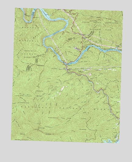
Tapoco, NC USGS Topographic Map
Click on map above to begin viewing in our Map Viewer.

This topographic map contains these locations and features:
Feature Name Type Latitude Longitude GNIS ID View Map
Aiken BranchStreamN35.4601°W83.9213°980065View Map
Attooga BranchStreamN35.3768°W83.8935°980362View Map
Barker CreekStreamN35.4387°W83.9199°980555View Map
Beach CreekStreamN35.4215°W83.9485°980673View Map
Bear CreekStreamN35.4404°W83.9316°980705View Map
Bear Creek Hunter CampLocaleN35.4198°W83.9493°1018015View Map
Bearpen GapGapN35.4412°W83.9182°980757View Map
Beers SchoolSchoolN35.4443°W83.9180°980917View Map
Bethel ChurchChurchN35.4434°W83.9357°981135View Map
Big Fat BranchStreamN35.4193°W83.9941°981387View Map
Big Fat GapGapN35.4173°W83.9727°981388View Map
Blackgum BranchStreamN35.4056°W83.9196°981552View Map
Buckeye BranchStreamN35.4154°W83.9921°982123View Map
Buggy BranchStreamN35.4598°W83.8943°982188View Map
Calderwood DamDamN35.4926°W83.9791°1641034View Map
Calderwood DamDamN35.4926°W83.9793°1305594View Map
Calderwood LakeReservoirN35.4995°W83.9698°982412View Map
Caney BranchStreamN35.4293°W83.9427°982604View Map
Caney LeadRidgeN35.4347°W83.9650°982607View Map
Chedah DamDamN35.4484°W83.9366°998976View Map
Cheoah DamDamN35.4481°W83.9363°983069View Map
Cheoah LakeReservoirN35.4490°W83.9366°1010192View Map
Cheoah RiverStreamN35.4481°W83.9396°1010194View Map
Cheoah Valley DamDamN35.4618°W83.9232°998995View Map
Cheoah Valley LakeReservoirN35.4627°W83.9266°998994View Map
Clat BranchStreamN35.4509°W83.9252°983238View Map
Cochran CreekStreamN35.4087°W83.8868°983321View Map
Cold Spring KnobSummitN35.4220°W83.9724°1019727View Map
Coom CemeteryCemeteryN35.3848°W83.8777°983496View Map
Cooper Camp BranchStreamN35.4806°W83.9416°1641077View Map
Cooper Camp BranchStreamN35.4804°W83.9416°1281188View Map
Cooper Camp BranchStreamN35.4343°W83.9227°983503View Map
Dalton GapGapN35.4934°W83.9005°1281990View Map
Dalton Gap BranchStreamN35.4934°W83.9363°1281991View Map
Dalton RidgeRidgeN35.4902°W83.8998°983920View Map
Deals BranchStreamN35.4673°W83.9102°984033View Map
Deals GapGapN35.4737°W83.9207°1307389View Map
Deep CreekStreamN35.4251°W83.9063°984055View Map
Deep Creek Hunter CampLocaleN35.4187°W83.9160°1018100View Map
Falls BranchStreamN35.4223°W83.8999°984992View Map
Farley CemeteryCemeteryN35.4529°W83.8891°985004View Map
First CreekStreamN35.4865°W83.9860°1284296View Map
First CreekStreamN35.4965°W83.9799°1641177View Map
Fishtrap BranchStreamN35.4615°W83.8991°985124View Map
Fork RidgeRidgeN35.4486°W83.9023°985302View Map
Forneys Creek Township (historical)CivilN35.4648°W83.9255°1027226View Map
Frisby BranchStreamN35.4318°W83.9085°985464View Map
Glen Gap BranchStreamN35.4023°W83.9941°1011530View Map
Goat CreekStreamN35.4884°W83.9796°1285543View Map
Goat CreekStreamN35.4887°W83.9799°1641033View Map
Gold Mine BranchStreamN35.3973°W83.8763°985773View Map
Grapevine BranchStreamN35.4106°W83.9949°1011614View Map
Grassy BranchStreamN35.4259°W83.9466°985943View Map
Halfmile BranchStreamN35.4331°W83.9121°986299View Map
Hangover CreekStreamN35.4084°W83.9941°986366View Map
Hangover LeadRidgeN35.3858°W83.9693°986367View Map
Haoe LeadRidgeN35.3851°W83.9675°986376View Map
Hudson Deaden BranchStreamN35.3879°W83.9530°987214View Map
Ike BranchStreamN35.4565°W83.9499°987320View Map
Indian Grave BranchStreamN35.4218°W83.9102°987357View Map
Jane BranchStreamN35.4259°W83.9466°987522View Map
Jenkins MeadowPopulated PlaceN35.3820°W83.9530°1020943View Map
Joyce Kilmer-Slickrock WildernessReserveN35.4046°W83.9761°1012571View Map
Judy BranchStreamN35.4645°W83.8874°987807View Map
Laurel BranchStreamN35.4156°W83.8893°988173View Map
Laurel BranchStreamN35.4612°W83.9146°988175View Map
Lifting Rock BranchStreamN35.4195°W83.8793°988469View Map
Little Blackgum BranchStreamN35.4293°W83.9438°988544View Map
Little Laurel BranchStreamN35.4548°W83.9224°988693View Map
Little Slickrock CreekStreamN35.4479°W83.9796°1641176View Map
Little Slickrock CreekStreamN35.4481°W83.9793°1291666View Map
Locust RidgeRidgeN35.4077°W83.9722°988850View Map
Lowdown BranchStreamN35.4656°W83.9655°1292188View Map
Lowdown BranchStreamN35.4656°W83.9660°1641032View Map
Lower FallsFallsN35.4546°W83.9719°989096View Map
Magazine BranchStreamN35.4556°W83.9466°989227View Map
Maple Springs Observation PointLocaleN35.3959°W83.9105°1008294View Map
Meadow BranchStreamN35.4431°W83.9377°989663View Map
Middle CreekStreamN35.4176°W83.9555°989770View Map
Naked GroundLocaleN35.3795°W83.9849°990849View Map
Naked Ground BranchStreamN35.3940°W83.9960°990850View Map
Nichols Cove BranchStreamN35.4454°W83.9816°991146View Map
Odom CemeteryCemeteryN35.3848°W83.8774°1018101View Map
Oldfield GapGapN35.4440°W83.9046°991625View Map
Orr CemeteryCemeteryN35.4226°W83.9455°991692View Map
Otter Rack BranchStreamN35.4409°W83.9368°1008289View Map
Parson BranchStreamN35.4898°W83.9341°1641212View Map
Parson BranchStreamN35.4918°W83.9371°1296887View Map
Persimmon Tree BranchStreamN35.4212°W83.8932°992070View Map
Pole Bridge BranchStreamN35.4659°W83.9013°992629View Map
Primitive ChurchChurchN35.4437°W83.9185°992819View Map
Puncheon Camp BranchStreamN35.4243°W83.8952°992905View Map
Rock CreekStreamN35.4001°W83.8807°993486View Map
Rock Creek KnobSummitN35.3876°W83.9213°1022323View Map
Rockwall BranchStreamN35.3954°W83.9346°993550View Map
Rocky Point Ferry BranchStreamN35.4604°W83.8938°993612View Map
Rough BranchStreamN35.4076°W83.9188°993731View Map
Rust BranchStreamN35.4065°W83.9938°1015142View Map
Saddle Tree GapGapN35.3876°W83.9688°993840View Map
Sam CoveValleyN35.4142°W83.9140°994203View Map
Santeetlah DamDamN35.3781°W83.8757°994339View Map
Shaw Grave BranchStreamN35.4929°W83.9610°1641217View Map
Shaw Grave BranchStreamN35.4929°W83.9599°1269936View Map
Sheep Wallow KnobSummitN35.4896°W83.9042°1022579View Map
Slickrock CreekStreamN35.4634°W83.9610°1015587View Map
State Line BranchStreamN35.4606°W83.9527°1271272View Map
State Line BranchStreamN35.4606°W83.9530°1641079View Map
Stillhouse BranchStreamN35.4576°W83.9488°995518View Map
Stratton BranchStreamN35.4554°W83.9246°995605View Map
Sugar Cove BranchStreamN35.4187°W83.9549°995642View Map
TapocoPopulated PlaceN35.4434°W83.9368°995845View Map
Township of Yellow CreekCivilN35.4099°W83.8980°1026711View Map
Tunnel BranchStreamN35.4801°W83.9432°1641078View Map
Tunnel BranchStreamN35.4798°W83.9430°1272981View Map
Twentymile CreekStreamN35.4643°W83.8813°1016300View Map
Wildcat BranchStreamN35.4398°W83.9921°1641080View Map
Wildcat BranchStreamN35.4404°W83.9918°1274530View Map
Yellow CreekStreamN35.4190°W83.8891°1016860View Map
Yellowhammer BranchStreamN35.4437°W83.9380°997717View Map
Yellowhammer GapGapN35.4465°W83.9638°997718View Map

Note: Coordinates in the location and feature list above are referenced to NAD83 datum.


Copyright (C) 2008-2024 Ryan Niemi / Sunset Dynamics ... All Rights Reserved