TopoQuest Logo
Do you find TopoQuest useful?
Help keep TopoQuest running and adding new maps/features by donating!
Bitcoin:  19c7KJd3qBynnjoSw5npx9KScwjBe4ifkT
Litecoin:  LXs6TkuXGGXo1vDsWCkWVdjQX94eUKd6ui
Home View Maps Find Maps Find Places Resources & Links


Tarkio East, Missouri Topographic Map

USGS Map Title: Tarkio East, MO
USGS Map MRC: 40095D3
DRG (GeoTIFF) Download: o40095d3.tif


Neighboring USGS Topographic Map Quads:


  Farmers City, MO  
40095E4
 

  Westboro, MO  
40095E3
 

  Blanchard, IA  
40095E2
 

  Tarkio West, MO  
40095D4
 

  Tarkio East, MO  
40095D3
 

  Skidmore NW, MO  
40095D2
 

  Fairfax, MO  
40095C4
 

  Tarkio SE, MO  
40095C3
 

  Dotham, MO  
40095C2


Map MRC Location:

N41°
W96°
N41°
W95°
H8 H7 H6 H5 H4 H3 H2 H1
G8 G7 G6 G5 G4 G3 G2 G1
F8 F7 F6 F5 F4 F3 F2 F1
E8 E7 E6 E5 E4 E3 E2 E1
D8 D7 D6 D5 D4 D3 D2 D1
C8 C7 C6 C5 C4 C3 C2 C1
B8 B7 B6 B5 B4 B3 B2 B1
A8 A7 A6 A5 A4 A3 A2 A1
N40°
W96°
N40°
W95°

Tarkio East, MO USGS 1:24K Topographic Map Preview:
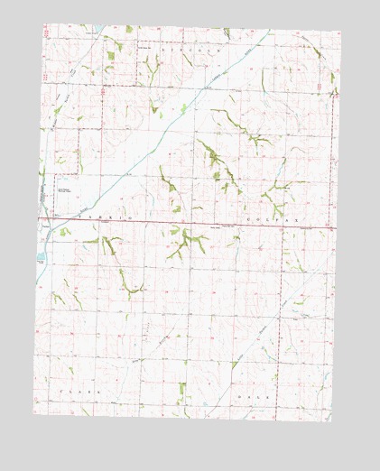
Tarkio East, MO USGS Topographic Map
Click on map above to begin viewing in our Map Viewer.

This topographic map contains these locations and features:
Feature Name Type Latitude Longitude GNIS ID View Map
Center Grove CemeteryCemeteryN40.4930°W95.3366°743281View Map
Center Grove ChurchChurchN40.4933°W95.3358°715639View Map
Center Grove School (historical)SchoolN40.4951°W95.3547°715641View Map
Center View LakeReservoirN40.4997°W95.3502°738575View Map
Center View School (historical)SchoolN40.4651°W95.3594°715663View Map
Community HallBuildingN40.4367°W95.2605°743280View Map
Deadmans HollowValleyN40.4947°W95.2953°716769View Map
Gould Peterson Municipal AirportAirportN40.4513°W95.3658°758964View Map
Homer School (historical)SchoolN40.4222°W95.3305°719748View Map
London School (historical)SchoolN40.4658°W95.2625°721436View Map
Middle Tarkio CreekStreamN40.4511°W95.3736°459056View Map
Morning Star School (historical)SchoolN40.4367°W95.2600°722627View Map
Moulton School (historical)SchoolN40.4939°W95.2786°722688View Map
Pleasant Mound School (historical)SchoolN40.4514°W95.3114°724569View Map
Prairie Hill CemeteryCemeteryN40.4369°W95.2986°724856View Map
South York School (historical)SchoolN40.3783°W95.2736°726799View Map
Squaw CreekStreamN40.4982°W95.2812°740021View Map
Wade School (historical)SchoolN40.3783°W95.3214°728236View Map
West Tarkio CreekStreamN40.4333°W95.3703°462918View Map
Westboro School (historical)SchoolN40.4947°W95.3147°747044View Map
YorkPopulated PlaceN40.4078°W95.2655°738574View Map
York School (historical)SchoolN40.4072°W95.2630°729205View Map

Note: Coordinates in the location and feature list above are referenced to NAD83 datum.


Copyright (C) 2008-2025 Ryan Niemi / Sunset Dynamics ... All Rights Reserved