TopoQuest Logo
Do you find TopoQuest useful?
Help keep TopoQuest running and adding new maps/features by donating!
Bitcoin:  19c7KJd3qBynnjoSw5npx9KScwjBe4ifkT
Litecoin:  LXs6TkuXGGXo1vDsWCkWVdjQX94eUKd6ui
Home View Maps Find Maps Find Places Resources & Links


Blooming Grove, Ohio Topographic Map

USGS Map Title: Blooming Grove, OH
USGS Map MRC: 40082F6
DRG (GeoTIFF) Download: o40082f6.tif


Neighboring USGS Topographic Map Quads:


  North Robinson, OH  
40082G7
 

  Crestline, OH  
40082G6
 

  Mansfield North, OH  
40082G5
 

  Galion, OH  
40082F7
 

  Blooming Grove, OH  
40082F6
 

  Mansfield South, OH  
40082F5
 

  Mount Gilead, OH  
40082E7
 

  Shauck, OH  
40082E6
 

  Bellville, OH  
40082E5


Map MRC Location:

N41°
W83°
N41°
W82°
H8 H7 H6 H5 H4 H3 H2 H1
G8 G7 G6 G5 G4 G3 G2 G1
F8 F7 F6 F5 F4 F3 F2 F1
E8 E7 E6 E5 E4 E3 E2 E1
D8 D7 D6 D5 D4 D3 D2 D1
C8 C7 C6 C5 C4 C3 C2 C1
B8 B7 B6 B5 B4 B3 B2 B1
A8 A7 A6 A5 A4 A3 A2 A1
N40°
W83°
N40°
W82°

Blooming Grove, OH USGS 1:24K Topographic Map Preview:
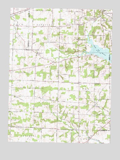
Blooming Grove, OH USGS Topographic Map
Click on map above to begin viewing in our Map Viewer.

This topographic map contains these locations and features:
Feature Name Type Latitude Longitude GNIS ID View Map
Ahrens LakeReservoirN40.7251°W82.6666°1079302View Map
Ahrens Lake DamDamN40.7251°W82.6666°1079301View Map
Beech Grove School (historical)SchoolN40.7328°W82.7027°1049858View Map
Blooming GrovePopulated PlaceN40.7078°W82.7166°1064454View Map
Blooming Grove CemeteryCemeteryN40.7109°W82.7177°1963204View Map
Burgener School (historical)SchoolN40.7403°W82.7443°1055729View Map
Camp AveryLocaleN40.7281°W82.6480°1038660View Map
Center School (historical)SchoolN40.6823°W82.7463°1054462View Map
Chestnut Ridge School (historical)SchoolN40.6612°W82.6899°1054463View Map
Clear Fork ReservoirReservoirN40.7074°W82.6304°1070716View Map
Craley School (historical)SchoolN40.6376°W82.6896°1054464View Map
Grogg Airport (historical)AirportN40.6256°W82.7130°1082233View Map
Haldeman CemeteryCemeteryN40.6592°W82.6666°1041239View Map
Half Acre School (historical)SchoolN40.6537°W82.7466°1054469View Map
Harbison School (historical)SchoolN40.6823°W82.7088°1054470View Map
JacksonPopulated PlaceN40.7114°W82.7457°1054477View Map
Jugs CornersPopulated PlaceN40.6809°W82.6455°1042158View Map
Jugs School (historical)SchoolN40.6806°W82.6449°1053026View Map
Line CemeteryCemeteryN40.7467°W82.7382°1963184View Map
Mid - Ohio Sports Car Course Fire StationBuildingN40.6868°W82.6344°2550286View Map
Mid-Ohio Race CourseLocaleN40.6889°W82.6371°1080147View Map
MillsboroPopulated PlaceN40.7489°W82.6377°1066285View Map
Peace ChurchChurchN40.6528°W82.7418°1075152View Map
Peace Reformed CemeteryCemeteryN40.6531°W82.7413°1963220View Map
Pleasant Hill CemeteryCemeteryN40.7409°W82.6463°1955078View Map
Pleasant Hill School (historical)SchoolN40.6531°W82.7085°1054487View Map
Pleasant Valley School (historical)SchoolN40.7056°W82.6616°1054488View Map
Red Squirrel CemeteryCemeteryN40.7320°W82.6892°1044903View Map
Ross CemeteryCemeteryN40.6813°W82.6812°1045203View Map
School Number 7 (historical)SchoolN40.7398°W82.6655°1049860View Map
Shauck CemeteryCemeteryN40.6312°W82.6491°1046149View Map
Steam CornersPopulated PlaceN40.6812°W82.6643°1065379View Map
Steam Corners Post Office (historical)Post OfficeN40.6806°W82.6638°2039663View Map
Steam Corners United Methodist ChurchChurchN40.6820°W82.6641°1065827View Map
Township of North BloomfieldCivilN40.6751°W82.7459°1086706View Map
Township of TroyCivilN40.6762°W82.6611°1086710View Map
Walters CemeteryCemeteryN40.6478°W82.6638°1047548View Map
Walters School (historical)SchoolN40.6523°W82.6641°1054493View Map
Webster CemeteryCemeteryN40.7400°W82.6371°1955082View Map
Wolf School (historical)SchoolN40.7212°W82.6635°1049859View Map

Note: Coordinates in the location and feature list above are referenced to NAD83 datum.


Copyright (C) 2008-2025 Ryan Niemi / Sunset Dynamics ... All Rights Reserved