TopoQuest Logo
Do you find TopoQuest useful?
Help keep TopoQuest running and adding new maps/features by donating!
Bitcoin:  19c7KJd3qBynnjoSw5npx9KScwjBe4ifkT
Litecoin:  LXs6TkuXGGXo1vDsWCkWVdjQX94eUKd6ui
Home View Maps Find Maps Find Places Resources & Links


North Robinson, Ohio Topographic Map

USGS Map Title: North Robinson, OH
USGS Map MRC: 40082G7
DRG (GeoTIFF) Download: o40082g7.tif


Neighboring USGS Topographic Map Quads:


  Chatfield, OH  
40082H8
 

  New Washington, OH  
40082H7
 

  Shelby, OH  
40082H6
 

  Bucyrus, OH  
40082G8
 

  North Robinson, OH  
40082G7
 

  Crestline, OH  
40082G6
 

  Caledonia, OH  
40082F8
 

  Galion, OH  
40082F7
 

  Blooming Grove, OH  
40082F6


Map MRC Location:

N41°
W83°
N41°
W82°
H8 H7 H6 H5 H4 H3 H2 H1
G8 G7 G6 G5 G4 G3 G2 G1
F8 F7 F6 F5 F4 F3 F2 F1
E8 E7 E6 E5 E4 E3 E2 E1
D8 D7 D6 D5 D4 D3 D2 D1
C8 C7 C6 C5 C4 C3 C2 C1
B8 B7 B6 B5 B4 B3 B2 B1
A8 A7 A6 A5 A4 A3 A2 A1
N40°
W83°
N40°
W82°

North Robinson, OH USGS 1:24K Topographic Map Preview:
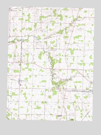
North Robinson, OH USGS Topographic Map
Click on map above to begin viewing in our Map Viewer.

This topographic map contains these locations and features:
Feature Name Type Latitude Longitude GNIS ID View Map
Allen RunStreamN40.7951°W82.7855°1065895View Map
Biddle (historical)Populated PlaceN40.8403°W82.8182°1063642View Map
Biddle CemeteryCemeteryN40.8273°W82.8088°1037985View Map
Biddle ChurchChurchN40.8289°W82.8091°1037986View Map
Biddle Mills Post Office (historical)Post OfficeN40.8403°W82.8180°1966943View Map
Cole AirfieldAirportN40.8278°W82.7969°1082630View Map
Colonel Crawford High SchoolSchoolN40.7881°W82.8560°1055731View Map
Colonel Crawford Intermediate SchoolSchoolN40.7892°W82.8563°1055732View Map
Crawford County Memory GardenCemeteryN40.8081°W82.8038°1963176View Map
Crawford County Sanitary LandfillLocaleN40.8197°W82.8700°2677720View Map
Dapper CemeteryCemeteryN40.8278°W82.7891°1039576View Map
Evangelical ChurchChurchN40.8403°W82.8182°1040251View Map
Fairview CemeteryCemeteryN40.7503°W82.7799°1040342View Map
Fisher School (historical)SchoolN40.8287°W82.7838°1055742View Map
Immanuel ChurchChurchN40.7703°W82.8193°1041926View Map
Jefferson Township Volunteer Fire DepartmentBuildingN40.7820°W82.7892°2550460View Map
Kile School (historical)SchoolN40.7703°W82.8193°1055756View Map
Lake GalionLakeN40.7876°W82.8010°1040744View Map
LeesvillePopulated PlaceN40.7953°W82.7882°1064982View Map
Leesville CemeteryCemeteryN40.7942°W82.7913°1963182View Map
Leesville Elementary SchoolSchoolN40.7962°W82.7866°1055757View Map
Liberty CemeteryCemeteryN40.8578°W82.7818°1042503View Map
Loss CreekStreamN40.8395°W82.8307°1066084View Map
Luke CemeteryCemeteryN40.8364°W82.8552°1042831View Map
MiddletownPopulated PlaceN40.7737°W82.7918°1056424View Map
Middletown CemeteryCemeteryN40.7696°W82.7914°1963186View Map
North RobinsonPopulated PlaceN40.7926°W82.8571°1057730View Map
North Robinson Post OfficePost OfficeN40.7931°W82.8568°1966927View Map
OlentangyPopulated PlaceN40.7617°W82.8735°1066275View Map
Pabst LakeReservoirN40.8034°W82.8082°1079334View Map
Pabst Lake DamDamN40.8034°W82.8082°1079333View Map
Paramour CreekStreamN40.7951°W82.7855°1066134View Map
Sandusky CemeteryCemeteryN40.8654°W82.8174°1045946View Map
School Number 1 (historical)SchoolN40.8020°W82.8680°1055769View Map
School Number 2 (historical)SchoolN40.7992°W82.8385°1055771View Map
School Number 3 (historical)SchoolN40.8426°W82.8727°1055775View Map
School Number 3 (historical)SchoolN40.7703°W82.8438°1055777View Map
School Number 3 (historical)SchoolN40.8573°W82.8280°1055778View Map
School Number 4 (historical)SchoolN40.8289°W82.8430°1055781View Map
School Number 5 (historical)SchoolN40.7703°W82.7824°1055785View Map
School Number 5 (historical)SchoolN40.8287°W82.8135°1055787View Map
Tabernacle of PraiseChurchN40.7987°W82.8058°2750114View Map
Township of JeffersonCivilN40.7850°W82.8117°1085940View Map
Township of SanduskyCivilN40.8583°W82.8272°1085944View Map
Township of VernonCivilN40.8606°W82.7647°1085947View Map
Valley View Golf CourseLocaleN40.7789°W82.7977°1055804View Map
Village of North RobinsonCivilN40.7924°W82.8568°2399522View Map
WAPQ-FM (Crestline)TowerN40.7703°W82.7563°1083816View Map
West LibertyPopulated PlaceN40.8623°W82.7760°1061742View Map
WGLX-AM (Galion)TowerN40.7584°W82.7882°1083728View Map
Windfall CemeteryCemeteryN40.7698°W82.8199°1047994View Map
WQLX-FM (Galion)TowerN40.7570°W82.7891°1083833View Map

Note: Coordinates in the location and feature list above are referenced to NAD83 datum.


Copyright (C) 2008-2024 Ryan Niemi / Sunset Dynamics ... All Rights Reserved